Splettstoesser Glacier
Splettstoesser Glacier (79°12′S 84°9′W) is a glacier, 35 nautical miles (65 km; 40 mi) long, draining from the plateau just south of Founders Escarpment and flowing east-northeast through the Heritage Range to the south of Founders Peaks and Anderson Massif to enter the Minnesota Glacier. Named by the University of Minnesota Ellsworth Mountains Party which explored the area in 1961-62 for John F. Splettstoesser, geologist with that party.
| Splettstoesser Glacier | |
|---|---|
 Location of Heritage Range in Western Antarctica | |
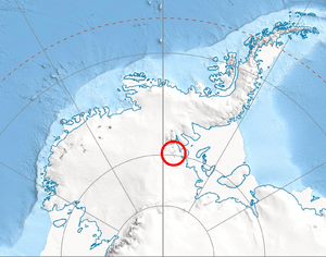
 Location of Splettstoesser Glacier in Antarctica | |
| Type | tributary |
| Location | Ellsworth Land |
| Coordinates | 79°12′00″S 84°09′00″W |
| Length | 35 nautical miles (65 km; 40 mi) |
| Thickness | unknown |
| Terminus | Minnesota Glacier |
| Status | unknown |
Maps
- Union Glacier. Scale 1:250 000 topographic map. Reston, Virginia: US Geological Survey, 1966.
- Antarctic Digital Database (ADD). Scale 1:250000 topographic map of Antarctica. Scientific Committee on Antarctic Research (SCAR). Since 1993, regularly updated.
References


| Types |
| ||||||
|---|---|---|---|---|---|---|---|
| Anatomy |
| ||||||
| Processes | |||||||
| Measurements | |||||||
| Volcanic relations | |||||||
| Landforms |
| ||||||
| |||||||
This article is issued from Wikipedia. The text is licensed under Creative Commons - Attribution - Sharealike. Additional terms may apply for the media files.