West Carson, California
West Carson is a census-designated place (CDP) in Los Angeles County, California. The population was 21,699 at the 2010 census, up from 21,138 at the 2000 census. The ZIP Codes encompassing the CDP area are 90502 and 90710.[2][3]
West Carson, California | |
|---|---|
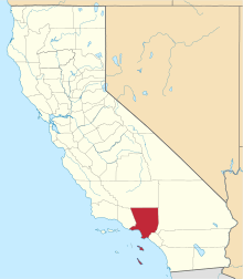
 Location of West Carson in Los Angeles County. | |
 West Carson, California Location in the United States | |
| Coordinates: 33°49′35″N 118°17′33″W | |
| Country | |
| State | |
| County | |
| Area | |
| • Total | 2.279 sq mi (5.902 km2) |
| • Land | 2.266 sq mi (5.869 km2) |
| • Water | 0.013 sq mi (0.033 km2) 0.56% |
| Elevation | 43 ft (13 m) |
| Population (2010) | |
| • Total | 21,699 |
| • Density | 9,500/sq mi (3,700/km2) |
| Time zone | UTC-8 (PST) |
| • Summer (DST) | UTC-7 (PDT) |
| ZIP code | |
| FIPS code | 06-84144 |
| GNIS feature ID | 1867069 |
The north to south boundary of this unincorporated area of Los Angeles County is Del Amo Boulevard to Lomita Boulevard; the west to east boundary is Normandie Avenue to the Harbor Freeway (Interstate 110).
Postal service
Much of the area is serviced by the post office in Torrance. Thus, being a Torrance P.O., and therefore having a Torrance zip code, residents and businesses of West Carson put "Torrance, CA" on their mail. For instance, the mailing address of Harbor-UCLA Medical Center is 1000 W. Carson Street Torrance, CA, because it is a Torrance P.O., but it is actually located in West Carson, CA.
Geography
West Carson is located at 33°49′35″N 118°17′33″W (33.826266, -118.292534),[4] or about two miles (3 km) west of Carson.[5]
According to the United States Census Bureau, the CDP has a total area of 2.3 square miles (6.0 km2), over 99% of it land.
The north to south boundary of this unincorporated area is 190th Street to Lomita Boulevard; the west to east boundary is Normandie Avenue to the Harbor Freeway (Interstate 110).
The incorporated City of Los Angeles area Harbor Gateway (from Western Avenue to Normandie) lies west of West Carson, and the incorporated city of Carson lies east of the Harbor Freeway from West Carson.
Government and infrastructure
The Harbor–UCLA Medical Center, operated by the Los Angeles County Department of Health Services, has a Torrance postal address, but it is located in West Carson.[6][7]
Politics
In the state legislature West Carson is located in the 28th Senate District, represented by Democrat Isadore Hall, III, and in the 55th Assembly District, represented by Democrat Al Muratsuchi. Federally, West Carson is located in California's 43rd and is represented by Democrat Maxine Waters.
Demographics
| Historical population | |||
|---|---|---|---|
| Census | Pop. | %± | |
| 1970 | 15,918 | — | |
| 1980 | 17,997 | 13.1% | |
| 1990 | 20,143 | 11.9% | |
| 2000 | 21,138 | 4.9% | |
| 2010 | 21,699 | 2.7% | |
| [8] | |||
2010
At the 2010 census West Carson had a population of 21,699. The population density was 9,522.0 people per square mile (3,676.5/km²). The racial makeup of West Carson was 7,630 (35.2%) White (21.4% Non-Hispanic White),[9] 2,330 (10.7%) African American, 185 (0.9%) Native American, 6,730 (31.0%) Asian, 301 (1.4%) Pacific Islander, 3,411 (15.7%) from other races, and 1,112 (5.1%) from two or more races. Hispanic or Latino of any race were 7,100 persons (32.7%).[10]
The census reported that 20,493 people (94.4% of the population) lived in households, 176 (0.8%) lived in non-institutionalized group quarters, and 1,030 (4.7%) were institutionalized.
There were 7,166 households, 2,236 (31.2%) had children under the age of 18 living in them, 3,634 (50.7%) were opposite-sex married couples living together, 978 (13.6%) had a female householder with no husband present, 450 (6.3%) had a male householder with no wife present. There were 311 (4.3%) unmarried opposite-sex partnerships, and 46 (0.6%) same-sex married couples or partnerships. 1,687 households (23.5%) were one person and 712 (9.9%) had someone living alone who was 65 or older. The average household size was 2.86. There were 5,062 families (70.6% of households); the average family size was 3.40.
The age distribution was 4,066 people (18.7%) under the age of 18, 1,816 people (8.4%) aged 18 to 24, 5,805 people (26.8%) aged 25 to 44, 6,109 people (28.2%) aged 45 to 64, and 3,903 people (18.0%) who were 65 or older. The median age was 42.1 years. For every 100 females, there were 94.9 males. For every 100 females age 18 and over, there were 91.8 males.
There were 7,426 housing units at an average density of 3,258.7 per square mile, of the occupied units 5,459 (76.2%) were owner-occupied and 1,707 (23.8%) were rented.The homeowner vacancy rate was 1.6%; the rental vacancy rate was 4.3%. 15,074 people (69.5% of the population) lived in owner-occupied housing units and 5,419 people (25.0%) lived in rental housing units.
According to the 2010 United States Census, West Carson had a median household income of $62,100, with 8.6% of the population living below the federal poverty line.[9]
2000
At the 2000 census there were 21,138 people, 7,156 households, and 5,052 families in the CDP. The population density was 9,355.3 inhabitants per square mile (3,611.3/km²). There were 7,406 housing units at an average density of 3,277.8 per square mile (1,265.3/km²). The racial makeup of the CDP was 41.99% White, 11.75% African American, 0.66% Native American, 25.07% Asian, 1.20% Pacific Islander, 13.94% from other races, and 5.39% from two or more races. Hispanic or Latino of any race were 29.44%.[11]
Of the 7,156 households 29.6% had children under the age of 18 living with them, 52.6% were married couples living together, 12.5% had a female householder with no husband present, and 29.4% were non-families. 24.0% of households were one person and 9.1% were one person aged 65 or older. The average household size was 2.85 and the average family size was 3.41.
The age distribution was 22.6% under the age of 18, 8.0% from 18 to 24, 29.3% from 25 to 44, 24.8% from 45 to 64, and 15.3% 65 or older. The median age was 38 years. For every 100 females, there were 92.5 males. For every 100 females age 18 and over, there were 89.5 males.
The median household income was $49,118 and the median family income was $55,000. Males had a median income of $41,085 versus $32,032 for females. The per capita income for the CDP was $21,023. About 7.4% of families and 9.5% of the population were below the poverty line, including 12.4% of those under age 18 and 7.1% of those age 65 or over.
Education
Residents are zoned to the Los Angeles Unified School District. Meyler Street Elementary School and Van Deene Elementary School are in West Carson.[7][12][13] Some of the students attend Torrance Unified School District even though it is located in the Los Angeles Unified School District.
See also
References
- U.S. Census
- Zip Codes for West Carson, Los Angeles County, California. Retrieved 2013-12-20.
- List of the Cities, Towns or CDPs with addresses in a given ZIP Code
- "US Gazetteer files: 2010, 2000, and 1990". United States Census Bureau. 2011-02-12. Retrieved 2011-04-23.
- http://www.city-data.com/city/West-Carson-California.html city-data.com
- "Contact Us". Harbor–UCLA Medical Center. Los Angeles County Department of Health Services. Retrieved 2018-05-18.
1000 West Carson Street, Torrance, California 90509
- "West Carson CDP, California." U.S. Census Bureau. Retrieved on May 18, 2019. Compare to the Zoning map of and Land use map of (which indicates hospitals) Torrance, California. Harbor-UCLA is not in the Torrance city limits.
- http://quickfacts.census.gov/qfd/states/06/0684144.html. Missing or empty
|title=(help) - "2010 Census Interactive Population Search: CA - West Carson CDP". U.S. Census Bureau. Archived from the original on July 15, 2014. Retrieved July 12, 2014.
- "U.S. Census website". United States Census Bureau. Retrieved 2008-01-31.
- Home. Meyler Street Elementary School. Retrieved on April 13, 2019. "333 S. Beaudry Ave., Los Angeles, CA 90017"
- Home. Van Deene Avenue Elementary School. Retrieved on April 13, 2019. "826 W. Javelin Street Torrance, California 90502"