Alsace, California
Alsace is an archaic place name near the development known as Playa Vista, Los Angeles, California.[1] It lies at an elevation of 16 feet (5 m).[1] It is located at Degrees Minutes Seconds: Latitude: 33-58'43 N, Longitude: 118-24'56 W (Decimal Degrees: Latitude: 33.9786232, Longitude: -118.4156329).[2] The Alsace Region is one of approximately 472 neighborhoods recognized in Los Angeles County.[3] Although once a large, amorphously defined section of Los Angeles lying between the Ballona Creek and what is now Jefferson Boulevard, today the Alsace Region consists of a strip of unincorporated Los Angeles County land located north of Jefferson Boulevard, west of Centinela, east of Grosvenor, and south of the Marina Freeway, California State Route 90.[4] The streets within the Region are one block sections of Hammack Street, Aneta Street, Lucile Street, Beatrice Street, as well as a very short span of Juniette Street. The Region features one east-west paved alley (parallel to Jefferson) and one north-south paved alley (parallel to Centinela). As is common in certain unincorporated sections of Los Angeles County, the streets in the Alsace Region do not have sidewalks as the County has limited funds available for sidewalk construction.[5] The Alsace Region is served by Los Angeles County first responders including the Los Angeles County Sheriff Department located in nearby Marina del Rey.[6]
Alsace, California | |
|---|---|
Archaic place name | |
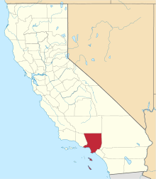
 Alsace, California Location in California  Alsace, California Alsace, California (the United States) | |
| Coordinates: 33°58′43″N 118°24′56″W | |
| Country | |
| State | |
| County | |
| Elevation | 5 m (16 ft) |
The Ballona Creek, which lies adjacent to the north boundary of the Alsace Region is integral to the settlement and geography of the Alsace Region. From the time of recorded human contact and continuing through the early Mexican period, the entire Los Angeles Basin, including the Region, was mostly a vast wetland with islands of forested land and dense shrub. The Los Angeles and San Gabriel Rivers watered the basin with most of the water sinking into the soil before reaching the coast. Periodically, the Los Angeles River would flow hard and fast enough to push its way through the Ballona wetlands and empty into the Sea in what is now Marina del Rey.[7] A great flood in 1815 caused the Los Angeles River to change its course near Downtown and flow into the ocean by way of Ballona Creek. The river changed and adopted its current course, which empties near Long Beach, in 1825 when an epic flood from Big Tujunga Canyon in the San Gabriel Mountains and possibly earthquakes[8] forced the Los Angeles River to begin emptying into San Pedro Bay (at Long Beach) where the river ends today.[9]
Originally the Ballona Creek was a picturesque natural waterway fed by runoff. The creek collected the water from "cienegas" (swamps) and the rains. The banks of Ballona Creek were lined with trees, like sycamores, willows and tules. This natural bounty attracted the earliest known human inhabitants of the Region who are known as the Shoshone and Gabrielino-Tongva Indians, the indigenous people of Los Angeles.[10] For some 3,000 years, the Tongva lived in the area encompassing the Ballona Creek flood plain and the Westchester Bluffs.[11] These indigenous peoples left a large burial ground near the Region along the southwest corner of the Ballona Wetlands.[12] The fact that Tongva lived near the Ballona Creek was specifically mentioned in the records of the San Gabriel Mission, which record recruitment of Tongva from a group of settlements named Washna (also referred to in some historical and scholarly sources as Saa’angna) near the mouth of Ballona Creek. Before the Spanish conquest, Washna was probably the most important Native American center for trade between the mainland and Catalina Island.[12]
When Mexico claimed sovereignty over all of Alta California, the Alsace Region was made part of a 13,920-acre (56.3 km2) Mexican land grant that was confirmed by Alta California Governor Juan Alvarado in 1839 that was collectively known as the "Rancho Ballona".[13] The origin and meaning of “Ballona” remain uncertain. Prevalent theories suggest that it was a misspelling. One school thinks the intended name was Ballena, which means whale in Spanish, and that at the edge of Ballona, where the creek empties, one could watch the migration of the whales. Others differ and hold the opinion that the Talamantes ancestors came from Bayona, Spain, so they named it for their early heritage.[10] The Rancho Ballona grant was made to Ygnacio and Augustin Machado and Felipe and Tomas Talamantes. The Machados and Talamantes had already been given a Spanish concession to graze their cattle on this land in 1819.[13]
At the time that Alta California became a State within the United States, the Alsace Region and adjacent Ballona Creek were still known primarily for fishing and duck hunting. There were initial hopes that what is now Marina del Rey could be developed and turned into a working harbor for Los Angeles. In 1887, a developer named M.L. Wicks (working under the auspices of the Santa Fe Railway) commenced efforts to create a commercial harbor for the city of Los Angeles from the estuary and inlets of the village of Playa del Rey. Three years, one wharf-destroying storm, and $300,000 later, Wicks’ Port Ballona Development Company was bankrupt and the ducks and hunters resumed their seasonal pas de deux.[14]
Oil was discovered in the area in 1929[15] and drilling was conducted on the then-vacant Alsace Region for a period of less than a decade thereafter. After that, the Region and adjacent areas remained otherwise primarily vacant through the 1950’s.[16] Two prior events changed the status of the region and the feasibility of development. The first was that the In 1940, Howard Hughes bought 380 acres (150 ha) of the Ballona wetlands south of Jefferson Avenue in south-west Culver City and the Alsace region. A total of 9,600 feet (2,900 m) were available for a runway and an unpaved runway 23/5 was operational in 1943. In 1948, 6,800 feet (2,100 m) were paved with asphalt, extended by 1962 to 8,800 feet (2,700 m).[17]
The second was that in 1949, the Army Corps of Engineers submitted an elaborate $23 million plan for a marina with the capability of mooring over 8,000 small-craft boats. In 1954, President Dwight D. Eisenhower signed Public Law 780, authorizing the study of the creation of the Marina as a federal project. After 7 years of legislative wrangling, California Congressman James Roosevelt, son of President Franklin D. Roosevelt, confirmed that the Marina would be developed by way of a telegram dated January 25, 1962, reading: “Happy To Advise Senate Passed H.R. 157 Today To Change Name To Marina Del Rey. President’s Signature Expected in Due Course. —James Roosevelt”, signaling that the name change and the actual project would be commenced shortly. Marina del Rey was finally officially approved, and work thereon started after President John F. Kennedy signed H.R. 157 into law, which fully and finally authorized the construction of the Marina.[14] HR 157 stated as follows: "Be it enacted by the Senate and the House of Representatives of the United States of America in Congress assembled, That the body of water designated as the Playa del Rey Inlet and Harbor, Venice, California, by section 101 of the River and Harbor Act of 1954 (68 Stat. 1252; Public Law 780, Eighty-third Congress), shall be known and designated hereafter as the "Marina del Rey, Los Angeles, California". Any law, regulation, map, document, record, or other paper of the United States in which such body of water is referred to shall be held to refer to it as the "Marina del Rey, Los Angeles, California" Approved February 2, 1962.[18]
Pictures of the Hughes Aircraft factory as late as 1952 confirm that there the Region remained undeveloped as of that date.[17] Shortly thereafter, construction commenced on free-standing single-family residences completed in 1953 and 1954. By 1960, the housing development portion of the Alsace was completed and was shown on the maps as currently configured.[17]
References
- U.S. Geological Survey Geographic Names Information System: Alsace, California
- http://lat-long.com/Latitude-Longitude-252843-California-Alsace.html
- https://la.curbed.com/2017/7/28/16059422/los-angeles-neighborhoods-map
- California State Route 90
- https://pw.lacounty.gov/general/faq/index.cfm?51094=51094&Action=getAnswers&FaqID=JSJNOzRRXSwgCg%3D%3D&Keywords=1
- per the Author
- https://www.latimes.com/archives/la-xpm-1994-02-13-we-22311-story.html
- https://www.kcet.org/shows/lost-la/the-lost-wetlands-of-los-angeles
- http://www.laalmanac.com/geography/ge04c.php
- http://ballonacreek.org/history/
- https://www.latimes.com/archives/la-xpm-2004-jun-20-op-gibson20-story.html/
- https://www.latimes.com/archives/la-xpm-2004-jun-20-op-gibson20-story.html
- Rancho La Ballona
- https://www.visitmarinadelrey.com/about-the-marina/history-of-the-marina
- "Archived copy". Archived from the original on 2019-12-31. Retrieved 2019-12-31.CS1 maint: archived copy as title (link)
- https://steemit.com/history/@donkeypong/hiding-in-plain-sight-the-oil-wells-of-los-angeles
- http://airfields-freeman.com/CA/Airfields_CA_LA_W.htm#hughes
- https://www.google.com/books/edition/United_States_Statutes_at_Large/QxxA19Y5PS0C?hl=en&gbpv=1&dq=hr+157+marina+del+rey&pg=PA3&printsec=frontcover