Big Pines, California
Big Pines is an unincorporated community in Los Angeles County, California, United States. It is in the Angeles National Forest, San Gabriel Mountains.
Big Pines, California | |
|---|---|
.jpg) Jackson Lake, west of Big Pines | |
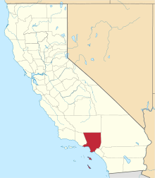
 Big Pines, California Location within the state of California | |
| Coordinates: 34°22′44″N 117°41′24″W | |
| Country | |
| State | |
| County | |
| Time zone | UTC-8 (Pacific (PST)) |
| • Summer (DST) | UTC-7 (PDT) |
| ZIP code | 92397 |
| Area code(s) | 760/442 |
Geography
The community is located in the Swarthout Valley, which was first settled in 1851. It is bordered on the east by the San Bernardino County line and the town of Wrightwood.
It is the highest elevation settlement located on the San Andreas Fault.
Recreation
Big Pines began as a year-round recreation area built by Los Angeles County in 1924.[1] It is a popular ski area close to Los Angeles, as it has a history of significant snowfall, even as late as May.[2][3]
The Mountain High Ski Resort and the Table Mountain Observatory are located in Big Pines.
See also
- Big Pines Highway
- Mountain High
- Wrightwood
- Carnival Boat a logging movie filmed on location in 1932
References
- Krig, Pat; Van Houten, Barbara (2004). Images of America: Wrightwood & Big Pines. Arcadia Publishing. ISBN 0-7385-2899-4. Retrieved 29 August 2011.
- "California Hit by Snow; Girl Dies in Drift". Sarasota Herald-Tribune. 5 May 1930. Retrieved 29 August 2011.
- "World's Ski Record Broken". Eugene Register-Guard. 2 February 1931. Retrieved 29 August 2011.
This article is issued from Wikipedia. The text is licensed under Creative Commons - Attribution - Sharealike. Additional terms may apply for the media files.