East Coventry Township, Chester County, Pennsylvania
East Coventry Township is a township in Chester County, Pennsylvania, United States. The population was 6,636 at the 2010 census.
East Coventry Township | |
|---|---|
 Abandoned house in Frick's Lock, with the Limerick Nuclear Plant in the background | |
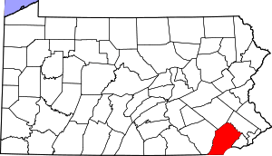
 Location in Chester County and the state of Pennsylvania. | |
.svg.png) Location of Pennsylvania in the United States | |
| Coordinates: 40°12′00″N 75°37′35″W | |
| Country | United States |
| State | Pennsylvania |
| County | Chester |
| Area | |
| • Total | 10.91 sq mi (28.26 km2) |
| • Land | 10.66 sq mi (27.62 km2) |
| • Water | 0.25 sq mi (0.64 km2) |
| Elevation | 243 ft (74 m) |
| Population (2010) | |
| • Total | 6,636 |
| • Estimate (2016)[2] | 6,730 |
| • Density | 631.10/sq mi (243.67/km2) |
| Time zone | UTC-5 (EST) |
| • Summer (DST) | UTC-4 (EDT) |
| Area code(s) | 610 |
| FIPS code | 42-029-21008 |
| Website | www |
History
The township derives its name from Coventry, England, the native home of an early settler.[3]
Fricks Locks Historic District, and River Bend Farm are listed on the National Register of Historic Places.[4]
Geography
According to the United States Census Bureau, the township has a total area of 11.0 square miles (28 km2), of which 10.8 square miles (28 km2) is land and 0.2 square miles (0.52 km2), or 1.55%, is water. The township includes the unincorporated community of Parker Ford.
Adjacent townships
- Lower Pottsgrove Township, Montgomery County (north)
- Limerick Township, Montgomery County (east)
- East Vincent Township, Chester County (south)
- South Coventry Township, Chester County (southwest)
- North Coventry Township, Chester County (west)
Demographics
At the 2010 census, the township was 92.5% non-Hispanic White, 3.1% Black or African American, 0.1% Native American, 1.4% Asian, and 1.4% were two or more races. 1.7% of the population were of Hispanic or Latino ancestry.[5]
At the 2000 census there were 4,566 people in 1,649 households, including 1,246 families, in the township. The population density was 423.4 people per square mile (163.5/km²). There were 1,684 housing units at an average density of 156.2/sq mi (60.3/km²). The racial makeup of the township was 98.38% White, 0.85% African American, 0.11% Native American, 0.22% Asian, 0.18% from other races, and 0.26% from two or more races. Hispanic or Latino of any race were 0.70%.[6]
There were 1,649 households, 32.7% had children under the age of 18 living with them, 66.5% were married couples living together, 6.8% had a female householder with no husband present, and 24.4% were non-families. 20.4% of households were made up of individuals, and 9.2% were one person aged 65 or older. The average household size was 2.64 and the average family size was 3.05.
The age distribution was 23.4% under the age of 18, 5.2% from 18 to 24, 25.8% from 25 to 44, 27.3% from 45 to 64, and 18.2% 65 or older. The median age was 43 years. For every 100 females, there were 91.0 males. For every 100 females age 18 and over, there were 86.2 males.
| Historical population | |||
|---|---|---|---|
| Census | Pop. | %± | |
| 1930 | 1,271 | — | |
| 1940 | 1,304 | 2.6% | |
| 1950 | 1,499 | 15.0% | |
| 1960 | 2,183 | 45.6% | |
| 1970 | 3,284 | 50.4% | |
| 1980 | 4,085 | 24.4% | |
| 1990 | 4,450 | 8.9% | |
| 2000 | 4,566 | 2.6% | |
| 2010 | 6,636 | 45.3% | |
| Est. 2016 | 6,730 | [2] | 1.4% |
| [7] | |||
The median household income was $58,125 and the median family income was $68,384. Males had a median income of $48,750 versus $32,031 for females. The per capita income for the township was $27,257. About 2.0% of families and 1.9% of the population were below the poverty line, including 0.9% of those under age 18 and none of those age 65 or over.
Notable people
- Grover C. Talbot, Pennsylvania State Representative for Delaware County (1925-1934), 116th Speaker of the Pennsylvania House of Representatives (1933-1934)
Points of interest
- Fricks Locks Historic District, an 18th-century village along the Schuylkill Canal
See also
References
- "2016 U.S. Gazetteer Files". United States Census Bureau. Retrieved Aug 13, 2017.
- "Population and Housing Unit Estimates". Retrieved June 9, 2017.
- "Church's 200th anniversary". Reading Eagle. Nov 10, 1924. p. 11. Retrieved 2 December 2015.
- "National Register Information System". National Register of Historic Places. National Park Service. July 9, 2010.
- https://www.usatoday.com/news/nation/census/profile/PA
- "U.S. Census website". United States Census Bureau. Retrieved 2008-01-31.
- http://www.dvrpc.org/data/databull/rdb/db82/appedixa.xls