Pennsylvania Route 113
Pennsylvania Route 113 (PA 113) is a 46.9-mile-long (75.5 km) state route in eastern Pennsylvania. The southern terminus of the route is at U.S. Route 30 Business (US 30 Bus.) in Downingtown. Its northern terminus is at PA 611 in Tinicum Township. The route is signed as north–south although its exact alignment follows a northeast-southwest routing. The route serves Chester, Montgomery, and Bucks counties, passing through Lionville, Phoenixville, Trappe, Skippack, Harleysville, Souderton, and Silverdale along the way.
| ||||
|---|---|---|---|---|
 | ||||
| Route information | ||||
| Maintained by PennDOT | ||||
| Length | 46.915 mi[1] (75.502 km) | |||
| Major junctions | ||||
| South end | ||||
| North end | ||||
| Location | ||||
| Counties | Chester, Montgomery, Bucks | |||
| Highway system | ||||
| ||||

PA 113 was originally designated by 1927 to run from PA 23 and PA 29 in Phoenixville to US 1 and PA 101 in Penndel. By 1930, PA 113 was extended from Phoenixville southwest to US 30 in Downingtown and south from Penndel to US 13 in Eddington. The route was moved to its current alignment between Phoenixville and Rahns in 1937, switching routes with PA 29. In 1946, the northern terminus of PA 113 was realigned at Kulps Corner to head to is current location, replacing part of PA 413. The former PA 113 between Kulps Corner and Eddington became PA 313, US 202, PA 413, PA 513, and Bensalem Boulevard. PA 113 was realigned to bypass Kimberton in the 1970s and Harleysville in the 1980s. In 2009, the new Gay Street Bridge over the French Creek was opened, replacing a bridge that was built in 1924.
Route description
Chester County
PA 113 begins at an intersection with US 30 Bus. in the borough of Downingtown in Chester County, heading north on Uwchlan Avenue, a two-lane divided highway. The road passes through residential areas and becomes an undivided road. The route crosses into East Caln Township and becomes a divided highway again as it reaches a partial interchange with the US 30 freeway, with access to westbound US 30 and from eastbound US 30. PA 113 becomes undivided again and continues northeast through wooded areas of homes with a few businesses. The road enters Uwchlan Township and widens to four lanes as it continues through suburban areas, passing to the northwest of Downingtown East High School. The route heads to the north and gains a center left-turn lane as it runs through commercial areas in Lionville. PA 113 curves to the northeast again and crosses PA 100. Past this intersection, the road passes west of a park and ride lot and heads near industrial parks before it comes to a bridge over the Pennsylvania Turnpike (Interstate 76, I-76). The route passes near residential areas with some farmland before it crosses into West Pikeland Township.[2][3]
Here, PA 113 becomes Kimberton Road and narrows to two lanes as it comes to an intersection with PA 401 at Opperman's Corner. The road continues northeast through wooded areas with some fields and residences, passing through the community of Chester Springs and crossing Pickering Creek. The route heads into East Pikeland Township and becomes Pike Springs Road as it continues through more rural areas with some development. PA 113 reaches the community of Kimberton and curves to the east, with the name becoming Kimberton Road again. The road passes through areas of homes and businesses and becomes the border between Schuylkill Township to the north and the borough of Phoenixville to the south at the Township Line Road intersection. The route passes more development and fully enters Schuylkill Township before crossing into Phoenixville and coming to the PA 23 junction.[2][3]
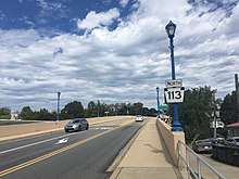
At this point, PA 113 turns southeast to form a concurrency with PA 23 on Nutt Road, a three-lane road with a center left-turn lane. The road passes businesses and crosses under an abandoned railroad line, at which point it continues through residential areas. PA 113 splits from PA 23 by heading northeast on two-lane Bridge Street. The road passes homes before heading into commercial areas. The route continues east into downtown Phoenixville, where it turns north to cross the French Creek, the Schuylkill River Trail, and the former Phoenix Iron Works site on the Gay Street Bridge. PA 113 becomes Franklin Street and heads into residential areas, turning east onto Emmet Street. The route turns north onto Dayton Street before it curves northeast along Freemont Street. The name changes to Black Rock Road and the road continues through wooded areas with some residential development, curving to the north before a turn to the northwest.[2][3]
Montgomery and Bucks counties
PA 113 crosses the Schuylkill River on the Black Rock Bridge into Upper Providence Township in Montgomery County and heads into fields, turning northeast onto Trappe Road. The road continues near residential neighborhoods and passes under the US 422 freeway. The route heads through a mix of fields and homes before it crosses into the borough of Trappe. Here, PA 113 becomes 3rd Avenue and runs through residential areas, crossing Main Street. Following this, the road passes through farmland before it enters Perkiomen Township and becomes Bridge Road, passing to the west of an industrial park. PA 113 curves east and passes homes as it comes to an intersection with PA 29 in Rahns. The road crosses the Perkiomen Trail and the Perkiomen Creek into Skippack Township and passes through wooded residential areas, turning back to the northeast. The route passes through a mix of fields and development as it runs to the southeast of State Correctional Institution – Phoenix and heads through the community of Creamery. PA 113 passes near more homes and comes to a junction with PA 73 in a commercial area.[2][4]
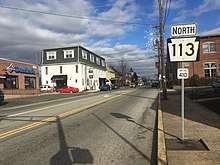
The road heads past more residential development and curves north, at which point it crosses into Lower Salford Township and becomes Harleysville Pike. The route passes through a mix of fields and woods with some homes, turning to the northeast in the community of Lederach. PA 113 heads north through an S-curve near more residential development before it turns northeast and gains a center left-turn lane as it comes to an intersection with PA 63 in Harleysville. The road becomes two-lane Souderton-Harleysville Pike and passes near residential neighborhoods and farm fields before it crosses into Franconia Township. The route runs through agricultural areas with a few homes and comes to a bridge over the Northeast Extension of the Pennsylvania Turnpike (I-476). PA 113 passes through more rural areas before it heads past a few businesses between Allentown Road and Godshall Road. The road curves east into areas of homes and crosses into the borough of Souderton. At this point, the route becomes Main Street and turns to the southeast, passing more homes and a few businesses. PA 113 heads into the downtown area and turns northeast onto Broad Street, immediately crossing the Bethlehem Line railroad line that is owned by SEPTA and operated by the Pennsylvania Northeastern Railroad at-grade. The road passes more homes before it gains a center left-turn lane and passes businesses.[2][4]
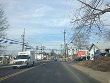
After crossing County Line Road, PA 113 enters Hilltown Township in Bucks County and becomes Souderton Road, passing more businesses as a five-lane road with a center left-turn lane and coming to an interchange with the PA 309 freeway. The road passes more development before it comes to the Bethlehem Pike intersection. The route narrows back to two lanes and runs through a mix of farmland and woodland with some housing developments. Farther northeast, PA 113 crosses into the borough of Silverdale and becomes Main Street, passing homes and a few businesses. In this borough, the route forms a short wrong-way concurrency with PA 152. The road crosses back into Hilltown Township and becomes Souderton Road again, running through more farmland with some woods and residences. PA 113 passes through the community of Blooming Glen and continues through rural areas to an intersection with PA 313 in Kulps Corner, at which point there are a few businesses. Upon crossing PA 313, the route heads into Bedminster Township as Bedminster Road, continuing through agricultural and wooded areas with occasional homes. The road heads northeast and passes through the community of Bedminster. Farther northeast, PA 113 crosses the Tohickon Creek into Tinicum Township and comes to its northern terminus at an intersection with PA 611.[2][5]
History

When Pennsylvania first legislated routes in 1911, what would become PA 113 was designated as Legislative Route 270 between Downingtown and Phoenixville, Legislative Route 202 between Phoenixville and Collegeville, Legislative Route 158 between Collegeville and Iron Bridge, Legislative Route 270 between Iron Bridge and Blooming Glen, Legislative Route 154 between Dublin and Doylestown, Legislative Route 178 between Doylestown and Buckingham, and Legislative Route 152 between Buckingham and Langhorne.[6] PA 113 was first designated by 1927 to run from PA 23 and PA 29 in Phoenixville east to US 1 (now US 1 Bus.) and PA 101 in Penndel. PA 113 continued northeast from Phoenixville through Collegeville and resumed along its present-day alignment in Iron Bridge. The route ran northeast through Harleysville, Souderton, and Silverdale before it turned southeast at Kulps Corner. From here, PA 113 passed through Dublin before it reached Doylestown, where it briefly ran concurrent south on US 611 on Main Street before heading east along US 122 (now US 202) at State Street to Buckingham. PA 113 split from US 122 here and ran southeast through Newtown and then south through Langhorne to Penndel.[7] By 1930, PA 113 was extended southwest to US 30 (now US 30 Bus.) in Downingtown along its present routing. The route was also extended from Penndel south through Hulmeville to US 13 near Eddington.[8] PA 113 and PA 29 switched alignments between Phoenixville and Rahns in 1937, with PA 113 now following its present alignment between those two places.[9][10] By 1940, PA 113 was paved from northeast of Downingtown to Lionville and between Hulmeville and Eddington.[9]
The northern terminus of PA 113 was realigned to its current location at US 611 (now PA 611) in 1946, replacing a portion of PA 413. The former alignment of PA 113 east of Kulps Corner became PA 313 between Kulps Corner and Doylestown, solely US 202 between Doylestown and Buckingham, PA 413 between Buckingham and Penndel, PA 513 between Penndel and Hulmeville, and present-day Bensalem Boulevard between Hulmeville and US 13.[11] PA 113 was slightly re-routed in the 1970s when a bypass was constructed around Kimberton. The historic roadbed is currently Kimberton Road and Hares Hill Road.[12] In the 1980s, PA 113 was rerouted to bypass the center of Harleysville, eliminating a short concurrency with PA 63.[13] In 2008, the structurally deficient Gay Street Bridge over the French Creek in Phoenixville, built in 1924, was closed and demolished in a project to build a new bridge.[14][15] The new Gay Street Bridge opened in fall 2009 at a cost of $17 million.[15]
Sly Fox Brewery, which operates a brewpub on PA 113 in Phoenixville, [16] produces Route 113 IPA, an India Pale Ale whose label features the black-and-white keystone silhouette of the route's sign.[17]
Major intersections
| County | Location | mi[1] | km | Destinations | Notes |
|---|---|---|---|---|---|
| Chester | Downingtown | 0.000 | 0.000 | Southern terminus | |
| East Caln Township | 0.584 | 0.940 | Interchange; access to westbound US 30 and from eastbound US 30 | ||
| Uwchlan Township | 3.935 | 6.333 | |||
| West Pikeland Township | 5.902 | 9.498 | |||
| Phoenixville | 12.791 | 20.585 | Southern terminus of concurrency | ||
| 13.260 | 21.340 | Northern terminus of concurrency | |||
| Schuylkill River | 16.121 | 25.944 | Black Rock Bridge | ||
| Montgomery | Perkiomen Township | 21.098 | 33.954 | Southern terminus of PA 113 Alternate Truck | |
| Skippack Township | 24.362 | 39.207 | Northern terminus of PA 113 Alternate Truck | ||
| Lower Salford Township | 28.506 | 45.876 | |||
| Bucks | Hilltown Township | 34.179 | 55.006 | Interchange | |
| Silverdale | 37.063 | 59.647 | Southern terminus of concurrency | ||
| 37.176 | 59.829 | Northern terminus of concurrency | |||
| Hilltown–Bedminster township line | 40.801 | 65.663 | |||
| Tinicum Township | 46.915 | 75.502 | Northern terminus | ||
1.000 mi = 1.609 km; 1.000 km = 0.621 mi
| |||||
PA 113 Alternate Truck
| |
|---|---|
| Location | Montgomery County, Pennsylvania |
| Existed | 2013–present |
Pennsylvania Route 113 Alternate Truck is a truck route of PA 113, bypassing a weight-restricted bridge over a branch of the Skippack Creek in Skippack Township, on which trucks over 34 tons and combination loads over 40 tons are prohibited. The route follows PA 29 and PA 73. It was signed in 2013.[18][19]
See also


References
- Bureau of Maintenance and Operations (January 2015). Roadway Management System Straight Line Diagrams (Report) (2015 ed.). Pennsylvania Department of Transportation. Retrieved June 30, 2015.
- Chester County (PDF)
- Montgomery County (PDF)
- Bucks County (PDF)
- Google (February 21, 2013). "overview of Pennsylvania Route 113" (Map). Google Maps. Google. Retrieved February 21, 2013.
- Chester County, Pennsylvania (Map) (17th ed.). 1"=2000'. ADC Map. 2006. ISBN 0-87530-778-7.
- Montgomery County, Pennsylvania (Map) (18th ed.). 1"=2000'. ADC Map. 2006. ISBN 0-87530-775-2.
- Bucks County, Pennsylvania (Map) (19th ed.). 1"=2000'. ADC Map. 2006. ISBN 0-87530-774-4.
- Map of Pennsylvania Showing State Highways (PDF) (Map). Pennsylvania Department of Highways. 1911. Archived from the original (PDF) on July 5, 2011. Retrieved January 1, 2014.
- Map of New Jersey (Map). Tydol Trails. 1927. Archived from the original on May 14, 2011. Retrieved February 9, 2011.
- Tourist Map of Pennsylvania (PDF) (Map). Pennsylvania Department of Highways. 1930. Archived from the original (PDF) on July 5, 2011. Retrieved January 1, 2014.
- Official Road Map of Pennsylvania (PDF) (Map). Pennsylvania Department of Highways. 1940. Archived from the original (PDF) on July 5, 2011. Retrieved January 1, 2014.
- "Phoenixville-Rahns Route Numbers Changed". Pottstown Mercury. Pottstown, PA. May 4, 1937. p. 11. Retrieved May 25, 2016 – via Newspapers.com.

- Map of Bucks County (PDF) (Map). Pennsylvania Department of Highways. 1946. Retrieved October 18, 2017.
- Pennsylvania Official Transportation Map (PDF) (Map). Pennsylvania Department of Transportation. 1980. Archived from the original (PDF) on October 24, 2011. Retrieved January 1, 2014.
- Pennsylvania Official Transportation Map (PDF) (Map). Pennsylvania Department of Transportation. 1989. Archived from the original (PDF) on July 5, 2011. Retrieved January 27, 2011.
- "Gay Street/Route 113 Bridge in Phoenixville to close for replacement on April 2". PennDOT. March 27, 2008. Archived from the original on January 2, 2014. Retrieved January 1, 2014.
- "Gay Street Bridge Phoenixville, PA". High Steel Structures Inc. Archived from the original on January 2, 2014. Retrieved January 1, 2014.
- LaBan, Craig (19 October 2017). "Craig LaBan's Best of the 'burbs: Beer-burbia". Philly.com. Retrieved 8 July 2018.
- "Route 113 I.P.A. (Sly Fox Brewing Company)". BeerAdvocate.
- Google (May 18, 2014). "overview of Pennsylvania Route 113 Alternate Truck" (Map). Google Maps. Google. Retrieved May 18, 2014.
- "Risk-Based Bridge Postings - State and Local Bridges" (PDF). Pennsylvania Department of Transportation. October 8, 2013. Retrieved December 18, 2014.
| Wikimedia Commons has media related to Pennsylvania Route 113. |