East Nottingham Township, Chester County, Pennsylvania
East Nottingham Township is a township in Chester County, Pennsylvania, United States. The population was 8,650 at the 2010 census.
East Nottingham Township | |
|---|---|
 | |
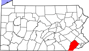
 Location in Chester County and the state of Pennsylvania. | |
.svg.png) Location of Pennsylvania in the United States | |
| Coordinates: 39°44′00″N 75°58′59″W | |
| Country | United States |
| State | Pennsylvania |
| County | Chester |
| Area | |
| • Total | 20.14 sq mi (52.17 km2) |
| • Land | 20.03 sq mi (51.87 km2) |
| • Water | 0.12 sq mi (0.31 km2) |
| Elevation | 499 ft (152 m) |
| Population (2010) | |
| • Total | 8,650 |
| • Estimate (2016)[2] | 8,962 |
| • Density | 447.52/sq mi (172.79/km2) |
| Time zone | UTC-5 (EST) |
| • Summer (DST) | UTC-4 (EDT) |
| Area code(s) | 610 |
| FIPS code | 42-029-21624 |
| Website | www |
History
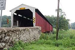
It is named after Nottinghamshire, England.[3] The township was originally disputed territory between Pennsylvania and Maryland, resolved eventually by the Mason–Dixon line.[3] Half of the current township also formed part of the northern section of Susquehanna Manor, a large settlement tract as part of Maryland belonging to George Talbot, nephew of Lord Baltimore, which he later named New Connaught after the western province of Connacht in Ireland that courted Irish settlement into the area.[3][4] The dispute led to heavy Quaker and Scotch-Irish settlement of the area.[3] The Hopewell Historic District is listed on the National Register of Historic Places.[5]
Geography
According to the United States Census Bureau, the township has a total area of 20.1 square miles (52 km2), of which 20.0 square miles (52 km2) is land and 0.04 square miles (0.10 km2), or 0.10%, is water.
Demographics
| Historical population | |||
|---|---|---|---|
| Census | Pop. | %± | |
| 1930 | 1,339 | — | |
| 1940 | 1,576 | 17.7% | |
| 1950 | 1,748 | 10.9% | |
| 1960 | 2,298 | 31.5% | |
| 1970 | 2,402 | 4.5% | |
| 1980 | 3,111 | 29.5% | |
| 1990 | 3,841 | 23.5% | |
| 2000 | 5,516 | 43.6% | |
| 2010 | 8,650 | 56.8% | |
| Est. 2016 | 8,962 | [2] | 3.6% |
| [6] | |||
At the 2010 census, the township was 86.0% non-Hispanic White, 3.1% Black or African American, 0.4% Asian, and 2.0% were two or more races. 9.2% of the population were of Hispanic or Latino ancestry.[7]
At the 2000 census there were 5,516 people, 1,759 households, and 1,442 families living in the township. The population density was 275.3 people per square mile (106.3/km²). There were 1,837 housing units at an average density of 91.7/sq mi (35.4/km²). The racial makeup of the township was 92.97% White, 2.94% African American, 0.25% Native American, 0.24% Asian, 2.32% from other races, and 1.29% from two or more races. Hispanic or Latino of any race were 5.29%.[8]
There were 1,759 households, 44.3% had children under the age of 18 living with them, 70.6% were married couples living together, 7.0% had a female householder with no husband present, and 18.0% were non-families. 12.7% of households were made up of individuals, and 4.7% were one person aged 65 or older. The average household size was 3.13 and the average family size was 3.41.
The age distribution was 32.6% under the age of 18, 7.0% from 18 to 24, 33.3% from 25 to 44, 19.9% from 45 to 64, and 7.3% 65 or older. The median age was 32 years. For every 100 females there were 107.3 males. For every 100 females age 18 and over, there were 103.4 males.
The median household income was $53,864 and the median family income was $57,904. Males had a median income of $39,920 versus $31,731 for females. The per capita income for the township was $19,710. About 4.4% of families and 8.7% of the population were below the poverty line, including 13.6% of those under age 18 and none of those age 65 or over.
References
- "2016 U.S. Gazetteer Files". United States Census Bureau. Retrieved Aug 13, 2017.
- "Population and Housing Unit Estimates". Retrieved June 9, 2017.
- "Nottingham Lots / Rising Sun, MD". www.risingsunmd.org. Retrieved 2016-05-08.
- Johnston, George (2009-06-01). History of Cecil County, Maryland. Genealogical Publishing Com. ISBN 9780806379883.
- "National Register Information System". National Register of Historic Places. National Park Service. July 9, 2010.
- http://www.dvrpc.org/data/databull/rdb/db82/appedixa.xls
- https://www.usatoday.com/news/nation/census/profile/PA
- "U.S. Census website". United States Census Bureau. Retrieved 2008-01-31.