Montezuma County, Colorado
Montezuma County is the southwesternmost of the 64 counties in the U.S. state of Colorado. As of the 2010 census, the population was 25,535.[1] The county seat is Cortez.[2]
Montezuma County | |
|---|---|
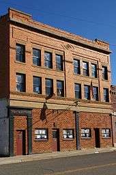
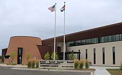 The Montezuma County Combined Courts building in Cortez | |
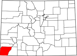 Location within the U.S. state of Colorado | |
 Colorado's location within the U.S. | |
| Coordinates: 37°20′N 108°36′W | |
| Country | |
| State | |
| Founded | April 16, 1889 |
| Named for | Moctezuma II |
| Seat | Cortez |
| Largest city | Cortez |
| Area | |
| • Total | 2,040 sq mi (5,300 km2) |
| • Land | 2,030 sq mi (5,300 km2) |
| • Water | 11 sq mi (30 km2) 0.5%% |
| Population | |
| • Estimate (2019) | 26,183 |
| • Density | 12/sq mi (5/km2) |
| Time zone | UTC−7 (Mountain) |
| • Summer (DST) | UTC−6 (MDT) |
| Congressional district | 3rd |
| Website | montezumacounty |

.jpg)
Mesa Verde National Park, Canyons of the Ancients National Monument, Yucca House National Monument, and Hovenweep National Monument preserve hundreds of ancient Amerindian structures, including the famous cliff-dwellings, found in the county. Montezuma County is also home to most of the Ute Mountain Indian Reservation, home of the Weeminuche Band of the Ute Nation, known as the Ute Mountain Ute Tribe, with its headquarters at Towaoc.
History
Montezuma County has been settled since approximately AD 600, and had an estimated population of approximately 100,000, four times its current population, in the 12th century. However, a series of events caused virtually all permanent settlements to be abandoned between 1200 and 1300, and the area was contested between nomadic Ute and Navajo bands until resettlement occurred in the 1870s. Montezuma County was created out of the western portion of La Plata County by the Colorado Legislature in April 1889. It was named in honor of Moctezuma II, a famous chief of the Aztec Indians in Mexico. The building ruins in Mesa Verde National Park were thought to be of Aztec origin at the time.
Geography
According to the U.S. Census Bureau, the county has a total area of 2,040 square miles (5,300 km2), of which 2,030 square miles (5,300 km2) is land and 11 square miles (28 km2) (0.5%) is water.[3]
A large county, roughly 1/3 of its area is tribal land, 1/3 is federal land (administered by the National Park Service, the United States Forest Service and the Bureau of Land Management), and 1/3 private or state/county land. It is also varied topographically, ranging in elevation from about 6,000 feet (1,800 m) to more than 13,200 feet (4,000 m), and from high Colorado Plateau desert to alpine tundra. The county has the second largest reservoir in Colorado, McPhee Reservoir, many other large reservoirs, and hundreds of private lakes and ponds. Much of the county is irrigated cropland, and it produces fruit, large numbers of cattle and sheep, and beans. It is served by U.S. Highways 160 and 491 (formerly US 666), and by Cortez Municipal Airport. It has no rail service, although both Mancos and Dolores were established as railroad towns in the 1890s.
Adjacent counties
- Dolores County - north
- San Juan County - northeast
- La Plata County - east
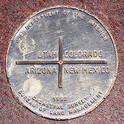
- San Juan County, New Mexico - south - New Mexico portion of Four Corners.
- Apache County, Arizona - southwest - Arizona portion of Four Corners.
- San Juan County, Utah - west - Utah portion of Four Corners.
Montezuma County is the only county in the United States to border three counties with the same name in three different states (San Juan County in Colorado, New Mexico, and Utah). The "border" with San Juan County, Colorado, is, however, only a point of zero length.
National protected areas
- Calico National Recreation Trail
- Canyons of the Ancients National Monument (part)
- Highline Loop National Recreation Trail
- Hovenweep National Monument (part)
- Lowry Ruin National Historic Landmark, now part of Canyons of the Ancients National Monument
- Mesa Verde National Park
- Mesa Verde Wilderness
- Old Spanish National Historic Trail
- Petroglyph Point National Recreation Trail
- San Juan National Forest
- Yucca House National Monument
State protected area
Other protected area
Demographics
| Historical population | |||
|---|---|---|---|
| Census | Pop. | %± | |
| 1890 | 1,529 | — | |
| 1900 | 3,058 | 100.0% | |
| 1910 | 5,029 | 64.5% | |
| 1920 | 6,260 | 24.5% | |
| 1930 | 7,798 | 24.6% | |
| 1940 | 10,463 | 34.2% | |
| 1950 | 9,991 | −4.5% | |
| 1960 | 14,024 | 40.4% | |
| 1970 | 12,952 | −7.6% | |
| 1980 | 16,510 | 27.5% | |
| 1990 | 18,762 | 13.6% | |
| 2000 | 23,830 | 27.0% | |
| 2010 | 25,535 | 7.2% | |
| Est. 2019 | 26,183 | [4] | 2.5% |
| U.S. Decennial Census[5] 1790-1960[6] 1900-1990[7] 1990-2000[8] 2010-2015[1] | |||
As of the census[9] of 2000, there were 23,830 people, 9,201 households, and 6,514 families residing in the county. The population density was 12 people per square mile (5/km²). There were 10,497 housing units at an average density of 5 per square mile (2/km²). The racial makeup of the county was 81.72% White, 0.14% Black or African American, 11.23% Native American, 0.20% Asian, 0.06% Pacific Islander, 4.26% from other races, and 2.38% from two or more races. 9.50% of the population were Hispanic or Latino of any race.
There were 9,201 households out of which 33.30% had children under the age of 18 living with them, 56.40% were married couples living together, 10.60% had a female householder with no husband present, and 29.20% were non-families. 24.60% of all households were made up of individuals and 9.30% had someone living alone who was 65 years of age or older. The average household size was 2.54 and the average family size was 3.04.
In the county, the population was spread out with 27.50% under the age of 18, 7.10% from 18 to 24, 26.30% from 25 to 44, 25.30% from 45 to 64, and 13.80% who were 65 years of age or older. The median age was 38 years. For every 100 females there were 96.70 males. For every 100 females age 18 and over, there were 92.20 males.
The median income for a household in the county was $32,083, and the median income for a family was $38,071. Males had a median income of $30,666 versus $21,181 for females. The per capita income for the county was $17,003. About 13.10% of families and 16.40% of the population were below the poverty line, including 23.20% of those under age 18 and 14.40% of those age 65 or over.
Communities
City
Other unincorporated places
Politics
In its early history Montezuma County favored the Democratic Party. It was one of the few counties in the West to be won by Alton B. Parker in 1904, and along with neighboring La Plata County was one of only two Colorado counties to give a plurality to John W. Davis in the three-way 1924 election. However, since the 1940s Montezuma has been a strongly Republican county: no Democrat since 1968 has won forty percent of the county's vote in a Presidential election.
| Year | Republican | Democratic | Others |
|---|---|---|---|
| 2016 | 61.1% 7,853 | 30.9% 3,973 | 8.0% 1,032 |
| 2012 | 60.1% 7,401 | 36.9% 4,542 | 3.0% 375 |
| 2008 | 58.9% 6,961 | 39.4% 4,661 | 1.7% 203 |
| 2004 | 63.4% 6,988 | 35.1% 3,867 | 1.5% 160 |
| 2000 | 65.6% 6,158 | 27.2% 2,556 | 7.1% 670 |
| 1996 | 53.3% 4,175 | 32.9% 2,578 | 13.8% 1,078 |
| 1992 | 40.9% 3,124 | 29.7% 2,270 | 29.4% 2,244 |
| 1988 | 64.2% 4,208 | 34.1% 2,233 | 1.7% 110 |
| 1984 | 73.1% 4,753 | 25.6% 1,665 | 1.4% 88 |
| 1980 | 68.6% 4,120 | 24.4% 1,467 | 7.0% 419 |
| 1976 | 58.0% 3,002 | 38.5% 1,993 | 3.5% 182 |
| 1972 | 73.5% 3,391 | 26.5% 1,223 | 0.0% 0 |
| 1968 | 56.4% 2,461 | 30.9% 1,349 | 12.7% 552 |
| 1964 | 43.0% 2,035 | 56.7% 2,686 | 0.4% 17 |
| 1960 | 56.7% 2,778 | 43.2% 2,115 | 0.1% 7 |
| 1956 | 63.6% 2,492 | 35.8% 1,402 | 0.6% 25 |
| 1952 | 68.0% 2,466 | 31.1% 1,127 | 0.9% 33 |
| 1948 | 49.2% 1,630 | 49.9% 1,653 | 0.9% 30 |
| 1944 | 57.0% 1,610 | 42.7% 1,207 | 0.3% 8 |
| 1940 | 59.3% 2,313 | 40.3% 1,573 | 0.5% 18 |
| 1936 | 38.9% 1,087 | 56.5% 1,579 | 4.6% 129 |
| 1932 | 31.8% 887 | 63.9% 1,779 | 4.3% 120 |
| 1928 | 62.4% 1,341 | 35.9% 772 | 1.7% 37 |
| 1924 | 34.6% 703 | 35.5% 721 | 30.0% 609 |
| 1920 | 52.2% 936 | 40.6% 727 | 7.3% 130 |
| 1916 | 21.6% 425 | 74.1% 1,458 | 4.3% 85 |
| 1912 | 15.9% 285 | 56.7% 1,017 | 27.4% 492 |
In gubernatorial elections, Montezuma County is also Republican-leaning: in 2010 it was along with neighboring Dolores County one of only two counties to give a plurality to Dan Maes.[11] The last Democratic gubernatorial nominee to win Montezuma County was Roy Romer in 1990 when he carried all but four counties statewide.[12] The last Democratic senatorial candidate to carry Montezuma County was Ben “Nighthorse” Campbell – later to switch to the Republican Party – in 1992.
See also
- Outline of Colorado
- Index of Colorado-related articles
- William B. Ebbert, represented Montezuma in the Colorado General Assembly in early 20th century.
- National Register of Historic Places listings in Montezuma County, Colorado
- East Canyon Fire
References
- "State & County QuickFacts". United States Census Bureau. Archived from the original on July 28, 2011. Retrieved June 8, 2014.
- "Find a County". National Association of Counties. Retrieved 2011-06-07.
- "US Gazetteer files: 2010, 2000, and 1990". United States Census Bureau. 2011-02-12. Retrieved 2011-04-23.
- "Population and Housing Unit Estimates". Retrieved December 12, 2019.
- "U.S. Decennial Census". United States Census Bureau. Retrieved June 8, 2014.
- "Historical Census Browser". University of Virginia Library. Retrieved June 8, 2014.
- "Population of Counties by Decennial Census: 1900 to 1990". United States Census Bureau. Retrieved June 8, 2014.
- "Census 2000 PHC-T-4. Ranking Tables for Counties: 1990 and 2000" (PDF). United States Census Bureau. Retrieved June 8, 2014.
- "U.S. Census website". United States Census Bureau. Retrieved 2011-05-14.
- Leip, David. "Dave Leip's Atlas of U.S. Presidential Elections". uselectionatlas.org. Retrieved May 26, 2017.
- Dave Leip’s U.S. Election Atlas; 2010 Gubernatorial General Election Results – Colorado
- Dave Leip’s U.S. Election Atlas; 1990 Gubernatorial General Election Results – Colorado
External links
- Montezuma County official website
- Montezuma County Sheriff's Office
- Canyons of the Ancients National Monument
- Hovenweep National Monument
- Mesa Verde National Park
- Yucca House National Monument
- Colorado County Evolution, by Don Stanwyck
- Colorado Historical Society
| Wikimedia Commons has media related to Montezuma County, Colorado. |
Places adjacent to Montezuma County, Colorado | ||||||||||
|---|---|---|---|---|---|---|---|---|---|---|
| ||||||||||
Municipalities and communities of Montezuma County, Colorado, United States | ||
|---|---|---|
| City | Map of Colorado highlighting Montezuma County | |
| Towns | ||
| CDP | ||
| Unincorporated communities | ||
| Indian reservations | ||
| Footnotes | ‡This populated place also has portions in an adjacent county or counties | |

| Authority control |
|
|---|