Grand County, Colorado
Grand County is one of the 64 counties in the U.S. state of Colorado. As of the 2010 census, the population was 14,843.[1] The county seat is Hot Sulphur Springs.[2]
Grand County | |
|---|---|
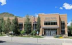 The Grand County Judicial Center in Hot Sulphur Springs, July 2016 | |
 Seal | |
 Location within the U.S. state of Colorado | |
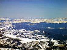
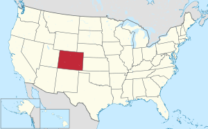 Colorado's location within the U.S. | |
| Coordinates: 40.10°N 106.12°W | |
| Country | |
| State | |
| Founded | February 2, 1874 |
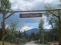
| Named for | Grand Lake and Grand River |
| Seat | Hot Sulphur Springs |
| Largest town | Granby |
| Area | |
| • Total | 1,870 sq mi (4,800 km2) |
| • Land | 1,846 sq mi (4,780 km2) |
| • Water | 23 sq mi (60 km2) 1.2%% |
| Population | |
| • Estimate (2019) | 15,734 |
| • Density | 8.0/sq mi (3.1/km2) |
| Time zone | UTC−7 (Mountain) |
| • Summer (DST) | UTC−6 (MDT) |
| Congressional district | 2nd |
| Website | co |
History
When Grand County was created February 2, 1874 it was carved out of Summit County and contained land to the western and northern borders of the state, which is in present-day Moffat County and Routt County. It was named after Grand Lake and the Grand River,[3] an old name for the upper Colorado River, which has its headwaters in the county. On January 29, 1877 Routt County was created and Grand County shrunk down to its current western boundary. When valuable minerals were found in North Park, Grand County claimed the area as part of its county, a claim Larimer County also held. It took a decision by the Colorado Supreme Court in 1886 to declare North Park part of Larimer County, setting Grand County's northern boundary.
Geography
According to the U.S. Census Bureau, the county has a total area of 1,870 square miles (4,800 km2), of which 1,846 square miles (4,780 km2) is land and 23 square miles (60 km2) (1.2%) is water.[4]
Adjacent counties
- Larimer County - northeast
- Gilpin County - east
- Boulder County - east
- Clear Creek County - southeast
- Summit County - south
- Eagle County - southwest
- Jackson County - north
- Routt County - west
National protected areas
- Arapaho National Forest
- Arapaho National Recreation Area
- Byers Peak Wilderness
- Continental Divide National Scenic Trail
- Indian Peaks Wilderness
- Never Summer Wilderness
- Ptarmigan Peak Wilderness
- Rocky Mountain National Park
- Routt National Forest
- Sarvis Creek Wilderness
- Vasquez Peak Wilderness
Bicycle routes
- Great Parks Bicycle Route
- TransAmerica Trail Bicycle Route
Scenic byways
- Colorado River Headwaters National Scenic Byway
- Trail Ridge Road/Beaver Meadow National Scenic Byway
| Historical population | |||
|---|---|---|---|
| Census | Pop. | %± | |
| 1880 | 417 | — | |
| 1890 | 604 | 44.8% | |
| 1900 | 741 | 22.7% | |
| 1910 | 1,862 | 151.3% | |
| 1920 | 2,659 | 42.8% | |
| 1930 | 2,108 | −20.7% | |
| 1940 | 3,587 | 70.2% | |
| 1950 | 3,963 | 10.5% | |
| 1960 | 3,557 | −10.2% | |
| 1970 | 4,107 | 15.5% | |
| 1980 | 7,475 | 82.0% | |
| 1990 | 7,966 | 6.6% | |
| 2000 | 12,442 | 56.2% | |
| 2010 | 14,843 | 19.3% | |
| Est. 2018 | 15,525 | [5] | 4.6% |
| U.S. Decennial Census[6] 1790-1960[7] 1900-1990[8] 1990-2000[9] 2010-2015[1] | |||
Demographics
At the 2000 census there were 12,442 people in 5,075 households, including 3,217 families, in the county. The population density was 7 people per square mile (3/km²). There were 10,894 housing units at an average density of 6 per square mile (2/km²). The racial makeup of the county was 95.15% White, 0.48% Black or African American, 0.43% Native American, 0.68% Asian, 0.10% Pacific Islander, 2.00% from other races, and 1.15% from two or more races. 4.36% of the population were Hispanic or Latino of any race. 23.8% were of German, 12.6% Irish, 10.0% English and 7.3% American ancestry.[10] Of the 5,075 households 28.10% had children under the age of 18 living with them, 54.70% were married couples living together, 5.20% had a female householder with no husband present, and 36.60% were non-families. 24.80% of households were one person and 4.80% were one person aged 65 or older. The average household size was 2.37 and the average family size was 2.85.
The age distribution was 21.80% under the age of 18, 9.00% from 18 to 24, 34.70% from 25 to 44, 26.80% from 45 to 64, and 7.80% 65 or older. The median age was 37 years. For every 100 females there were 112.70 males. For every 100 females age 18 and over, there were 115.70 males.
The median household income was $47,759 and the median family income was $55,217. Males had a median income of $34,861 versus $26,445 for females. The per capita income for the county was $25,198. About 5.40% of families and 7.30% of the population were below the poverty line, including 7.90% of those under age 18 and 6.10% of those age 65 or over.
Politics
| Year | Republican | Democratic | Others |
|---|---|---|---|
| 2016 | 52.3% 4,494 | 39.1% 3,358 | 8.6% 736 |
| 2012 | 52.0% 4,253 | 45.0% 3,684 | 3.1% 250 |
| 2008 | 48.6% 4,037 | 49.7% 4,128 | 1.7% 144 |
| 2004 | 56.0% 4,260 | 42.6% 3,243 | 1.4% 106 |
| 2000 | 56.2% 3,570 | 36.3% 2,308 | 7.5% 475 |
| 1996 | 46.3% 2,264 | 41.2% 2,012 | 12.6% 614 |
| 1992 | 35.9% 1,763 | 34.1% 1,678 | 30.0% 1,477 |
| 1988 | 60.1% 2,306 | 37.8% 1,451 | 2.1% 81 |
| 1984 | 72.7% 2,865 | 25.8% 1,017 | 1.5% 58 |
| 1980 | 61.3% 2,133 | 23.6% 820 | 15.2% 528 |
| 1976 | 61.8% 1,703 | 33.0% 910 | 5.2% 144 |
| 1972 | 69.9% 1,721 | 27.8% 685 | 2.2% 55 |
| 1968 | 67.4% 1,167 | 25.0% 433 | 7.6% 132 |
| 1964 | 47.2% 814 | 52.3% 902 | 0.5% 8 |
| 1960 | 62.6% 1,104 | 37.3% 657 | 0.1% 2 |
| 1956 | 71.3% 1,239 | 28.6% 496 | 0.1% 2 |
| 1952 | 70.3% 1,333 | 29.2% 554 | 0.4% 8 |
| 1948 | 49.7% 777 | 48.9% 763 | 1.4% 22 |
| 1944 | 63.5% 968 | 36.4% 554 | 0.1% 2 |
| 1940 | 55.2% 1,074 | 44.4% 863 | 0.5% 9 |
| 1936 | 45.5% 714 | 54.0% 846 | 0.5% 8 |
| 1932 | 42.9% 598 | 55.3% 771 | 1.9% 26 |
| 1928 | 62.2% 770 | 36.4% 451 | 1.5% 18 |
| 1924 | 54.3% 681 | 24.6% 308 | 21.1% 265 |
| 1920 | 52.5% 649 | 44.7% 553 | 2.8% 34 |
| 1916 | 37.2% 378 | 61.4% 624 | 1.5% 15 |
| 1912 | 25.8% 248 | 52.7% 507 | 21.5% 207 |
Communities
Other
See also
References
- "State & County QuickFacts". United States Census Bureau. Archived from the original on June 6, 2011. Retrieved January 25, 2014.
- "Find a County". National Association of Counties. Archived from the original on 2011-05-31. Retrieved 2011-06-07.
- Gannett, Henry (1905). The Origin of Certain Place Names in the United States. Govt. Print. Off. pp. 141.
- "US Gazetteer files: 2010, 2000, and 1990". United States Census Bureau. 2011-02-12. Retrieved 2011-04-23.
- "Population and Housing Unit Estimates". Retrieved December 3, 2019.
- "U.S. Decennial Census". United States Census Bureau. Retrieved June 8, 2014.
- "Historical Census Browser". University of Virginia Library. Retrieved June 8, 2014.
- "Population of Counties by Decennial Census: 1900 to 1990". United States Census Bureau. Retrieved June 8, 2014.
- "Census 2000 PHC-T-4. Ranking Tables for Counties: 1990 and 2000" (PDF). United States Census Bureau. Retrieved June 8, 2014.
- "U.S. Census website". United States Census Bureau. Retrieved 2011-05-14.
- Leip, David. "Dave Leip's Atlas of U.S. Presidential Elections". uselectionatlas.org. Retrieved May 26, 2017.
External links
| Wikimedia Commons has media related to Grand County, Colorado. |
- Official website
- Arapaho National Recreation Area website
- Colorado County Evolution by Don Stanwyck
- Colorado Historical Society
- Grand County Library District website
- Grand County News website
- Grand County Tourism Board website
- Town of Hot Sulphur Springs website
- Rocky Mountain National Park website
- Winter Park and Fraser Valley Chamber of Commerce website
- Grand Lake Chamber of Commerce homepage
- WorkInGrand Portal
Places adjacent to Grand County, Colorado | ||||||||||
|---|---|---|---|---|---|---|---|---|---|---|
| ||||||||||
Municipalities and communities of Grand County, Colorado, United States | ||
|---|---|---|
| Towns | Map of Colorado highlighting Grand County | |
| CDPs | ||
| Unincorporated communities | ||
| Ghost towns | ||

| Authority control |
|
|---|