Eagle County, Colorado
Eagle County is one of the 64 counties of the U.S. state of Colorado. As of the 2010 census, the population was 52,197.[1] The county seat is the Town of Eagle.[2] The county is named for the Eagle River.
Eagle County | |
|---|---|
 | |
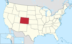
 Location within the U.S. state of Colorado | |
 Colorado's location within the U.S. | |
| Coordinates: 39°37′N 106°42′W | |
| Country | |
| State | |
| Founded | February 11, 1883 |
| Named for | Eagle River |
| Seat | Eagle |
| Largest community | Edwards |
| Area | |
| • Total | 1,692 sq mi (4,380 km2) |
| • Land | 1,685 sq mi (4,360 km2) |
| • Water | 7.3 sq mi (19 km2) 0.4%% |
| Population | |
| • Estimate (2019) | 55,127 |
| • Density | 31/sq mi (12/km2) |
| Time zone | UTC−7 (Mountain) |
| • Summer (DST) | UTC−6 (MDT) |
| Congressional districts | 2nd, 3rd |
| Website | www |
Eagle County comprises the Edwards, CO Micropolitan Statistical Area.
History
Eagle County was created by the Colorado legislature on February 11, 1883, from portions of Summit County. It was named after the Eagle River, which runs through the county. The county seat was originally set in Red Cliff, Colorado, but was moved to the town of Eagle in 1921.
The Ground Hog Mine, near Red Cliff, produced gold and silver in two vertical veins in 1887. One vein, or "chimney", contained gold in crystalline form, cemented by iron, while the other contained wire gold in the form of "ram's horns". One of these ram's horns is now on display in the Harvard Mineralogical Museum.[3]:59
Geography
The highest elevation in the county is the Mount of the Holy Cross which rises to 14,011 feet (4,271 m) above sea level. The lowest elevation is on the Colorado River at 6,128 feet (1,868 m).[4]
According to the U.S. Census Bureau, the county has a total area of 1,692 square miles (4,380 km2), of which 1,685 square miles (4,360 km2) is land and 7.3 square miles (19 km2) (0.4%) is water.[5]
Much of the county is taken up by White River National Forest, and much of the rest is managed by the Bureau of Land Management. Interstate 70 crosses the county from east to west.
The Eagle River rises in the southeastern part of the county. It receives Gore Creek at Dowds Junction, and joins the Colorado River in the west. Fryingpan River and the Roaring Fork River intersect the southwest corner of the county.
Adjacent counties
- Grand County – northeast
- Summit County – east
- Lake County – south
- Pitkin County – southwest
- Garfield County – west
- Routt County – northwest
National protected areas
- White River National Forest
- Eagles Nest Wilderness
- Flat Tops Wilderness
- Holy Cross Wilderness
State protected area
Trails
- Colorado Trail
- Continental Divide National Scenic Trail
- Two Elk National Recreation Trail
- Vail Pass National Recreation Trail
Scenic byways
- Colorado River Headwaters National Scenic Byway
- Top of the Rockies National Scenic Byway
Demographics
| Historical population | |||
|---|---|---|---|
| Census | Pop. | %± | |
| 1890 | 3,725 | — | |
| 1900 | 3,008 | −19.2% | |
| 1910 | 2,985 | −0.8% | |
| 1920 | 3,385 | 13.4% | |
| 1930 | 3,924 | 15.9% | |
| 1940 | 5,361 | 36.6% | |
| 1950 | 4,488 | −16.3% | |
| 1960 | 4,677 | 4.2% | |
| 1970 | 7,498 | 60.3% | |
| 1980 | 13,320 | 77.6% | |
| 1990 | 21,928 | 64.6% | |
| 2000 | 41,659 | 90.0% | |
| 2010 | 52,197 | 25.3% | |
| Est. 2019 | 55,127 | [6] | 5.6% |
| U.S. Decennial Census[7] 1790–1960[8] 1900–1990[9] 1990–2000[10] 2010–2015[1] | |||
As of the census[11] of 2000, there were 41,659 people, 15,148 households, and 9,013 families living in the county. The population density was 25 people per square mile (10/km²). There were 22,111 housing units at an average density of 13 per square mile (5/km²). The racial makeup of the county was 85.4% White, 0.3% Black or African American, 0.7% Native American, 0.8% Asian, 0.1% Pacific Islander, 10.8% from other races, and 1.9% from two or more races. 23.2% of the population were Hispanic or Latino of any race.
There were 15,148 households out of which 32.7% had children under the age of 18 living with them, 50.0% were married couples living together, 5.6% had a female householder with no husband present, and 40.5% were non-families. 20.9% of all households were made up of individuals and 1.9% had someone living alone who was 65 years of age or older. The average household size was 2.73 and the average family size was 3.17.
In the county, the population was spread out with 23.5% under the age of 18, 11.4% from 18 to 24, 42.1% from 25 to 44, 20.0% from 45 to 64, and 3.0% who were 65 years of age or older. The median age was 31 years. For every 100 females there were 121.00 males. For every 100 females age 18 and over, there were 125.80 males.
The median income for a household in the county was $62,682, and the median income for a family was $68,226. Males had a median income of $37,603 versus $30,579 for females. The per capita income for the county was $32,011. About 3.9% of families and 7.8% of the population were below the poverty line, including 6.8% of those under age 18 and 7.6% of those age 65 or over.
Life expectancy
According to a report in the Journal of the American Medical Association, residents of Eagle County had a life expectancy from birth of 85.94 years in 2014, the third longest in the United States.[12] Men live 84.4 years on the average and women live 87.6 years.[13] Two contiguous counties, Summit and Pitkin counties, rank numbers one and two in the nation in life expectancy.
Factors contributing to the high life expectancy of the three Colorado counties are "high education, high income, high access to medical care, the people are physically active, obesity is lower than anywhere else – so you’re doing it right.” said Dr. Ali Mokdad, one of the study's co-authors.[14]
Politics
| Year | Republican | Democratic | Others |
|---|---|---|---|
| 2016 | 35.6% 8,990 | 55.9% 14,099 | 8.5% 2,134 |
| 2012 | 41.5% 9,411 | 56.4% 12,792 | 2.1% 465 |
| 2008 | 37.8% 8,181 | 60.9% 13,191 | 1.3% 286 |
| 2004 | 46.1% 8,533 | 52.6% 9,744 | 1.3% 234 |
| 2000 | 47.2% 7,165 | 44.6% 6,772 | 8.2% 1,251 |
| 1996 | 40.9% 4,637 | 44.9% 5,094 | 14.2% 1,610 |
| 1992 | 28.5% 3,100 | 35.6% 3,870 | 35.9% 3,900[16] |
| 1988 | 55.9% 4,366 | 42.4% 3,314 | 1.7% 129 |
| 1984 | 67.8% 4,500 | 30.6% 2,032 | 1.5% 101 |
| 1980 | 52.6% 3,061 | 27.7% 1,608 | 19.7% 1,147 |
| 1976 | 64.2% 2,963 | 32.5% 1,502 | 3.3% 152 |
| 1972 | 58.2% 1,920 | 39.6% 1,306 | 2.3% 75 |
| 1968 | 49.1% 1,049 | 43.4% 927 | 7.5% 160 |
| 1964 | 33.1% 644 | 66.8% 1,299 | 0.1% 2 |
| 1960 | 52.9% 989 | 47.0% 880 | 0.1% 2 |
| 1956 | 57.4% 1,154 | 42.4% 852 | 0.3% 6 |
| 1952 | 53.7% 1,242 | 45.7% 1,058 | 0.6% 13 |
| 1948 | 40.3% 738 | 55.1% 1,008 | 4.6% 85 |
| 1944 | 49.1% 922 | 50.7% 952 | 0.3% 5 |
| 1940 | 42.0% 1,077 | 57.5% 1,474 | 0.5% 13 |
| 1936 | 33.1% 776 | 65.7% 1,541 | 1.3% 30 |
| 1932 | 33.8% 712 | 64.0% 1,348 | 2.2% 46 |
| 1928 | 63.2% 1,014 | 35.5% 570 | 1.3% 21 |
| 1924 | 44.4% 722 | 26.5% 431 | 29.1% 472 |
| 1920 | 55.1% 854 | 41.9% 649 | 3.0% 46 |
| 1916 | 25.2% 397 | 72.1% 1,136 | 2.7% 43 |
| 1912 | 25.8% 387 | 48.5% 727 | 25.6% 384 |
See also
References
- "State & County QuickFacts". United States Census Bureau. Archived from the original on June 6, 2011. Retrieved June 7, 2014.
- "Find a County". National Association of Counties. Archived from the original on 2012-07-12. Retrieved 2011-06-07.
- Voynick, S.M., 1992, Colorado Gold, Missoula: Mountain Press Publishing Company, ISBN 0878424555
- Google Earth
- "US Gazetteer files: 2010, 2000, and 1990". United States Census Bureau. 2011-02-12. Retrieved 2011-04-23.
- "Population and Housing Unit Estimates". Retrieved December 3, 2019.
- "U.S. Decennial Census". United States Census Bureau. Retrieved June 7, 2014.
- "Historical Census Browser". University of Virginia Library. Retrieved June 7, 2014.
- "Population of Counties by Decennial Census: 1900 to 1990". United States Census Bureau. Retrieved June 7, 2014.
- "Census 2000 PHC-T-4. Ranking Tables for Counties: 1990 and 2000" (PDF). United States Census Bureau. Retrieved June 7, 2014.
- "U.S. Census website". United States Census Bureau. Retrieved 2011-05-14.
- Dwyer-Lindgren, Laura (8 May 2017). "Inequalities in Life Expectancy Among US Counties, 1980 to 2014". JAMA Internal Medicine. 177: 1003–1011. doi:10.1001/jamainternmed.2017.0918. PMC 5543324. PMID 28492829. Retrieved 9 May 2017.
- "County Profile: Summit County Colorado," http://www.healthdata.org/sites/default/files/files/county_profiles/US/2015/County_Report_Eagle_County_Colorado.pdf, accessed 2 Aug 2017
- Achenbach, Joel, "U.S. life expectancy varies more than 20 years from county to county," Washington Post, May 8, 2017
- Leip, David. "Dave Leip's Atlas of U.S. Presidential Elections". uselectionatlas.org. Retrieved May 26, 2017.
- The leading "other" candidate, Independent Ross Perot, received 3,821 votes, while Libertarian candidate Andre Marrou received 61 votes, and New Alliance candidate Lenora Fulani received 18 votes.
External links
- Eagle County Government website
- Eagle County Transportation Service, Vail Taxi
- Vail Valley Partnership – The Chamber and Tourism Bureau
- Colorado County Evolution by Don Stanwyck
- Colorado Historical Society
Places adjacent to Eagle County, Colorado | ||||||||||
|---|---|---|---|---|---|---|---|---|---|---|
| ||||||||||
Municipalities and communities of Eagle County, Colorado, United States | ||
|---|---|---|
| Towns | Map of Colorado highlighting Eagle County | |
| CDPs | ||
| Unincorporated communities | ||
| Ghost towns | ||
| Footnotes | ‡This populated place also has portions in an adjacent county or counties | |

| Authority control |
|
|---|