Lewis, Colorado
Lewis is an unincorporated town and census-designated place (CDP) in Montezuma County, Colorado, United States. As of the 2010 census, it had a population of 302.[3] The Lewis Post Office has the ZIP Code 81327.[2]
Lewis, Colorado | |
|---|---|
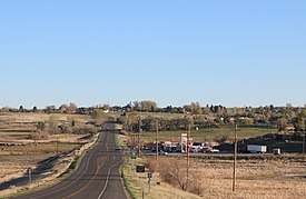 Looking north along U.S. Highway 491 in Lewis | |
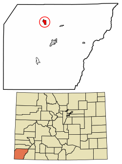 Location of Lewis in Montezuma County, Colorado. | |
 Location in Montezuma County and the state of Colorado | |
| Coordinates: 37°30′03″N 108°40′06″W | |
| Country | |
| State | |
| County | Montezuma[1] |
| Area | |
| • Total | 3.1 sq mi (8.1 km2) |
| • Land | 3.1 sq mi (8.1 km2) |
| • Water | 0 sq mi (0 km2) |
| Elevation | 6,719 ft (2,048 m) |
| Population (2010) | |
| • Total | 302 |
| • Density | 97/sq mi (37/km2) |
| Time zone | UTC-7 (MST) |
| • Summer (DST) | UTC-6 (MDT) |
| ZIP code[2] | 81327 |
| Area code(s) | 970 |
| GNIS feature ID | 0202602 |
Geography
Lewis is located at 37°30′03″N 108°40′06″W (37.500738,-108.668346).
See also
- Outline of Colorado
- State of Colorado
- Colorado cities and towns
- Colorado census designated places
- Colorado counties
- Colorado cities and towns
- Old Spanish National Historic Trail
References
- "US Board on Geographic Names". United States Geological Survey. 2007-10-25. Retrieved 2008-01-31.
- "ZIP Code Lookup". United States Postal Service. December 28, 2006. Archived from the original (JavaScript/HTML) on November 23, 2010. Retrieved December 28, 2006.
- "Profile of General Population and Housing Characteristics: 2010 Demographic Profile Data (DP-1): Lewis CDP, Colorado". United States Census Bureau. Retrieved February 1, 2012.
- "Census of Population and Housing". Census.gov. Retrieved June 4, 2016.
| Wikimedia Commons has media related to Lewis. |
Municipalities and communities of Montezuma County, Colorado, United States | ||
|---|---|---|
| City | 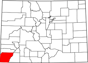 Map of Colorado highlighting Montezuma County | |
| Towns | ||
| CDP | ||
| Unincorporated communities | ||
| Indian reservations | ||
| Footnotes | ‡This populated place also has portions in an adjacent county or counties | |
This article is issued from Wikipedia. The text is licensed under Creative Commons - Attribution - Sharealike. Additional terms may apply for the media files.