Saiha district
Siaha District is one of the eleven districts of Mizoram state in India. The district is bounded on the northwest by Lunglei district, on the north and west by Lawngtlai District and on the south and east by Myanmar. The district occupies an area of 1399.9 km². Siaha town is the administrative headquarters of the Mara Autonomous District Council. The population had decreased from 60,823 (in 2001 census) to 56,574 (in 2011 census). It is the least populous district of Mizoram (out of 8).[1]
Siaha district | |
|---|---|
District of Mizoram | |
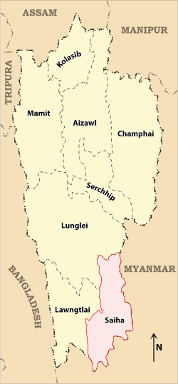 Location of Siaha district in Mizoram | |
| Country | India |
| State | Mizoram |
| Headquarters | Siaha |
| Government | |
| • Lok Sabha constituencies | Mizoram |
| • Vidhan Sabha constituencies | 2 |
| Area | |
| • Total | 1,400 km2 (500 sq mi) |
| Population (2011) | |
| • Total | 56,574 |
| • Density | 40/km2 (100/sq mi) |
| • Urban | 25,110 (44.38%) |
| Demographics | |
| • Literacy | 90.01 |
| • Sex ratio | 979 |
| Time zone | UTC+05:30 (IST) |
| Website | saiha |
History
Siaha District was formerly part of Chhimtuipui District. In 1998 when Chhimtuipui District was split in half, the half that became Saiha District was briefly called by the old name Chhimtuipui District.
Geography
Siaha is the administrative headquarters of Siaha district. It is the third largest town in Mizoram after Aizawl, the state capital and Lunglei. Tipa, Laki, Zyhno, Phura and No-ao-tlah are the other main towns in Siaha district.
Economy
In 2006 the Ministry of Panchayati Raj named Siaha one of the country's 250 most backward districts (out of a total of 640).[2] It is one of the two districts in Mizoram currently receiving funds from the Backward Regions Grant Fund Programme (BRGF).[2]
Divisions
The district has 2 R.D. Blocks, Siaha also known as Siaha, and Tuipang also known as Tipa V. The 2 assembly constituencies in this district are Siaha and Tuipang.
Demographics
According to the 2011 census Siaha district has a population of 56,574, roughly equal to the island of Greenland.[3] This gives it a ranking of 628th in India (out of a total of 640). The district has a population density of 40 inhabitants per square kilometre (100/sq mi). Its population growth rate over the decade 2001-2011 was -7.34%; the only district in Mizoram to have decreased population. Saiha has a sex ratio of 979 females for every 1000 males, and a literacy rate of 90.01%.[4]
The majority of the district inhabitants are Mara people, who also have an autonomous district council called Mara Autonomous District Council composed of the two R.D. Blocks of Saiha and Tuipang.
| Historical population | ||
|---|---|---|
| Year | Pop. | ±% p.a. |
| 1971 | 13,508 | — |
| 1981 | 22,143 | +5.07% |
| 1991 | 34,930 | +4.66% |
| 2001 | 47,084 | +3.03% |
| 2011 | 56,574 | +1.85% |
| source:[5] | ||
Flora and fauna
In 2007 Siaha district became home to Tokalo wildlife sanctuary, which has an area of 250 km2 (96.5 sq mi).[6]
References
- "District Census 2011". Census2011.co.in. 2011. Retrieved 30 September 2011.
- Ministry of Panchayati Raj (8 September 2009). "A Note on the Backward Regions Grant Fund Programme" (PDF). National Institute of Rural Development. Archived from the original (PDF) on 5 April 2012. Retrieved 27 September 2011.
- US Directorate of Intelligence. "Country Comparison:Population". Retrieved 1 October 2011.
Greenland 57,670 July 2011 est.
- census2011. "Siaha District : Census 2011 data". census2011.co.in. Retrieved 15 June 2013.
- Decadal Variation In Population Since 1901
- Indian Ministry of Forests and Environment. "Protected areas: Mizoram". Archived from the original on 23 August 2011. Retrieved 25 September 2011.
External links
Places adjacent to Saiha district | ||||||||||
|---|---|---|---|---|---|---|---|---|---|---|
| ||||||||||
| State symbols | |
|---|---|
| Government |
|
| Topics | |
| Districts | |
| Urban Areas | |
| Infrastructure |
|
| Education |
|
| Tourism | |
| Protected areas | |
| Mizo Culture | |