Belgharia
Belgharia or Belghoria is a locality in Kamarhati Municipality of North 24 Parganas district in the Indian state of West Bengal. It is close to Kolkata and also a part of the area covered by Kolkata Metropolitan Development Authority (KMDA).
Belgharia | |
|---|---|
Neighbourhood | |
 Feeder road to Belgharia railway station | |
 Belgharia Location West Bengal, India  Belgharia Belgharia (India) | |
| Coordinates: 22.65°N 88.38°E | |
| Country | |
| State | West Bengal |
| District | North 24 Parganas |
| Region | Greater Kolkata |
| Metro Station | Baranagar (under construction) |
| Government | |
| • Type | Municipality |
| • Body | Kamarhati Municipality |
| Languages | |
| • Official | Bengali, English |
| Time zone | UTC+5:30 (IST) |
| PIN | 700056, 700083 |
| Telephone code | +91 33 |
| Vehicle registration | WB |
| Lok Sabha constituency | Dum Dum |
| Vidhan Sabha constituency | Kamarhati, Baranagar |
Etymology
The name "Belgharia" is derived from "Bell Ghor". There was a Big bell used for calling the porters for unloading and carrying jute from the boats.
History
The oldest jetty was situated in Ariadaha on the river Ganges. In the 17th century Belgharia and Nimta were the biggest wholesale markets for jute, fish and vegetables.
Ramakrishna Paramhansa visited this place eight times; the first time was in 1875. Swami Vijnanananda, a direct disciple of Ramakrishna also resided here.
Geography
 |
| Cities and towns in the southern portion of Barrackpore subdivision in North 24 Parganas district M: municipal city/ town, CT: census town, N: neighbourhood/ administrative location Owing to space constraints in the small map, the actual locations in a larger map may vary slightly |
Location
96% of the population of Barrackpore subdivision (partly presented in the map alongside, all places marked on the map are linked in the full screen map) lives in urban areas. In 2011, it had a density of population of 10,967 per km2. The subdivision has 16 municipalities and 24 census towns.[1]
For most of the cities/ towns information regarding density of population is available in the Infobox. Population data is not available for neighbourhoods. It is available for the entire Municipal area and thereafter ward-wise.
Police station
Belgharia police station under Barrackpore Police Commissionerate has jurisdiction over Kamarhati Municipal area.[2][3]
Demographics
Kolkata Urban Agglomeration
The following Municipalities, Census Towns and other locations in Barrackpore subdivision were part of Kolkata Urban Agglomeration in the 2011 census: Kanchrapara (M), Jetia (CT), Halisahar (M), Balibhara (CT), Naihati (M), Bhatpara (M), Kaugachhi (CT), Garshyamnagar (CT), Garulia (M), Ichhapur Defence Estate (CT), North Barrackpur (M), Barrackpur Cantonment (CB), Barrackpore (M), Jafarpur (CT), Ruiya (CT), Titagarh (M), Khardaha (M), Bandipur (CT), Panihati (M), Muragachha (CT) New Barrackpore (M), Chandpur (CT), Talbandha (CT), Patulia (CT), Kamarhati (M), Baranagar (M), South Dumdum (M), North Dumdum (M), Dum Dum (M), Noapara (CT), Babanpur (CT), Teghari (CT), Nanna (OG), Chakla (OG), Srotribati (OG) and Panpur (OG).[4]
Economy
Now it has become a business hub, well connected with Kolkata through trains, buses and other means of transport. The nearest Industrial area is Kamarhatty (3 km), with the following companies: Agarpara Jute Mill, Allied Ceramic, ESDEE Allumina, Emami, Kamarhatty Jute Mill, Texmaco,[5] TIL, WIMCO.
Transport
Feeder road is one of the main roads in Belgharia. Feeder road connects Belgharia to Barrackpore Trunk Road (B.T. Road) on the west and through Madhusudan Banerjee Road (M.B. Road) to Nimta, Birati and consequently to Jessore Road in the east. Feeder Road and Madhusudan Banerjee Road (M.B. Road) are connected with a rail overbridge named Kabi Satyendranath Dutta Setu above Belgharia railway station.[6] The newly built Belghoria Expressway which links with Dumdum/Kolkata Airport on Jessore Road and Nivedita Setu on the Hooghly River increased the importance of this place.

Bus
Private Bus
- 56 Ruiya Purbapara - Howrah Station
- 78 Barrackpore Court - Esplanade
- 78/1 Rahara Bazar/Parthapur - Babughat
- 81/1 Rajchandrapur - Barasat
- 201 Nimta Post Office- Salt Lake Sector-V
- 214 Sajirhat - Babughat
- 214A Sodepur Girja - Esplanade
- 230 Kamarhati/Agarpara railway station - Alipore Zoo
- 234 Belgharia railway station - Golf Green
- 234/1 Belgharia railway station - Golf Green
- DN2 Dakshineswar - Barasat
- DN43 Dakshineswar - Barasat Checkpost
Mini Bus
- S180 Nandannagar - Howrah Maidan
- S185 Nimta Paikpara - Howrah Station
WBTC Bus
- C28 Barrackpore Court - Howrah Station
- E32 Nilganj - Howrah Station
- S9A Dunlop/Belgharia (Rathtala) - Ballygunge railway station
- S11 Nilganj - Esplanade
- S32 Barrackpore Court - Howrah Station
- S32A Belgharia (Rathtala) - Howrah Station
- AC2B Belgharia (Rathtala) - Jadavpur (Sulekha)
- AC20 Barrackpore Court - Santragachi railway station (8 AM to 9 AM and afternoon 2 PM to 3 PM. In the Evening, the Bus plies from B.B.D. Bagh to Dunlop.)
- AC54 Belgharia (Rathtala) - Howrah Station
- EB1A Belgharia (Rathtala) - Nabanna/Santragachi railway station
Bus Routes Without Numbers
- Madhyamgram - Howrah station
- Sodepur Girja - Uluberia Court
- Lalkuthi – Howrah Station
- Barrackpore Court - Salap
- Barrackpore Court - Mourigram railway station
Train
.jpg)
Belgharia railway station is one of the stations on the main train line (Sealdah-Ranaghat line) starting from Sealdah Station.
Metro Rail
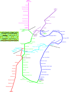
The under Construction Baranagar metro station, which is a part of the Kolkata Metro Line 1 (North-South line) and will also serve as the planned terminus of Kolkata Metro Line 5, is close to Belgharia. Kamarhati is also a planned Metro Station of Kolkata Metro Line 5, near to Belgharia.
Education
Bhairab Ganguly College was established at Belgharia in 1968. It offers honours courses in Bengali, English, Sanskrit, Hindi, Urdu, history, philosophy, political science, geography, education, physical education, physics, chemistry, mathematics, botany, zoology, physiology, economics, electronics, computer science, accountancy and general BA, BSc and B Com courses.[7][8]
Culture
Ramakrishna Mission is also situated here. They run a Students' Home for meritorious poor and needy students along with a three-year Diploma Engg. College. They also conduct relief activities with a public library and homeopathic dispensary. A small unit of Ramkrishna Mission is situated here (near Belgharia Rail Overbridge) which was established by Swami Vijnananandaji, architect of Belur Math.
The population consists of generally middle class Bengali. Of late a lot of student messes has sprung up chiefly because of the comparative low cost of living and close proximity to the city of Kolkata.
References
- "District Statistical Handbook". North 24 Parganas 2013, Tables 2.1, 2.2, 2.4b. Department of Statistics and Programme Implementation, Government of West Bengal. Retrieved 2 May 2018.
- "District Statistical Handbook". North 24 Parganas 2013, Table 2.1. Department of Statistics and Programme Implementation, Government of West Bengal. Retrieved 11 June 2018.
- "Barrackpore Police Commissionerate". List of Police Stations with telephone numbers. West Bengal Police. Retrieved 11 June 2018.
- "Provisional Population Totals, Census of India 2011" (PDF). Constituents of Urban Agglomeration Having Population Above 1 Lakh. Census of India 2011. Retrieved 30 May 2018.
- "Texmaco".
- Google maps
- "Bhairab Ganguly College". BGC. Retrieved 8 May 2018.
- "Bhairab Ganguly College". College Admission. Retrieved 8 May 2018.
External links
| Wikimedia Commons has media related to Belgharia. |
North 24 Parganas district topics | |||||||||
|---|---|---|---|---|---|---|---|---|---|
| General |
| ||||||||
| Subdivisions | |||||||||
| Municipalities | |||||||||
| Community development blocks |
| ||||||||
| Rivers | |||||||||
| Transport |
| ||||||||
| Railway stations |
| ||||||||
| Institutes of higher learning |
| ||||||||
| Lok Sabha constituencies | |||||||||
| Vidhan Sabha constituencies |
| ||||||||
| Former Vidhan Sabha constituencies | |||||||||
| See also |
| ||||||||
| Kolkata Municipal Corporation |
|
|---|---|
| Kolkata Urban Agglomeration Outside KMC |
|
| |