Ituna
| Town of Ituna,SK | |
|---|---|
| Town | |
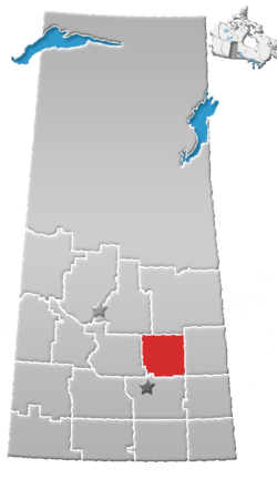
 Location of Ituna in Saskatchewan  Ituna (Canada) | |
| Coordinates: 51°10′12″N 103°29′35″W / 51.170°N 103.493°W | |
| Country | Canada |
| Province | Saskatchewan |
| Region | Saskatchewan |
| Census division | No. 10 |
| Rural Municipality | Ituna Bon Accord |
| Post office Founded | 1909 |
| Incorporated (Village) | N/A |
| Incorporated (Town) | 1910 |
| Government | |
| • Mayor | Joe Garchinski |
| • Town Manager | N/A |
| • Governing body | Ituna Town Council |
| Area | |
| • Total | 1.56 km2 (0.60 sq mi) |
| Population (2006)[1] | |
| • Total | 622 |
| • Density | 400/km2 (1,000/sq mi) |
| Time zone | CST |
| Postal code | S0A 1N0 |
| Area code(s) | 306 |
| Highways | Highway |
| Website | http://www.ituna.ca/ |
Ituna is a town in Saskatchewan, Canada. In 2006, it had a population of 622. It is 165 km north of the capital Regina.
Services
The town contains several business serving the local residents and rural community, including financial services, grocery stores, restaurants and a hotel. The Ituna Theatre (building in 1946) is one of remaining small town movie theaters still in operation.[2][3]
Demographics
| Canada census – Ituna community profile | |||
|---|---|---|---|
| 2006 | |||
| Population: | 622 (-12.3% from 2001) | ||
| Land area: | 1.56 km2 (0.60 sq mi) | ||
| Population density: | 398.5/km2 (1,032/sq mi) | ||
| Median age: | 55.4 (M: 50.8, F: 56.8) | ||
| Total private dwellings: | 361 | ||
| Median household income: | $Not Available | ||
| References: 2006[4] earlier[5] | |||
Transportation
The community is served by Ituna Airport which is located 2.6 nautical miles (4.8 km) southeast.
History
Ituna has one registered historical site, the Red Brick Schoolhouse that was constructed in 1920 as a composite school for the Fruitville School District. The school build was closed in 1980 when the town school moved into a new building.[6]
See also
References
- ↑ Statistics Canada. 2006. Ituna Community nProfile
- ↑ http://www.canada.com/reginaleaderpost/columnists/story.html?id=40510c2a-cf3f-48df-993e-e1e16dc4faeb Big screen thrives in small town THE LEADER-POST (REGINA)JANUARY 21, 2008
- ↑ http://www.astonishmentartist.com/Ituna_Theatre/page_1514062.html
- ↑ "2006 Community Profiles". Canada 2006 Census. Statistics Canada. March 30, 2011. Retrieved 2009-02-24.
- ↑ "2001 Community Profiles". Canada 2001 Census. Statistics Canada. February 17, 2012.
- ↑ http://heritageapp.cyr.gov.sk.ca/assets/pdf/471.pdf Saskatchewan Register of Heritage Property - Red Brick Schoolhouse
External links
This article is issued from
Wikipedia.
The text is licensed under Creative Commons - Attribution - Sharealike.
Additional terms may apply for the media files.
