Morse, Saskatchewan
| Morse | |
|---|---|
| Town | |
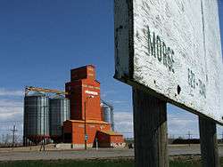 Morse grain elevator | |
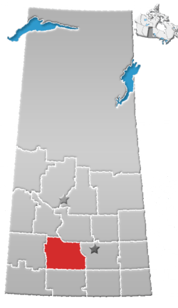
 Morse Location of Morse in Saskatchewan  Morse Morse (Canada) | |
| Coordinates: 50°24′50″N 107°01′55″W / 50.414°N 107.032°W | |
| Country | Canada |
| Province | Saskatchewan |
| Census division | 7 |
| Rural Municipality | Morse |
| Settled | 1902 |
| Incorporated (village) | 1910 |
| Incorporated (town) | 1912 |
| Government | |
| • Mayor | George Byklum |
| • Town Manager | Tamara Knight |
| • Governing body | Morse Town Council |
| Area | |
| • Total | 1.45 km2 (0.56 sq mi) |
| Population (2011) | |
| • Total | 240 |
| • Density | 165.7/km2 (429/sq mi) |
| Time zone | CST |
| Postal code | S0H 3C0 |
| Area code(s) | 306 |
| Highways | Trans Canada Highway |
| Website | Official website |
| [1][2][3][4] | |
Morse is a town in southern Saskatchewan, Canada.[5] It is situated on the Trans Canada Highway near the north shore of Reed Lake. The town is named after the American scholar and inventor Samuel Morse, best known for the invention of the telegraph based on the European telegraph system. Although he was an American, he left a large enough impression that the town was named after him.
Demographics
| Canada census – Morse, Saskatchewan community profile | |||
|---|---|---|---|
| 2006 | |||
| Population: | 236 (-4.8% from 2001) | ||
| Land area: | 1.45 km2 (0.56 sq mi) | ||
| Population density: | 162.9/km2 (422/sq mi) | ||
| Median age: | 51.8 (M: 51.7, F: 52.0) | ||
| Total private dwellings: | 154 | ||
| Median household income: | $N/A | ||
| References: 2006[6] earlier[7] | |||
See also
References
- ↑ "2011 Community Profiles". Statistics Canada. Government of Canada. Retrieved 2014-04-09.
- ↑ National Archives, Archivia Net. "Post Offices and Postmasters". Retrieved 2014-07-15.
- ↑ Government of Saskatchewan, MRD Home. "Municipal Directory System". Retrieved 2014-07-15.
- ↑ Commissioner of Canada Elections, Chief Electoral Officer of Canada (2005). "Elections Canada On-line". Retrieved 2014-07-15.
- ↑ "Community Profile - Morse" (PDF). Southwest Regional Economic Development Authority. Retrieved 2008-04-07.
- ↑ "2006 Community Profiles". Canada 2006 Census. Statistics Canada. March 30, 2011. Retrieved 2009-02-24.
- ↑ "2001 Community Profiles". Canada 2001 Census. Statistics Canada. February 17, 2012.
External links

- Town Website
- Encyclopedia of Saskatchewan
Places adjacent to Morse, Saskatchewan | |
|---|---|
Coordinates: 50°24′50″N 107°01′55″W / 50.414°N 107.032°W
This article is issued from
Wikipedia.
The text is licensed under Creative Commons - Attribution - Sharealike.
Additional terms may apply for the media files.