Imperial, Saskatchewan
| Town of Imperial | |
|---|---|
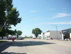 Royal Street | |
 Town of Imperial Location of Imperial  Town of Imperial Town of Imperial (Canada) | |
| Coordinates: 51°20′38″N 105°26′35″W / 51.344°N 105.443°W | |
| Country | Canada |
| Province | Saskatchewan |
| Census division | 11 |
| Rural Municipality | Big Arm |
| Post office Founded | March 1, 1907 |
| Incorporated (Village) | July 4, 1911 |
| Incorporated (Town) | April 1, 1962 |
| Government | |
| • Mayor | Harvey McLane |
| • Town Administrator | Sheila Newlove |
| • Governing body | Imperial Town Council |
| Area | |
| • Total | 1.23 km2 (0.47 sq mi) |
| Population (2016) | |
| • Total | 360 |
| • Density | 292.4/km2 (757/sq mi) |
| Time zone | CST |
| Postal code | S0G 2J0 |
| Area code(s) | 306 |
| Highways | Highway 2 |
| Waterways | Last Mountain Lake |
| Website | Town of Imperial |
| [1][2][3][4] | |
Imperial is a town in the Canadian province of Saskatchewan. The town is located along Saskatchewan Highway 2.
Demographics
| Canada census – Imperial, Saskatchewan community profile | |||
|---|---|---|---|
| 2016 | 2011 | 2006 | |
| Population: | 360 (3.2% from 2011) | 349 (+8.7% from 2006) | 321 (-5.3% from 2001) |
| Land area: | 1.23 km2 (0.47 sq mi) | 1.23 km2 (0.47 sq mi) | 1.23 km2 (0.47 sq mi) |
| Population density: | 292.4/km2 (757/sq mi) | 283.5/km2 (734/sq mi) | 260.7/km2 (675/sq mi) |
| Median age: | 52.5 (M: 50.8, F: 55.3) | 51.9 (M: 51.2, F: 53.2) | |
| Total private dwellings: | 182 | 176 | 176 |
| Median household income: | $38,636 | ||
| References: 2016[5] 2011[6] 2006[7] earlier[8] | |||
See also
Footnotes
- ↑ National Archives, Archivia Net, Post Offices and Postmasters, archived from the original on October 6, 2006
- ↑ Government of Saskatchewan, MRD Home, Municipal Directory System, archived from the original (– Scholar search) on November 21, 2008
- ↑ Canadian Textiles Institute. (2005), CTI Determine your provincial constituency, archived from the original on 2007-09-11
- ↑ Commissioner of Canada Elections, Chief Electoral Officer of Canada (2005), Elections Canada On-line, archived from the original on April 21, 2007
- ↑ "2016 Community Profiles". Canada 2016 Census. Statistics Canada. February 21, 2017.
- ↑ "2011 Community Profiles". Canada 2011 Census. Statistics Canada. July 5, 2013. Retrieved 2016-12-28.
- ↑ "2006 Community Profiles". Canada 2006 Census. Statistics Canada. March 30, 2011. Retrieved 2016-12-28.
- ↑ "2001 Community Profiles". Canada 2001 Census. Statistics Canada. February 17, 2012.
External links
Places adjacent to Imperial, Saskatchewan | |
|---|---|
Coordinates: 51°20′38″N 105°26′35″W / 51.344°N 105.443°W
This article is issued from
Wikipedia.
The text is licensed under Creative Commons - Attribution - Sharealike.
Additional terms may apply for the media files.