Lemberg, Saskatchewan
| Lemberg | |
|---|---|
| Town | |
| Nickname(s): Community In Motion | |
 Lemberg Location of Lemberg in Saskatchewan  Lemberg Lemberg (Canada) | |
| Coordinates: 50°43′55″N 103°11′42″W / 50.732°N 103.195°W | |
| Country | Canada |
| Province | Saskatchewan |
| Region | Saskatchewan |
| Census division | No. 5 |
| Rural Municipality | No. 186 |
| Post office established | 1904 |
| Village Incorporated | July 12, 1904 |
| Town Incorporated | September 1, 1907 |
| Government | |
| • Mayor | Murray Clarke |
| • Governing body | Lemberg Town Council |
| Area | |
| • Land | 2.67 km2 (1.03 sq mi) |
| Elevation | 614 m (2,014 ft) |
| Population (2011) | |
| • Total | 274 |
| • Density | 102.7/km2 (266/sq mi) |
| Time zone | CST |
| Postal code | S0A 2B0 |
| Area code(s) | 306 |
| Highways | Highway 22 |
| Website | Town of Lemberg |
| [1][2][3][4] | |
Lemberg is a town in Saskatchewan, Canada. It was founded by immigrants from Lviv (Austria-Hungary), for which the German name was "Lemberg."[5]
Demographics
| Canada census – Lemberg, Saskatchewan community profile | |||
|---|---|---|---|
| Population: | |||
| Land area: | |||
| Population density: | |||
| Median age: | |||
| Total private dwellings: | |||
| Median household income: | |||
| References: earlier[6] | |||
Religion
Lemberg is currently home to four places of worship: Saint Michael's Roman Catholic Church, Trinity Lutheran Church, Grace United Church, and the Pentecostal Assembly. A Baptist church used to stand just south of Lemberg, but all that remains now is the cemetery.
Points of Interest
- Historic Sites
- Weissenberg Roman Catholic Public School #49
- Saint Michael’s Roman Catholic Church
- Pool Grain Elevator
- Trinity Lutheran Church
- War Memorial Cenotaph
- Recreational Facilities
- Lemberg Baseball Park
- Town Campgrounds
- Lemberg Rink (Skating and Curling)
- Community Hall Complex (5 pin Bowling, Pool, Foosball table, Shuffleboard, Table Tennis, Snack Bar)
- Lemberg Lions’ Playground
- Walking Trails and Mercy Grotto
Notable people
- The Right Honourable James Garfield Gardiner, premier of Saskatchewan from 1926–29 and 1934–35
Education
Lemberg is the home of North Valley High School (grades 7-12). North Valley Elementary School (grades K-6) is located in the neighbouring town of Neudorf.
See also
References
- ↑ "2011 Community Profiles". Statistics Canada. Government of Canada. Retrieved 2014-04-09.
- ↑ National Archives, Archivia Net. "Post Offices and Postmasters". Archived from the original on 2006-10-06. Retrieved 2014-07-15.
- ↑ Government of Saskatchewan, MRD Home. "Municipal Directory System". Archived from the original on 2016-01-15. Retrieved 2014-07-15.
- ↑ Commissioner of Canada Elections, Chief Electoral Officer of Canada (2005). "Elections Canada On-line". Archived from the original on 2007-04-21. Retrieved 2014-07-15.
- ↑ David McLennan. "Lemberg". Encyclopedia of Saskatchewan. Canadian Plains Research Center. Retrieved 22 September 2017.
- ↑ "2001 Community Profiles". Canada 2001 Census. Statistics Canada. February 17, 2012.
Places adjacent to Lemberg, Saskatchewan | |
|---|---|
| Cities | 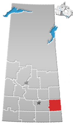 | ||
|---|---|---|---|
| Towns | |||
| Villages | |||
| Resort villages | |||
| Rural municipalities | |||
| First Nations | |||
| Indian reserves | |||
| Unincorporated communities |
| ||
This article is issued from
Wikipedia.
The text is licensed under Creative Commons - Attribution - Sharealike.
Additional terms may apply for the media files.