Kyle, Saskatchewan
| Kyle, Saskatchewan | |
|---|---|
| Town | |
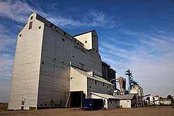 Former Saskatchewan Wheat Pool grain elevator in Kyle. | |
 Kyle, Saskatchewan | |
| Coordinates: 50°49′54″N 108°02′14″W / 50.8316°N 108.0373°W | |
| Country | Canada |
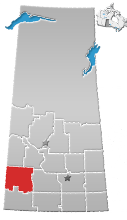
| Province | Saskatchewan |
| Region | Southwest |
| Census division | 8 |
| Rural Municipality | Lacadena |
| Government | |
| • Governing body | Kyle Town Council |
| • Mayor | Doug Barker |
| • Administrator | Audrey Blohm |
| • MP | David L. Anderson |
| • MLA | Jim Reiter |
| Area | |
| • Land | 1.01 km2 (0.39 sq mi) |
| Population (2006) | |
| • Total | 423 |
| • Density | 419.5/km2 (1,087/sq mi) |
| • Dwellings | 218 |
| Time zone | CST |
| Postal code | S0L 1T0 |
| Area code(s) | 306 |
| Highways | Highway 4 |
| Railways | Canadian National Railway |
| [1][2][3][4] | |
Kyle is a town in Lacadena Rural Municipality No. 228, Saskatchewan, Canada. The town had a population of 423 in the 2006 Census. The village was named for its original settler, Jeremiah Kyle in 1923. Kyle is 45 miles (72 kilometers) north of Swift Current, 125 miles (201 kilometers) southwest of Saskatoon, 200 miles (320 kilometers) west of Regina and 20 miles (32 km) north of Saskatchewan Landing Provincial Park on Highway 4. The Canada Post postal code for Kyle is S0L 1T0.
Demographics
In 2006, Kyle had a population of 423 living in 218 dwellings, a -11.5% decrease from 1996. The town has a land area of 1.01 square kilometres (0.39 sq mi) and a population density of 419.5/km2 (1,087/sq mi).[5]
Attractions
The town is well-known locally both for being the site of a 12,000-year-old woolly mammoth discovery during road construction in 1964 (the bones of which are now on display at the Royal Saskatchewan Museum in Regina), and being the nearest community to La Reata Ranch, a working cattle ranch that doubles as a resort and allows guests to experience a real cowboy lifestyle first-hand.
Near the town of Kyle is the Clearwater Lake Regional Park. On the road to it stands one of the last few Drive-in theaters in Western Canada, which remains a very popular evening attraction for both young and old in the summer months.
References
- ↑ National Archives, Archivia Net, Post Offices and Postmasters, archived from the original on 2006-10-06
- ↑ Government of Saskatchewan, MRD Home. "Municipal Directory System". Archived from the original on 2016-01-15. Retrieved 2014-03-17.
- ↑ Canadian Textiles Institute. (2005), CTI Determine your provincial constituency, archived from the original on 2007-09-11
- ↑ Commissioner of Canada Elections, Chief Electoral Officer of Canada (2005), Elections Canada On-line, archived from the original on 2007-04-21
- ↑ Statistics Canada. "Canada 2006 Census: Kyle - Community Profile". Retrieved 2010-09-15.
External links
- Municipal Affairs - Kyle, Saskatchewan
- Kyle, SK
- Saskatchewan Landing Provincial Park
- Encyclopedia of Saskatchewan
Places adjacent to Kyle, Saskatchewan | ||||||||||
|---|---|---|---|---|---|---|---|---|---|---|
| ||||||||||
Coordinates: 50°49′54″N 108°02′15″W / 50.831690°N 108.037370°W