Villorceau
| Villorceau | |
|---|---|
| Commune | |
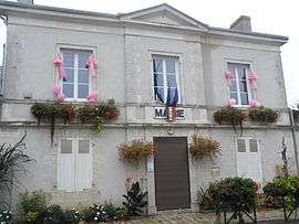 The town hall in Villorceau | |
 Villorceau Location within Centre-Val de Loire region  Villorceau | |
| Coordinates: 47°48′01″N 1°35′52″E / 47.8003°N 1.5978°ECoordinates: 47°48′01″N 1°35′52″E / 47.8003°N 1.5978°E | |
| Country | France |
| Region | Centre-Val de Loire |
| Department | Loiret |
| Arrondissement | Orléans |
| Canton | Beaugency |
| Government | |
| • Mayor (2008–2014) | Daniel Thouvenin |
| Area1 | 9.5 km2 (3.7 sq mi) |
| Population (2006)2 | 1,018 |
| • Density | 110/km2 (280/sq mi) |
| Time zone | UTC+1 (CET) |
| • Summer (DST) | UTC+2 (CEST) |
| INSEE/Postal code | 45344 /45190 |
| Elevation | 104–121 m (341–397 ft) |
|
1 French Land Register data, which excludes lakes, ponds, glaciers > 1 km2 (0.386 sq mi or 247 acres) and river estuaries. 2 Population without double counting: residents of multiple communes (e.g., students and military personnel) only counted once. | |
Villorceau is a commune in the Loiret department in north-central France.
Demographics
| Year | 1962 | 1968 | 1975 | 1982 | 1990 | 1999 | 2007 |
|---|---|---|---|---|---|---|---|
| Population | 311 | 346 | 380 | 754 | 839 | 907 | 1053 |
| From the year 1962 on: No double counting—residents of multiple communes (e.g. students and military personnel) are counted only once. | |||||||
See also
References
- ↑ "Recensements sur Cassini". cassini.ehess.fr. Retrieved 13 January 2010.
- ↑ "dernier recensement INSEE". www.insee.fr. 2010. Retrieved 13 January 2010.
| Wikimedia Commons has media related to Villorceau. |
This article is issued from
Wikipedia.
The text is licensed under Creative Commons - Attribution - Sharealike.
Additional terms may apply for the media files.