Préfontaines
| Préfontaines | |
|---|---|
| Commune | |
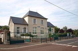 The town hall in Préfontaines | |
 Préfontaines Location within Centre-Val de Loire region  Préfontaines | |
| Coordinates: 48°06′31″N 2°41′27″E / 48.1086°N 2.6908°ECoordinates: 48°06′31″N 2°41′27″E / 48.1086°N 2.6908°E | |
| Country | France |
| Region | Centre-Val de Loire |
| Department | Loiret |
| Arrondissement | Montargis |
| Canton | Courtenay |
| Intercommunality | Communauté de communes des Quatre Vallées |
| Government | |
| • Mayor (2014–2020) | Michel Harang |
| Area1 | 11.75 km2 (4.54 sq mi) |
| Population (2006)2 | 468 |
| • Density | 40/km2 (100/sq mi) |
| Demonym(s) | Pratifontain(e)s |
| Time zone | UTC+1 (CET) |
| • Summer (DST) | UTC+2 (CEST) |
| INSEE/Postal code | 45255 / |
| Elevation | 77–102 m (253–335 ft) |
|
1 French Land Register data, which excludes lakes, ponds, glaciers > 1 km2 (0.386 sq mi or 247 acres) and river estuaries. 2 Population without double counting: residents of multiple communes (e.g., students and military personnel) only counted once. | |
Préfontaines is a commune in the Loiret department in north-central France.
See also
| Wikimedia Commons has media related to Préfontaines. |
This article is issued from
Wikipedia.
The text is licensed under Creative Commons - Attribution - Sharealike.
Additional terms may apply for the media files.