Saint-Pryvé-Saint-Mesmin
| Saint-Pryvé-Saint-Mesmin | |
|---|---|
| Commune | |
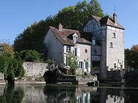 Old mill on the Loire | |
 Saint-Pryvé-Saint-Mesmin Location within Centre-Val de Loire region  Saint-Pryvé-Saint-Mesmin | |
| Coordinates: 47°52′54″N 1°52′07″E / 47.8817°N 1.8686°ECoordinates: 47°52′54″N 1°52′07″E / 47.8817°N 1.8686°E | |
| Country | France |
| Region | Centre-Val de Loire |
| Department | Loiret |
| Arrondissement | Orléans |
| Canton | Olivet |
| Intercommunality | Orléans Métropole |
| Government | |
| • Mayor (2001–2008) | Gilles Gaillard |
| Area1 | 8.87 km2 (3.42 sq mi) |
| Population (2012)2 | 5,223 |
| • Density | 590/km2 (1,500/sq mi) |
| Time zone | UTC+1 (CET) |
| • Summer (DST) | UTC+2 (CEST) |
| INSEE/Postal code | 45298 /45750 |
| Elevation | 87–99 m (285–325 ft) |
|
1 French Land Register data, which excludes lakes, ponds, glaciers > 1 km2 (0.386 sq mi or 247 acres) and river estuaries. 2 Population without double counting: residents of multiple communes (e.g., students and military personnel) only counted once. | |
Saint-Pryvé-Saint-Mesmin is a commune in the Loiret department in north-central France.
See also
References
External links
- Official Web site (in French)
| Wikimedia Commons has media related to Saint-Pryvé-Saint-Mesmin. |
This article is issued from
Wikipedia.
The text is licensed under Creative Commons - Attribution - Sharealike.
Additional terms may apply for the media files.