Griselles, Loiret
| Griselles | |
|---|---|
| Commune | |
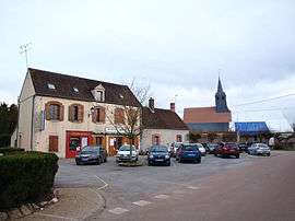 The village square in Griselles | |
 Griselles Location within Centre-Val de Loire region  Griselles | |
| Coordinates: 48°04′46″N 2°49′46″E / 48.0794°N 2.8294°ECoordinates: 48°04′46″N 2°49′46″E / 48.0794°N 2.8294°E | |
| Country | France |
| Region | Centre-Val de Loire |
| Department | Loiret |
| Arrondissement | Montargis |
| Canton | Courtenay |
| Intercommunality | CC4V |
| Government | |
| • Mayor (2008–2014) | Jean-François Lepetit |
| Area1 | 30.32 km2 (11.71 sq mi) |
| Population (2006)2 | 747 |
| • Density | 25/km2 (64/sq mi) |
| Demonym(s) | Grisellois |
| Time zone | UTC+1 (CET) |
| • Summer (DST) | UTC+2 (CEST) |
| INSEE/Postal code | 45161 /45210 |
| Elevation | 87–107 m (285–351 ft) |
|
1 French Land Register data, which excludes lakes, ponds, glaciers > 1 km2 (0.386 sq mi or 247 acres) and river estuaries. 2 Population without double counting: residents of multiple communes (e.g., students and military personnel) only counted once. | |
Griselles is a commune in the Loiret department in north-central France.
See also
| Wikimedia Commons has media related to Griselles (Loiret). |
This article is issued from
Wikipedia.
The text is licensed under Creative Commons - Attribution - Sharealike.
Additional terms may apply for the media files.