Louzouer
| Louzouer | |
|---|---|
| Commune | |
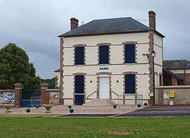 The town hall in Louzouer | |
 Louzouer Location within Centre-Val de Loire region  Louzouer | |
| Coordinates: 48°02′20″N 2°52′56″E / 48.0389°N 2.8822°ECoordinates: 48°02′20″N 2°52′56″E / 48.0389°N 2.8822°E | |
| Country | France |
| Region | Centre-Val de Loire |
| Department | Loiret |
| Arrondissement | Montargis |
| Canton | Courtenay |
| Area1 | 11.23 km2 (4.34 sq mi) |
| Population (2006)2 | 271 |
| • Density | 24/km2 (63/sq mi) |
| Time zone | UTC+1 (CET) |
| • Summer (DST) | UTC+2 (CEST) |
| INSEE/Postal code | 45189 /45210 |
| Elevation | 112–138 m (367–453 ft) |
|
1 French Land Register data, which excludes lakes, ponds, glaciers > 1 km2 (0.386 sq mi or 247 acres) and river estuaries. 2 Population without double counting: residents of multiple communes (e.g., students and military personnel) only counted once. | |
Louzouer is a commune in the Loiret department in north-central France.
See also
| Wikimedia Commons has media related to Louzouer. |
This article is issued from
Wikipedia.
The text is licensed under Creative Commons - Attribution - Sharealike.
Additional terms may apply for the media files.