Sully-la-Chapelle
| Sully-la-Chapelle | |
|---|---|
| Commune | |
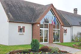 The town hall in Sully-la-Chapelle | |
 Sully-la-Chapelle Location within Centre-Val de Loire region  Sully-la-Chapelle | |
| Coordinates: 47°58′35″N 2°10′59″E / 47.9764°N 2.1831°ECoordinates: 47°58′35″N 2°10′59″E / 47.9764°N 2.1831°E | |
| Country | France |
| Region | Centre-Val de Loire |
| Department | Loiret |
| Arrondissement | Orléans |
| Canton | Châteauneuf-sur-Loire |
| Intercommunality | Communauté de communes des Loges |
| Government | |
| • Mayor (2001–2008) | Benoît Lonceint |
| Area1 | 26.17 km2 (10.10 sq mi) |
| Population (2006)2 | 367 |
| • Density | 14/km2 (36/sq mi) |
| Time zone | UTC+1 (CET) |
| • Summer (DST) | UTC+2 (CEST) |
| INSEE/Postal code | 45314 /45450 |
| Elevation | 106–147 m (348–482 ft) |
|
1 French Land Register data, which excludes lakes, ponds, glaciers > 1 km2 (0.386 sq mi or 247 acres) and river estuaries. 2 Population without double counting: residents of multiple communes (e.g., students and military personnel) only counted once. | |
Sully-la-Chapelle is a commune in the Loiret department in north-central France.
See also
| Wikimedia Commons has media related to Sully-la-Chapelle. |
This article is issued from
Wikipedia.
The text is licensed under Creative Commons - Attribution - Sharealike.
Additional terms may apply for the media files.