Dammarie-sur-Loing
| Dammarie-sur-Loing | |
|---|---|
| Commune | |
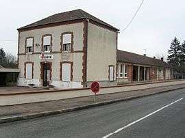 The town hall in Dammarie-sur-Loing | |
 Dammarie-sur-Loing Location within Centre-Val de Loire region  Dammarie-sur-Loing | |
| Coordinates: 47°47′23″N 2°53′30″E / 47.7897°N 2.8917°ECoordinates: 47°47′23″N 2°53′30″E / 47.7897°N 2.8917°E | |
| Country | France |
| Region | Centre-Val de Loire |
| Department | Loiret |
| Arrondissement | Montargis |
| Canton | Lorris |
| Intercommunality | Communauté de communes de Châtillon-Coligny |
| Government | |
| • Mayor (2008–2014) | Philippe Poirier |
| Area1 | 20.94 km2 (8.08 sq mi) |
| Population (2006[1])2 | 505 |
| • Density | 24/km2 (62/sq mi) |
| Demonym(s) | Dammariens |
| Time zone | UTC+1 (CET) |
| • Summer (DST) | UTC+2 (CEST) |
| INSEE/Postal code | 45121 /45230 |
| Elevation | 126–177 m (413–581 ft) |
|
1 French Land Register data, which excludes lakes, ponds, glaciers > 1 km2 (0.386 sq mi or 247 acres) and river estuaries. 2 Population without double counting: residents of multiple communes (e.g., students and military personnel) only counted once. | |
Dammarie-sur-Loing is a commune in the Loiret department in north-central France.
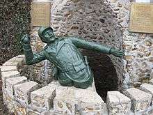
Detail of the war memorial.
See also
References
| Wikimedia Commons has media related to Dammarie-sur-Loing. |
This article is issued from
Wikipedia.
The text is licensed under Creative Commons - Attribution - Sharealike.
Additional terms may apply for the media files.