Pannecières
| Pannecières | |
|---|---|
| Commune | |
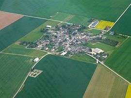 An aerial view of Pannecières | |
 Pannecières Location within Centre-Val de Loire region  Pannecières | |
| Coordinates: 48°17′36″N 2°08′52″E / 48.2933°N 2.1478°ECoordinates: 48°17′36″N 2°08′52″E / 48.2933°N 2.1478°E | |
| Country | France |
| Region | Centre-Val de Loire |
| Department | Loiret |
| Arrondissement | Pithiviers |
| Canton | Pithiviers |
| Intercommunality | Communauté de communes du Plateau Beauceron |
| Government | |
| • Mayor (2008–2014) | José Bréchemier |
| Area1 | 7.02 km2 (2.71 sq mi) |
| Population (2006)2 | 121 |
| • Density | 17/km2 (45/sq mi) |
| Demonym(s) | Pannecièrois |
| Time zone | UTC+1 (CET) |
| • Summer (DST) | UTC+2 (CEST) |
| INSEE/Postal code | 45246 /45300 |
| Elevation | 120–136 m (394–446 ft) |
|
1 French Land Register data, which excludes lakes, ponds, glaciers > 1 km2 (0.386 sq mi or 247 acres) and river estuaries. 2 Population without double counting: residents of multiple communes (e.g., students and military personnel) only counted once. | |
Pannecières is a commune in the Loiret department in north-central France.
Pannecieres is a small village in a rural area located 62 km south of Paris, France.
Agriculture is the main resource, while more and more "suburbanites" are moving in to become "rurbanites".
More information and pictures at:
See also
| Wikimedia Commons has media related to Pannecières. |
This article is issued from
Wikipedia.
The text is licensed under Creative Commons - Attribution - Sharealike.
Additional terms may apply for the media files.