La Chapelle-Saint-Mesmin
| La Chapelle-Saint-Mesmin | ||
|---|---|---|
| Commune | ||
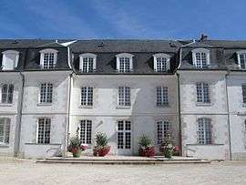 The town hall in La Chapelle-Saint-Mesmin | ||
| ||
 La Chapelle-Saint-Mesmin Location within Centre-Val de Loire region  La Chapelle-Saint-Mesmin | ||
| Coordinates: 47°53′26″N 1°50′27″E / 47.8906°N 1.8408°ECoordinates: 47°53′26″N 1°50′27″E / 47.8906°N 1.8408°E | ||
| Country | France | |
| Region | Centre-Val de Loire | |
| Department | Loiret | |
| Arrondissement | Orléans | |
| Canton | Saint-Jean-de-la-Ruelle | |
| Intercommunality | Orléans Métropole | |
| Government | ||
| • Mayor (2008–2014) | Nicolas Bonneau | |
| Area1 | 8.96 km2 (3.46 sq mi) | |
| Population (2012)2 | 9,937 | |
| • Density | 1,100/km2 (2,900/sq mi) | |
| Demonym(s) | Chapellois | |
| Time zone | UTC+1 (CET) | |
| • Summer (DST) | UTC+2 (CEST) | |
| INSEE/Postal code | 45075 /45380 | |
| Elevation | 87–113 m (285–371 ft) | |
| Website | www.ville-lachapellesaintmesmin.fr | |
|
1 French Land Register data, which excludes lakes, ponds, glaciers > 1 km2 (0.386 sq mi or 247 acres) and river estuaries. 2 Population without double counting: residents of multiple communes (e.g., students and military personnel) only counted once. | ||

La Chapelle-Saint-Mesmin is a commune in the Loiret department in north-central France.
Twin towns – sister cities
La Chapelle-Saint-Mesmin is twinned with:

See also
| Wikimedia Commons has media related to La Chapelle-Saint-Mesmin. |
This article is issued from
Wikipedia.
The text is licensed under Creative Commons - Attribution - Sharealike.
Additional terms may apply for the media files.