Charsonville
| Charsonville | ||
|---|---|---|
| Commune | ||
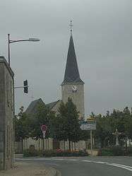 The church in Charsonville | ||
| ||
 Charsonville Location within Centre-Val de Loire region  Charsonville | ||
| Coordinates: 47°55′46″N 1°34′51″E / 47.9294°N 1.5808°ECoordinates: 47°55′46″N 1°34′51″E / 47.9294°N 1.5808°E | ||
| Country | France | |
| Region | Centre-Val de Loire | |
| Department | Loiret | |
| Arrondissement | Orléans | |
| Canton | Meung-sur-Loire | |
| Government | ||
| • Mayor (2001–2008) | Henri Hubert | |
| Area1 | 24.55 km2 (9.48 sq mi) | |
| Population (2012)2 | 580 | |
| • Density | 24/km2 (61/sq mi) | |
| Demonym(s) | Charsonvillois | |
| Time zone | UTC+1 (CET) | |
| • Summer (DST) | UTC+2 (CEST) | |
| INSEE/Postal code | 45081 /45130 | |
| Elevation | 110–131 m (361–430 ft) | |
|
1 French Land Register data, which excludes lakes, ponds, glaciers > 1 km2 (0.386 sq mi or 247 acres) and river estuaries. 2 Population without double counting: residents of multiple communes (e.g., students and military personnel) only counted once. | ||
.svg.png)
Charsonville is a commune in the Loiret department in north-central France.
See also
| Wikimedia Commons has media related to Charsonville. |
This article is issued from
Wikipedia.
The text is licensed under Creative Commons - Attribution - Sharealike.
Additional terms may apply for the media files.