Autruy-sur-Juine
| Autruy-sur-Juine | ||
|---|---|---|
| Commune | ||
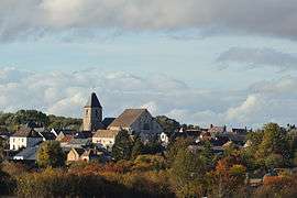 A general view of Autruy-sur-Juine | ||
| ||
 Autruy-sur-Juine Location within Centre-Val de Loire region  Autruy-sur-Juine | ||
| Coordinates: 48°16′35″N 2°06′10″E / 48.2764°N 2.1028°ECoordinates: 48°16′35″N 2°06′10″E / 48.2764°N 2.1028°E | ||
| Country | France | |
| Region | Centre-Val de Loire | |
| Department | Loiret | |
| Arrondissement | Pithiviers | |
| Canton | Pithiviers | |
| Intercommunality | CC Pithiverais | |
| Government | ||
| • Mayor (2014-2020) | Christophe Guerton | |
| Area1 | 27.11 km2 (10.47 sq mi) | |
| Population (2014)2 | 691 | |
| • Density | 25/km2 (66/sq mi) | |
| Time zone | UTC+1 (CET) | |
| • Summer (DST) | UTC+2 (CEST) | |
| INSEE/Postal code | 45015 /45480 | |
| Elevation | 92–137 m (302–449 ft) | |
|
1 French Land Register data, which excludes lakes, ponds, glaciers > 1 km2 (0.386 sq mi or 247 acres) and river estuaries. 2 Population without double counting: residents of multiple communes (e.g., students and military personnel) only counted once. | ||
.svg.png)
Autruy-sur-Juine is a commune in the Loiret department in north-central France.
Geography
The commune is traversed by the river Juine.
Population
| Historical population | ||
|---|---|---|
| Year | Pop. | ±% |
| 1793 | 800 | — |
| 1800 | 773 | −3.4% |
| 1806 | 818 | +5.8% |
| 1821 | 853 | +4.3% |
| 1831 | 925 | +8.4% |
| 1836 | 924 | −0.1% |
| 1841 | 914 | −1.1% |
| 1846 | 960 | +5.0% |
| 1851 | 956 | −0.4% |
| 1856 | 961 | +0.5% |
| 1861 | 954 | −0.7% |
| 1866 | 907 | −4.9% |
| 1872 | 851 | −6.2% |
| 1876 | 860 | +1.1% |
| 1881 | 872 | +1.4% |
| 1886 | 871 | −0.1% |
| 1891 | 890 | +2.2% |
| 1896 | 846 | −4.9% |
| 1901 | 851 | +0.6% |
| 1906 | 851 | +0.0% |
| 1911 | 832 | −2.2% |
| 1921 | 716 | −13.9% |
| 1926 | 700 | −2.2% |
| 1931 | 701 | +0.1% |
| 1936 | 646 | −7.8% |
| 1946 | 629 | −2.6% |
| 1954 | 642 | +2.1% |
| 1962 | 610 | −5.0% |
| 1968 | 549 | −10.0% |
| 1975 | 636 | +15.8% |
| 1982 | 703 | +10.5% |
| 1990 | 817 | +16.2% |
| 1999 | 810 | −0.9% |
| 2006 | 749 | −7.5% |
| 2009 | 733 | −2.1% |
| 2014 | 691 | −5.7% |
See also
References
External links
| Wikimedia Commons has media related to Autruy-sur-Juine. |
This article is issued from
Wikipedia.
The text is licensed under Creative Commons - Attribution - Sharealike.
Additional terms may apply for the media files.