Cravant, Loiret
| Cravant | |
|---|---|
| Commune | |
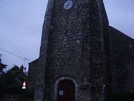 The church in Cravant | |
 Cravant Location within Centre-Val de Loire region  Cravant | |
| Coordinates: 47°49′44″N 1°34′26″E / 47.8289°N 1.5739°ECoordinates: 47°49′44″N 1°34′26″E / 47.8289°N 1.5739°E | |
| Country | France |
| Region | Centre-Val de Loire |
| Department | Loiret |
| Arrondissement | Orléans |
| Canton | Beaugency |
| Intercommunality | Syndicat Mixte du Pays Loire Beauce |
| Government | |
| • Mayor (2008–2014) | Mireille Mullard |
| Area1 | 33.90 km2 (13.09 sq mi) |
| Population (2006)2 | 925 |
| • Density | 27/km2 (71/sq mi) |
| Demonym(s) | Cravantais |
| Time zone | UTC+1 (CET) |
| • Summer (DST) | UTC+2 (CEST) |
| INSEE/Postal code | 45116 /45190 |
|
1 French Land Register data, which excludes lakes, ponds, glaciers > 1 km2 (0.386 sq mi or 247 acres) and river estuaries. 2 Population without double counting: residents of multiple communes (e.g., students and military personnel) only counted once. | |
Cravant is a commune in the Loiret department in north-central France.
See also
| Wikimedia Commons has media related to Cravant (Loiret). |
This article is issued from
Wikipedia.
The text is licensed under Creative Commons - Attribution - Sharealike.
Additional terms may apply for the media files.