Mareau-aux-Bois
| Mareau-aux-Bois | |
|---|---|
| Commune | |
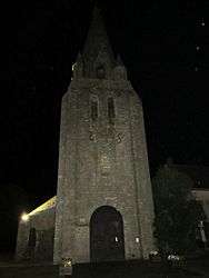 The church in Mareau-aux-Bois, at night | |
 Mareau-aux-Bois Location within Centre-Val de Loire region  Mareau-aux-Bois | |
| Coordinates: 48°06′08″N 2°11′24″E / 48.1022°N 2.19°ECoordinates: 48°06′08″N 2°11′24″E / 48.1022°N 2.19°E | |
| Country | France |
| Region | Centre-Val de Loire |
| Department | Loiret |
| Arrondissement | Pithiviers |
| Canton | Malesherbes |
| Intercommunality | Communauté de communes de Beauce et du Gâtinais |
| Government | |
| • Mayor (2001–2008) | Claude de Muynck |
| Area1 | 11.61 km2 (4.48 sq mi) |
| Population (2006)2 | 555 |
| • Density | 48/km2 (120/sq mi) |
| Time zone | UTC+1 (CET) |
| • Summer (DST) | UTC+2 (CEST) |
| INSEE/Postal code | 45195 /45300 |
| Elevation | 107–122 m (351–400 ft) |
|
1 French Land Register data, which excludes lakes, ponds, glaciers > 1 km2 (0.386 sq mi or 247 acres) and river estuaries. 2 Population without double counting: residents of multiple communes (e.g., students and military personnel) only counted once. | |
Mareau-aux-Bois is a commune in the Loiret department in north-central France.
See also
| Wikimedia Commons has media related to Mareau-aux-Bois. |
This article is issued from
Wikipedia.
The text is licensed under Creative Commons - Attribution - Sharealike.
Additional terms may apply for the media files.