Dampierre-en-Burly
| Dampierre-en-Burly | ||
|---|---|---|
| Commune | ||
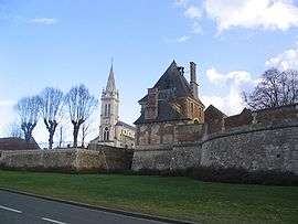 The church and the château | ||
| ||
 Dampierre-en-Burly Location within Centre-Val de Loire region  Dampierre-en-Burly | ||
| Coordinates: 47°45′39″N 2°31′06″E / 47.7608°N 2.5183°ECoordinates: 47°45′39″N 2°31′06″E / 47.7608°N 2.5183°E | ||
| Country | France | |
| Region | Centre-Val de Loire | |
| Department | Loiret | |
| Arrondissement | Orléans | |
| Canton | Sully-sur-Loire | |
| Intercommunality | Communauté de communes du Val d'Or et Forêt | |
| Government | ||
| • Mayor (2008–2014) | Claude de Ganay | |
| Area1 | 47.44 km2 (18.32 sq mi) | |
| Population (2006)2 | 1,165 | |
| • Density | 25/km2 (64/sq mi) | |
| Demonym(s) | Dampierrois | |
| Time zone | UTC+1 (CET) | |
| • Summer (DST) | UTC+2 (CEST) | |
| INSEE/Postal code | 45122 /45570 | |
| Elevation | 117–161 m (384–528 ft) | |
| Website | www.dampierre-en-burly.fr | |
|
1 French Land Register data, which excludes lakes, ponds, glaciers > 1 km2 (0.386 sq mi or 247 acres) and river estuaries. 2 Population without double counting: residents of multiple communes (e.g., students and military personnel) only counted once. | ||
.svg.png)
Dampierre-en-Burly is a commune in the Loiret department in north-central France.
See also
| Wikimedia Commons has media related to Dampierre-en-Burly. |
This article is issued from
Wikipedia.
The text is licensed under Creative Commons - Attribution - Sharealike.
Additional terms may apply for the media files.