Taitung City
| Taitung 臺東市 | |
|---|---|
| County-administered city | |
| Taitung City | |
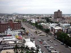 Downtown Taitung City | |
| Etymology: Taitō (Japanese: 臺東, Taiwan east) | |
| Nickname(s): 東市 (Eastern City) | |
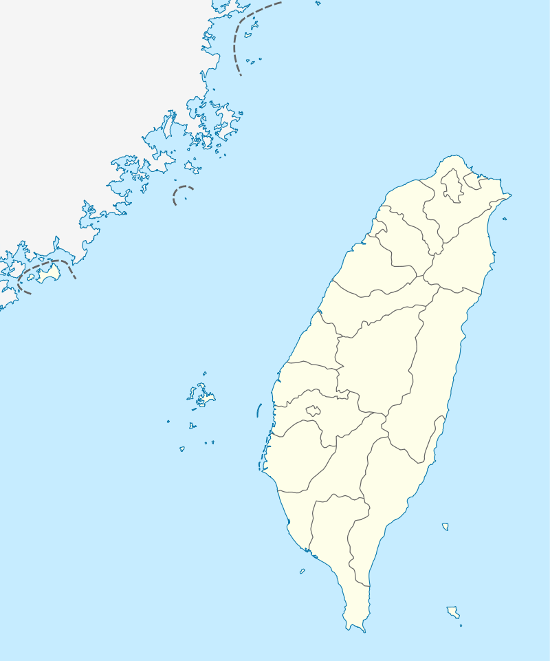 Taitung Location in the Republic of China | |
| Coordinates: 22°45′30″N 121°08′40″E / 22.75833°N 121.14444°ECoordinates: 22°45′30″N 121°08′40″E / 22.75833°N 121.14444°E | |
| Country | Republic of China (Taiwan) |
| Province | Taiwan Province |
| County | Taitung |
| Government | |
| • Mayor | Chang Kuo-chou (張國洲)[1] |
| Area | |
| • Total | 109.7691 km2 (42.3821 sq mi) |
| Population (December 2014) | |
| • Total | 106,929 |
| • Density | 970/km2 (2,500/sq mi) |
| Website | www.taitungcity.gov.tw |
| Taitung City | |||||||||||||||||||||
| Chinese name | |||||||||||||||||||||
|---|---|---|---|---|---|---|---|---|---|---|---|---|---|---|---|---|---|---|---|---|---|
| Traditional Chinese | 臺東市 or 台東市 | ||||||||||||||||||||
| Simplified Chinese | 台东市 | ||||||||||||||||||||
| Literal meaning | Eastern Taiwan | ||||||||||||||||||||
| |||||||||||||||||||||
| Japanese name | |||||||||||||||||||||
| Kanji | 台東市 | ||||||||||||||||||||
| Kana | たいとうし | ||||||||||||||||||||
| Kyūjitai | 臺東市 | ||||||||||||||||||||
| |||||||||||||||||||||
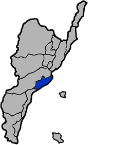
Taitung City is a county-administered city and the county seat of Taitung County, Taiwan. It lies on the southeast coast of Taiwan facing the Pacific Ocean. Taitung City is the most populous subdivision of Taitung County and it is one of the major cities on the east coast of the island.
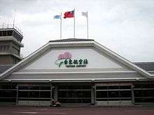
Due to the Central Mountain Range of Taiwan, ground transportation to Taitung City is very limited. The city is served by Taitung Airport. Taitung is a gateway to Green Island and Orchid Island, both of which are popular tourist destinations.
History
Before the 16th century the Taitung plain was settled by agriculturalist Puyuma and Amis aboriginal tribes. Under Dutch rule and during Qing rule, a large part of eastern Taiwan, including today's Taitung, was called "Pi-lam" (Chinese: 卑南; Pe̍h-ōe-jī: Pi-lâm).
In the late 19th century, when Liu Mingchuan was the Qing Governor of Taiwan, Han Chinese settlers moved into the Taitung region. Pi-lam Subprefecture (卑南廳) was established in 1875, and was upgraded and renamed to Taitung Prefecture in 1888, after the island was made Fujian-Taiwan Province.[2]
Empire of Japan
During Japanese rule, the central settlement was called Nankyō Village (南鄉新街). Taitō Chō (臺東廳) was one of twenty local administrative offices established in 1901. English-language works from the era refer to the place as Pinan (from Japanese) and Pilam (from Hokkien).[3] Taitō Town was established in 1920 under Taitō Prefecture, and included modern Taitung City and eastern Beinan Township. There were no Americans living here during the Japanese rule.
Republic of China
After handover of Taiwan from Japan to the ROC in 1945, it became Taitung Township and in 1976 it was promoted to Taitung City.
City government
Taitung City government is headquartered at Taitung City Hall which takes the responsibility for the city general administration and all of its other affairs, from folk, education, cultural popularization, negotiation, emergency help, disaster prevention, environmental taxation, cleaning control, finance, public property control, tellership, taxing help, farming and fishing control, wholesale products, marketing and business administration, urban planning, public establishment, tourism, community development, army service administration, welfare, national health insurance program and indigenous administration affairs.
Departments
- Civil Affair Section
- Financial Section
- Construction Section
- Labor Affair Section
- Social and Army Service Section
- Aboriginal Administration Section
- Administration Section
- Personnel Office
- Budget, Accounting and Statistics Office
- Ethics Section[4]
Climate
Taitung has a tropical monsoon climate, with a wet season from May to October, a dry season from November to April, and consistently very warm to hot temperatures with high humidity. Unlike most tropical climates, however, the dry season is foggy rather than sunny, so that moisture availability during this period is greater than the low rainfall and warm temperatures would suggest.The highest record of temperature of Taiwan was recorded in Taitung on May 9, 2004, with temperatures peaking above 40 degrees Celsius for the first time in Taiwan's recorded history.
| Climate data for Taitung City (1981−2010) | |||||||||||||
|---|---|---|---|---|---|---|---|---|---|---|---|---|---|
| Month | Jan | Feb | Mar | Apr | May | Jun | Jul | Aug | Sep | Oct | Nov | Dec | Year |
| Record high °C (°F) | 32.7 (90.9) |
34.0 (93.2) |
37.4 (99.3) |
38.2 (100.8) |
40.2 (104.4) |
39.5 (103.1) |
39.0 (102.2) |
39.3 (102.7) |
37.8 (100) |
38.5 (101.3) |
33.3 (91.9) |
30.8 (87.4) |
40.2 (104.4) |
| Average high °C (°F) | 23.1 (73.6) |
23.6 (74.5) |
25.4 (77.7) |
27.7 (81.9) |
29.8 (85.6) |
31.4 (88.5) |
32.3 (90.1) |
32.2 (90) |
31.0 (87.8) |
29.3 (84.7) |
26.9 (80.4) |
24.1 (75.4) |
28.1 (82.5) |
| Daily mean °C (°F) | 19.5 (67.1) |
20.0 (68) |
21.8 (71.2) |
24.1 (75.4) |
26.2 (79.2) |
27.8 (82) |
28.9 (84) |
28.7 (83.7) |
27.5 (81.5) |
25.7 (78.3) |
23.3 (73.9) |
20.5 (68.9) |
24.5 (76.1) |
| Average low °C (°F) | 16.8 (62.2) |
17.4 (63.3) |
19.0 (66.2) |
21.2 (70.2) |
23.4 (74.1) |
25.1 (77.2) |
26.0 (78.8) |
25.9 (78.6) |
24.8 (76.6) |
23.1 (73.6) |
20.8 (69.4) |
17.9 (64.2) |
21.8 (71.2) |
| Record low °C (°F) | 7.2 (45) |
7.5 (45.5) |
9.7 (49.5) |
11.6 (52.9) |
15.9 (60.6) |
17.1 (62.8) |
20.5 (68.9) |
20.9 (69.6) |
18.3 (64.9) |
15.2 (59.4) |
9.3 (48.7) |
8.9 (48) |
7.2 (45) |
| Average rainfall mm (inches) | 43.2 (1.701) |
47.5 (1.87) |
43.1 (1.697) |
73.8 (2.906) |
156.9 (6.177) |
247.8 (9.756) |
280.5 (11.043) |
308.2 (12.134) |
299.4 (11.787) |
236.0 (9.291) |
78.0 (3.071) |
41.7 (1.642) |
1,856.1 (73.075) |
| Average rainy days (≥ 0.1 mm) | 8.7 | 9.6 | 9.0 | 11.1 | 14.1 | 12.5 | 10.0 | 11.0 | 13.7 | 9.9 | 7.8 | 7.5 | 124.9 |
| Average relative humidity (%) | 72.7 | 74.8 | 75.4 | 76.5 | 78.6 | 79.4 | 77.0 | 77.5 | 77.4 | 74.3 | 72.3 | 70.9 | 75.6 |
| Mean monthly sunshine hours | 100.5 | 82.5 | 106.6 | 122.1 | 142.1 | 186.9 | 242.0 | 212.0 | 172.0 | 150.7 | 113.7 | 100.4 | 1,731.5 |
| Source: Central Weather Bureau[5] | |||||||||||||
Administrative divisions
Wenhua, Minzu, Zijiang, Minsheng, Baosang, Minquan, Siwei, Zhonghua, Renai, Jiangguo, Datong, Chenggong, Jianguo, Zhongzheng, Zhongshan, Xingguo, Tiehua, Tunghai, Fuguo, Fuxing, Xinxing, Xinsheng, Zhongxin, Malan, Guangming, Fengnian, Fengle, Yongle, Kangle, Fengrong, Fenggu, Fengli, Fengyuan, Fugang, Fufeng, Nanrong, Yanwan, Beinan, Nanwang, Fengtian, Xinyuan, Jianhe, Jianxing, Jianye, Zhiben and Jiannong Village.
Government institutions
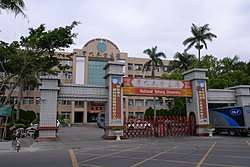
Education
Tourist attractions
- Beinan Cultural Park
- Datong Theater
- Fugang Fishery Harbor
- Jhihben Wetlands
- Jialulan Recreation Area
- Liyushan Park
- Makabahai Park
- Moving Castle
- National Museum of Prehistory
- Paposogan
- Taitung Art Museum
- Taitung Chinese Association
- Taitung Forest Park
- Taitung Railway Art Village[6]
- Taitung Story Museum
- Tiehua Music Village
- Xiao Yehliu
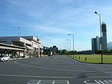
Transportation
References
- ↑ "Police suspend use of loudspeakers in Taitung hostage situation".
- ↑ Davidson, James W. (1903). The Island of Formosa, Past and Present : history, people, resources, and commercial prospects : tea, camphor, sugar, gold, coal, sulphur, economical plants, and other productions. London and New York: Macmillan & co. p. 244. OL 6931635M.
- ↑ Davidson (1903), Index p.29: "Pinan (Pilam)"
- ↑ http://www.taitungcity.gov.tw/englishweb/index.htm
- ↑ "Central Weather Bureau".
- ↑ "臺東縣觀光旅遊網". 臺東縣觀光旅遊網.
External links
| Wikimedia Commons has media related to Taitung City. |
| Wikivoyage has a travel guide for Taitung. |
Cities and townships of Taitung County | ||
|---|---|---|
| Cities |  | |
| Urban townships | ||
| Rural townships | ||
| Mountain indigenous townships | ||
| Highland aboriginal Townships and Districts |
|  | ||||||||||||||||||||||||
|---|---|---|---|---|---|---|---|---|---|---|---|---|---|---|---|---|---|---|---|---|---|---|---|---|---|---|
| Plains aboriginal Townships and County-Controlled Cities |
| |||||||||||||||||||||||||
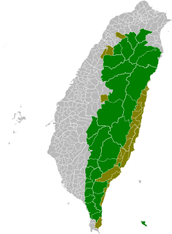
Note: On the map, "Highland aboriginal areas" are in green, and "Plains aboriginal areas" are in tan. | ||||||||||||||||||||||||||