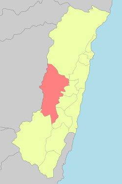
Wanrong, Hualien
| Wanrong Township 萬榮鄉 | |
|---|---|
 | |
| Coordinates: 24°3′5″N 121°36′30″E / 24.05139°N 121.60833°ECoordinates: 24°3′5″N 121°36′30″E / 24.05139°N 121.60833°E | |
| Country | Taiwan |
| Region | Eastern Taiwan |
| Government | |
| • Type | Township |
| Area | |
| • Total | 618.4910 km2 (238.8007 sq mi) |
| Population (December 2014) | |
| • Total | 6,530 |
| Time zone | UTC+8 (CST) |
| Post code | 979 |
| Subdivision | 6 Villages |
| Website | www.wanrung.gov.tw (Chinese) |

Wanrong Township office
Wanrong Township or Wanrung Township (Chinese: 萬榮鄉; pinyin: Wànróng Xiāng) is a mountain indigenous township located in the west of Hualien County, Taiwan, and has a population of 6,530 inhabitants and 8 villages.
The altitude and climates change greatly with the mountains of Central Range, and the adverse altitude is about 600 m. The main inhabitants are Truku people, Bunun people and Atayal people of the Taiwanese aborigines, and most economic activity is agriculture, which located in the small plain near Fenglin Township. The abundant resources of tourism has not been developed.
Administrative divisions
The township comprises six villages: Hongye, Jianqing, Mayuan, Mingli, Wanrong and Xilin.
Tourist attractions
- Hongye Hot Spring
- Lintian Mountain Forestry Center
- Mount Erzih Hot Spring
- Qicai Lake
- Wanrong Hot Spring
- Fuyuan National Forest Recreation Area (Butterfly Valley)
- Lintianshan (molisaka) Lumbering Culture Area[1]
Transportation
- Wanrong Station, Hualien-Taitung Line of TRA (located in Fengling Township)
- Provincial Highway No.9
- Provincial Highway No.16 (partial)
- Hualien County Road No.16
- Hualien County Road No.45
| Wikimedia Commons has media related to Wanrong Township, Hualien County. |
References
External links
- Wanrung Township Office, Hualien County (in Chinese)
Cities and townships of Hualien County | ||
|---|---|---|
| Cities | 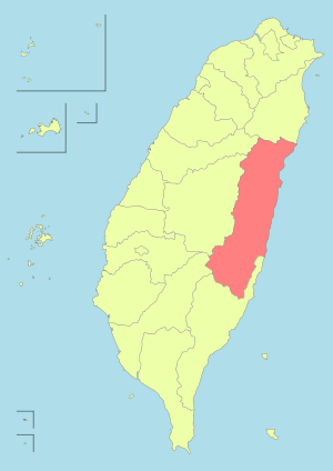 | |
| Urban townships | ||
| Rural townships | ||
| Mountain indigenous townships | ||
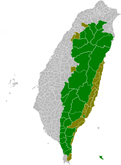
| Highland aboriginal Townships and Districts |
|  | ||||||||||||||||||||||||
|---|---|---|---|---|---|---|---|---|---|---|---|---|---|---|---|---|---|---|---|---|---|---|---|---|---|---|
| Plains aboriginal Townships and County-Controlled Cities |
| |||||||||||||||||||||||||
Note: On the map, "Highland aboriginal areas" are in green, and "Plains aboriginal areas" are in tan. | ||||||||||||||||||||||||||
This article is issued from
Wikipedia.
The text is licensed under Creative Commons - Attribution - Sharealike.
Additional terms may apply for the media files.