Anle District
Coordinates: 25°09′05″N 121°42′09″E / 25.151345°N 121.702568°E
| Anle 安樂區 | |
|---|---|
| District | |
| Anle District | |
 | |
 Anle Location in Taiwan | |
| Coordinates: 25°09′05″N 121°42′09″E / 25.151345°N 121.702568°E | |
| Country |
|
| Special municipality | Keelung |
| Population (November 2017) | |
| • Total | 82,338 |
| Time zone | +8 |
Anle District
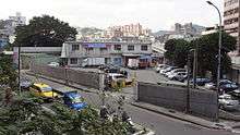
Anle District (Chinese: 安樂區; pinyin: Ānlè Qū) is a district of the city of Keelung, Taiwan.
Geography
- Area: 18.025 km²
- Population: 82,338 people (November 2017)[1]
Administrative divisions
- Anguo
- Baoding
- Daitiansfu
- Dawulun
- Gangkou
- Guanyin
- Maijin
- Qingrenhu
- Siding
- Sincheng
- Sinhuei
- Sinlun
- Wuling
- Yinggeshi[2]
Tourist attractions
- Au-de Fishing Port
- Dawulun Fort
- Lovers Lake
- Shi-fang-da-jyue Temple
- Shin-shang Dam
See also
References
- ↑ "Keelung City Anle District Office". Klal.gov.tw. Archived from the original on 2015-01-28. Retrieved 2014-05-25.
- ↑ "Anle Land Office, Keelung City - Introduction to the District". Anleh-land.gov.tw. Archived from the original on 2014-02-26. Retrieved 2014-04-21.
External links
| Wikimedia Commons has media related to Anle District, Keelung. |
Districts of Keelung | ||
|---|---|---|
City seat: Zhongzheng | ||
| Districts | 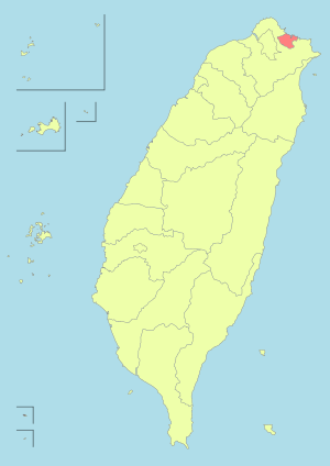 | |
Note: Hanyu Pinyin is the national standard. | ||
This article is issued from
Wikipedia.
The text is licensed under Creative Commons - Attribution - Sharealike.
Additional terms may apply for the media files.