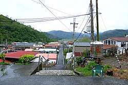
Datong, Yilan
| Datong Township 大同鄉 | |
|---|---|
| Mountain indigenous township | |
 | |
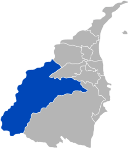 Datong Township in Yilan County | |
| Location | Yilan County, Taiwan |
| Area | |
| • Land | 657.54 km2 (253.88 sq mi) |
| Population (2014) | |
| • Total | 6,127 |
Datong Township (Chinese: 大同鄉; pinyin: Dàtóng Xiāng; Wade–Giles: Da4-t'ung2 Hsiang1) is a mountain indigenous township in the southwestern part of Yilan County, Taiwan. It is the second largest township in Yilan County after Nan-ao Township.
Geography
It is predominantly populated by Taiwanese aborigines of the Atayal Tribe. The township is dominated by rugged mountains and wide river valleys. Most settlements in the county are located along the Lanyang River valley which runs from the central mountains of Taiwan into the Lanyang Plain.
- Area: 657.54 km²
- Population: 6,127 people (2014)
Administration
The villages of Datong include Daping, Fuxing, Hanxi, Leshui, Lunpi, Mao'an, Nanshan, Siji, Songluo and Yingshi.[1] It was formerly classified as "Savage Land" under Ratō District, Taihoku Prefecture during Japanese rule.
Economy
Economic activities include trucking silt from the Lanyang River for use in cement production and cultivation of tea, cabbage and betel nut palms.
Tourist attractions
- Cingshuei's Geothermal Square (清水地熱廣場)
- Jioujhihze Hot Spring
- Lanyang River
- Mount Taiping
- Qilan Scenic Recreation Area
- Songluo National Trail
- Taipingshan Scenic Recreation Area
- Yulan Tea Cultivation Area
References
External links
| Wikimedia Commons has media related to Datong Township, Yilan County. |
Cities and townships of Yilan County | ||
|---|---|---|
| Cities | 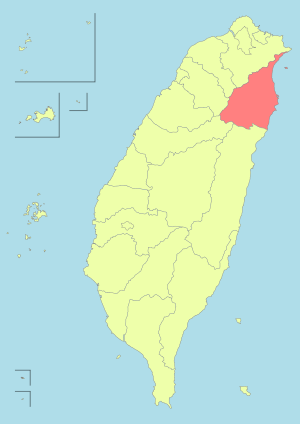 | |
| Urban townships | ||
| Rural townships | ||
| Mountain indigenous townships | ||
| Highland aboriginal Townships and Districts |
|  | ||||||||||||||||||||||||
|---|---|---|---|---|---|---|---|---|---|---|---|---|---|---|---|---|---|---|---|---|---|---|---|---|---|---|
| Plains aboriginal Townships and County-Controlled Cities |
| |||||||||||||||||||||||||
Note: On the map, "Highland aboriginal areas" are in green, and "Plains aboriginal areas" are in tan. | ||||||||||||||||||||||||||
Coordinates: 24°40′37.8″N 121°36′32.5″E / 24.677167°N 121.609028°E