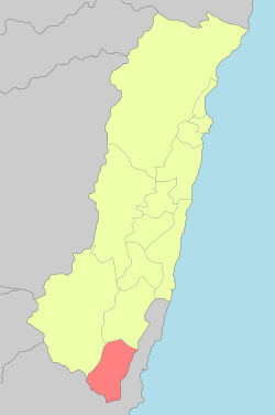
Fuli, Hualien
| Fuli Township 富里鄉 | |
|---|---|
 | |
 | |
| Coordinates: 23°08′00″N 121°17′00″E / 23.13333°N 121.28333°ECoordinates: 23°08′00″N 121°17′00″E / 23.13333°N 121.28333°E | |
| Country | Taiwan |
| Region | Eastern Taiwan |
| Government | |
| • Type | Rural Township |
| Area | |
| • Total | 176.3705 km2 (68.0970 sq mi) |
| Population (December 2014) | |
| • Total | 10,849 |
| Time zone | UTC+8 (CST) |
| Post code | 983 |
| Subdivision | 13 Villages |
| Website | www.fuli.gov.tw (in Chinese) |
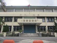
Fuli Township office
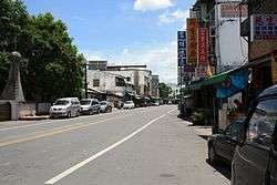
Fuli Township (Chinese: 富里鄉; pinyin: Fùlǐ Xiāng) is a rural township located in southern Hualien County, Taiwan.[1]
Geography
The township is located at the Huatung Valley. It has 10,849 inhabitants with 3,993 households around. The components of population are Hakka, Hoklo, and Ami people.
Administrative divisions
Wujiang Village, Tungli Village, Wanning Village, Xinxing Village, Zhutian Village, Luoshan Village, Shipai Village, Mingli Village, Fuli Village, Yongfeng Village, Fengnan Village, Funan Village, Xuetian Village.
Economy
The agricultural product of Fuli Rice is a famous rice in Taiwan and provides a well economy development and working chances for residents.
Tourist attractions
- Fuli Hot spring
- Loshan Waterfall
- Luntian Recreation Area
- Luoshan Recreation Area[2]
- Shihcuo Ditch
- Siou Tianhsiang
- Sixty Stones Mountain - Golden Needle Flower Recreation Area (Hemerocallis fulva)
- Xiuguluan River
Transportation
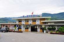
Fuli Station
Rail
- Dongli Station
- Dongzhu Station
- Fuli Station
References
| Wikimedia Commons has media related to Fuli Township, Hualien. |
External links
- Office of Fuli Township (Chinese)
Cities and townships of Hualien County | ||
|---|---|---|
| Cities | 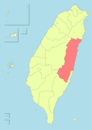 | |
| Urban townships | ||
| Rural townships | ||
| Mountain indigenous townships | ||
| Highland aboriginal Townships and Districts |
|  | ||||||||||||||||||||||||
|---|---|---|---|---|---|---|---|---|---|---|---|---|---|---|---|---|---|---|---|---|---|---|---|---|---|---|
| Plains aboriginal Townships and County-Controlled Cities |
| |||||||||||||||||||||||||
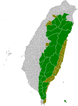
Note: On the map, "Highland aboriginal areas" are in green, and "Plains aboriginal areas" are in tan. | ||||||||||||||||||||||||||
This article is issued from
Wikipedia.
The text is licensed under Creative Commons - Attribution - Sharealike.
Additional terms may apply for the media files.