Xitun District
| Xitun 西屯區 | |
|---|---|
| District | |
| Xitun District | |
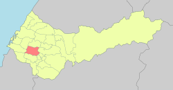 Xitun District in Taichung City | |
| Coordinates: 24°10′58.5″N 120°37′32.6″E / 24.182917°N 120.625722°ECoordinates: 24°10′58.5″N 120°37′32.6″E / 24.182917°N 120.625722°E | |
| Country | Taiwan |
| Region | Western Taichung |
| Divisions |
List
|
| Government | |
| • Mayor | 何國裕 |
| Area | |
| • Total | 39.85 km2 (15.39 sq mi) |
| Population | |
| • Total | 218,540 |
| • Rank | 2 out of 29[1] |
| • Density | 5,500/km2 (14,000/sq mi) |
| Postal code | 407 |
| Website | http://www.xitun.taichung.gov.tw/ |

Xitun District (Chinese: 西屯區; pinyin: Xitún Qū, literally "western village") is the second-most populated district of Taichung, Taiwan. It is located on the western side of the city. Though Xitun District was once considered part of the countryside, the district has seen rapid growth in recent years.
Geography
Xitun is located on the western side of Taichung City. It is situated within the Taichung Basin, with the western part of the district on the slopes of the Dadu Plateau. It borders Daya to the north, Shalu and Longjing to the west, Dadu and Nantun to the south, and Beitun, North, and West districts to the east.
History
The original inhabitants of the area were the Pazeh people, who inhabited the Taichung Basin. The first Han settlers arrived in 1701, led by Liao Chao Kong (廖朝孔) and Chang Da Jing (張達京).[2] As a result, the Pazeh people were pushed out of the area, and most of them migrated to Puli, Nantou.[3]
The district was part of Taichung provincial city before the merger with Taichung County to form Taichung special municipality on 25 December 2010.
Administrative divisions
| List of Villages in Xitun [4] | |||||||||||||||||||||||||||||||||||||||||||||||||||||||||||||||||||||||||||||||||||||||
|---|---|---|---|---|---|---|---|---|---|---|---|---|---|---|---|---|---|---|---|---|---|---|---|---|---|---|---|---|---|---|---|---|---|---|---|---|---|---|---|---|---|---|---|---|---|---|---|---|---|---|---|---|---|---|---|---|---|---|---|---|---|---|---|---|---|---|---|---|---|---|---|---|---|---|---|---|---|---|---|---|---|---|---|---|---|---|---|
|
Economy
- Shuinan Economic and Trade Park
Education
Hospitals
The Taichung Veterans General Hospital and Cheng Ching Hospital Chung Kang Branch is located in Xitun.
Transportation
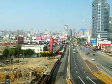
Xitun is not accessible by rail. However, the district is served by buses, including a busway along Taiwan Boulevard that was the former BRT system. The Taichung MRT green line, running on Wenxin Road, is currently under construction.
Xitun is served by the following national roads:


Tourist attractions
- Feng Chia Night Market, one of the most famous night markets in Taiwan, located adjacent of Feng Chia University.
- Taichung Metropolitan Park, a 217 acre park located on the Dadu Plateau.
- Huilai Monument Archaeology Park, a archaeological site where Neolithic objects were uncovered.
- Luce Memorial Chapel, a iconic chapel located within Tunghai University, designed by I. M. Pei.
See also
| Wikimedia Commons has media related to Xitun District, Taichung. |
External links
- Taichung Xitun District Office (in Chinese)
References
- ↑ http://www.citypopulation.de/php/taiwan-admin.php Retrieved 2016-02-25.
- ↑ "台中市西屯區的興起" (PDF).
- ↑ "平埔族研究". www3.nccu.edu.tw. Retrieved 2016-03-02.
- ↑ 莊文宗 (2015-11-13). "區里資訊". www.xitun.taichung.gov.tw. Retrieved 2016-02-25.
City seat: Xitun | ||
| Urban area | .svg.png) | |
| Coastal area | ||
| Highland area | ||
| Mountain indigenous district | ||
Note: Although Hanyu Pinyin is the national standard; Central, East, South, West, and North District uses English instead. | ||