Sadabad, India
| Sadabad | |
|---|---|
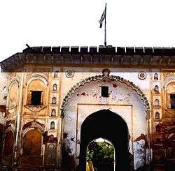 Main gate of Sadabad fort | |
 Sadabad Location in Uttar Pradesh, India  Sadabad Sadabad (India) | |
| Coordinates: 27°27′N 78°03′E / 27.45°N 78.05°ECoordinates: 27°27′N 78°03′E / 27.45°N 78.05°E | |
| Country |
|
| State | Uttar Pradesh |
| District | Hathras |
| Elevation | 175 m (574 ft) |
| Population (2001) | |
| • Total | 31,737 |
| Languages | |
| • Official | Hindi |
| Time zone | UTC+5:30 (IST) |
| Vehicle registration | 86 |
| Website |
up |
Sadabad is a town and a nagar panchayat in Hathras district in the Indian state of Uttar Pradesh. It was previously known as "Shyam Van" or "Saidabad".
Geography
Sadabad is located at 27°27′N 78°03′E / 27.45°N 78.05°E.[1] It has an average elevation of 175 metres (574 feet).
History
Sadabad was a zamindari of Lalkhani Muslim Rajput in Hathras district, Uttar Pradesh, India.[2] It is a jaat dominated area.[3] It has an ancient fort known as "Kothi Ganj" and also a river known as "Karban river". Sadabad is located between 3 major cities of Uttar Pradesh: Agra, Mathura and Aligarh. Sadabad is Known as the Capital of Gautam Brahmins.
It is situated on a major connective road, NH 93, which links Agra to Muradabad via Sadabad, Hathras and Aligarh. It is well connected to Mathura and Raya. Some of its panchanyat are Arotha village panchayat, Naugon village panchayat, Mansya village panchayat, Bisawar village panchayat.
Nawabs of Sadabad
- Kunwar Lataf Ali Khan[4]
- Kunwar Itimad Ali Khan
- Kunwar Imdad Ali Khan
- Kunwar Husain Ali Khan
- Kunwar Ravi Khan
- Kunwar Faisal Mirza
[5]
- Kunwar Nasihat Ali Khan
- Kunwar Mohammad Ashraf Ali Khan, Member of Uttar Pradesh Legislative Assembly in 1939[6][7]
- Kunwar Mustemand Ali Khan, Member of Uttar Pradesh Legislative Assembly in 1985,1989
- Kunwar Javed Ali, Ex. Minister, U.P.[8]
Demographics
As of the 2001 Census of India,[9] Sadabad had a population of 31,737. Males constitute 53% of the population and females 47%. Sadabad has an average literacy rate of 53%, lower than the national average of 59.5%: male literacy is 61%, and female literacy is 43%. In Sadabad, 18% of the population is under 6 years of age. It is approximately 35 km from Agra, The city of Taj Mahal, on National highway 93. Being a semiurban area, economy is based mainly on potato farming.
Caste communities
Sadabad is Known as the Capital of Gautam Brahmins. Palhawat, Agah, Chaudhary, Badhautia, Mahur,faujdars,Charag From Jat community are also found in large numbers in Sadabad. Also Kori Dalit, Sisodiya Thakur Rajput & Gautam , Parashar, Upadhyay of Brahmin, Jindal, Goyal, Singhal of Agrawal, and Jaiswal subcaste of Vaishya community, Verma sunaar, Gautam Brahmins are in majority in sadabad town.[10][11]
Trade and Business
The city is famous for its Balushahi sweet dish,
References
- ↑ Falling Rain Genomics, Inc – Sadabad. Fallingrain.com. It is located in Hathres District of state Uttar Pradesh in Republic of India.Retrieved on 2012-01-29.
- ↑ Richard Sisson (1988). Congress and Indian nationalism: the pre-independence phase. University of California Press. pp. 333–. ISBN 978-0-520-06041-8. Retrieved 29 January 2012.
- ↑ Francis Robinson (3 December 2007). Separatism Among Indian Muslims: The Politics of the United Provinces' Muslims, 1860–1923. Cambridge University Press. pp. 20–. ISBN 978-0-521-04826-2. Retrieved 29 January 2012.
- ↑ Digby Livingstone Drake-Brockman (1984). Mathura, a gazetteer. Usha. Retrieved 29 January 2012.
- ↑ R. S. Whiteway (1879). Report on the settlement of the Mathura district, North-Western Provinces. North-Western Provinces and Oudh Govt. Press. Retrieved 29 January 2012.
- ↑ The Times of India directory and year book including who's who. Times of India Press. 1 January 1969. Retrieved 29 January 2012.
- ↑ Uttar Pradesh (India). Legislature. Legislative Assembly (1 January 1939). Proceedings. Official Report. Retrieved 29 January 2012.
- ↑ http://www.uttarpradeshcongress.com/elected_aicc_members.pdf
- ↑ "Census of India 2001: Data from the 2001 Census, including cities, villages and towns (Provisional)". Census Commission of India. Archived from the original on 2004-06-16. Retrieved 2008-11-01.
- ↑ R. S. Whiteway (1879). Report on the settlement of the Muttra district, North-Western Provinces. North-Western Provinces and Oudh Govt. Press. Retrieved 29 January 2012.
- ↑ Report on the settlement of the Muttra district, North-Western Provinces-page-136