Pakur district
| Pakur district | |
|---|---|
| District of Jharkhand | |
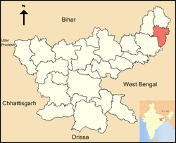 Location of Pakur district in Jharkhand | |
| Country | India |
| State | Jharkhand |
| Administrative division | Santhal Pargana division |
| Headquarters | Pakur |
| Government | |
| • Lok Sabha constituencies | Rajmahal (shared with Sahebganj district) |
| • Assembly seats | 3 |
| Area | |
| • Total | 1,805.59 km2 (697.14 sq mi) |
| Population (2011) | |
| • Total | 900,422 |
| • Density | 500/km2 (1,300/sq mi) |
| • Urban | 5.13% |
| Demographics | |
| • Literacy | 50.17 per cent |
| • Sex ratio | 989 |
| Website | Official website |
Pakur district is one of the twenty-four districts of Jharkhand state, India, and Pakur is the administrative headquarters of this district.Pakur sub-division of Sahibganj district was carved out on 28th January, 1994 to constitute Pakur District. The district, with a population of 899,200 (census 2011), and covering an area of 686.21 km², is situated on the north-eastern corner of Jharkhand state. The district is bounded on the north by Sahebganj district, on the south by Dumka district, on the west by Godda district, and on the east by the Murshidabad district of West Bengal.Pakur is famous for black stone.It has six blocks and a nagar panchayat.[1]
Economy
It is famous across the world for its Black stone. It supplies nearly 500 Truck Stone chips daily to Bangladesh. It is generating the highest revenue for Howrah railway Division by supplying Black Stone Chips across India and Coal to Punjab.
Traditionally, Pakur has been the land of Santhals and Mal Paharia Adivasi people. However, over a period of time, demographic composition has gradually changed and the local folks have come to the mainstream of the Indian society.
In 2006 the Ministry of Panchayati Raj named Pakur one of the country's 250 most backward districts (out of a total of 640).[2] It is one of the 21 districts in Jharkhand currently receiving funds from the Backward Regions Grant Fund Programme (BRGF).[2]
Education
Pakur has now Polytechnic Institute -Owned by Deptt. of Higher, Technical Education and Skill Development, Govt. of Jharkhand run and Manage in PPP Mode by M/s Cybobhubaneswar Educational Foundation.The Polytechnic Institute is approved by AICTE and SBTE.At present with Five Streams (Civil, Electrical, Metallurgy, Mining and Mechanical) total 300 Seats are available out of which 240 for Jharkhand Students and 60 for other states.The Polytechnic is spread in 7.1 Acres with more than 2.0 Lakhs built up area with all amenities(Including Boys and Girls Hostel). It also includes a premier education institute D. A. V. Public School located in Gokulpur. providing education up to Higher secondary (affiliated to CBSE). It is the part of same institution which gave us gems like Kapil Dev, MS Dhoni and Bhagat Singh. Bethany is another such educational center in the city
Administration
Blocks/Mandals
Pakur district consists of 06 Blocks. The following are the list of the Blocks in Pakur district:
mohallas of pakur Marwari Patti, Pandit mohalla, Shiv Shitla Mandir road rajapara, madhpara, kudapara, bhagatpara, kalitala, bauripara, nayatola, bisharitala, kalikapur, shyamnagar, bank colony, sindhipara, baganpara, tantipara
Demographics
According to the 2011 census Pakur district has a population of 899,200,[3] roughly equal to the nation of Fiji[4] or the US state of Delaware.[5] This gives it a ranking of 465th in India (out of a total of 640).[3] The district has a population density of 498 inhabitants per square kilometre (1,290/sq mi) .[3] Its population growth rate over the decade 2001-2011 was 28.15%.[3] Pakur has a sex ratio of 985 females for every 1000 males,[3] and a literacy rate of 50.17%.[3] Hindi is the principal language spoken in Pakur district.
See also
References
- ↑ "Profle".
- 1 2 Ministry of Panchayati Raj (September 8, 2009). "A Note on the Backward Regions Grant Fund Programme" (PDF). National Institute of Rural Development. Archived from the original (PDF) on April 5, 2012. Retrieved September 27, 2011.
- 1 2 3 4 5 6 "District Census 2011". Census2011.co.in. 2011. Retrieved 2011-09-30.
- ↑ US Directorate of Intelligence. "Country Comparison:Population". Retrieved 2011-10-01.
Fiji 883,125 July 2011 est.
- ↑ "2010 Resident Population Data". U. S. Census Bureau. Retrieved 2011-09-30.
Delaware 897,934
External links
Places adjacent to Pakur district | |
|---|---|
Coordinates: 24°37′48″N 87°51′00″E / 24.63000°N 87.85000°E