Dwarka River
| Dwarka River (দ্বারকা) | |
| Babla River | |
 | |
| Country | India |
|---|---|
| States | Jharkhand, West Bengal |
| Districts | Birbhum, Murshidabad |
| Tributaries | |
| - right | Brahmani |
| Cities | Chondrapur, Deucha, Tarapith |
| Landmark | Chondrapur |
| Length | 156.5 km (97 mi) |
The Dwarka River (also called Babla) is a tributary of Bhagirathi.
Course
The Dwaraka originates in Santhal Parganas in Jharkhand, flows through Deucha, and then through Mayureswar and Rampurhat police station areas of Birbhum district. It finally flows through Murshidabad district, where it joins the Bhagirathi.[1] total length of Dwarka river is 156.5 km.
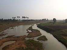
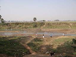
Though a moderate river, it has several names and many small tributaries and estuaries. It flows through Kandi subdivission and near Kalyanpur (Murshidabad) this river merged with Bhagirathi.[2] Its many backwaters and side channels also connect with the Bhagirathi. It is a hill stream with beds full of pebbles and yellow clay.[3]
Deucha barrage
A barrage at Deucha on the Dwarka river has a capacity of 1,700,000 cubic metres (1,400 acre⋅ft).[4] It is on the west side of NH 60, in Birbhum district .
See also
References
- ↑ O'Malley, L.S.S., ICS, Birbhum, Bengal District Gazetteers, p. 5, 1995 reprint, Government of West Bengal
- ↑ Anandabazar Patrika, www.anandabazar.com/district/nodia-murshidabbad/river-water-and-their-mingling-eyes-for-present-condition-1.418674
- ↑ "Murshidabad". District administration. Archived from the original on 2009-03-05. Retrieved 2009-08-19.
- ↑ "Poverty and Vulnerability" (PDF). Vulnerability due to flood. Human Development Report: Birbhum. Retrieved 2010-06-15.
Coordinates: 24°06′36″N 87°47′56″E / 24.1100943°N 87.7989578°E