Ovid, Colorado
| Ovid, Colorado | |
|---|---|
| Town | |
 Entering from the east on U.S. Route 138. | |
 Location of Ovid in Sedgwick County, Colorado. | |
| Coordinates: 40°57′36″N 102°23′20″W / 40.96000°N 102.38889°WCoordinates: 40°57′36″N 102°23′20″W / 40.96000°N 102.38889°W | |
| Country |
|
| State |
|
| County[1] | Sedgwick |
| Incorporated (town) | December 21, 1925[2] |
| Government | |
| • Type | Statutory Town[1] |
| Area[3] | |
| • Total | 0.16 sq mi (0.42 km2) |
| • Land | 0.16 sq mi (0.42 km2) |
| • Water | 0.00 sq mi (0.00 km2) |
| Elevation[4] | 3,533 ft (1,077 m) |
| Population (2010) | |
| • Total | 318 |
| • Estimate (2016)[5] | 315 |
| • Density | 1,944.44/sq mi (750.60/km2) |
| Time zone | UTC-7 (Mountain (MST)) |
| • Summer (DST) | UTC-6 (MDT) |
| ZIP code[6] | 80744 |
| Area code(s) | 970 |
| FIPS code | 08-56475 |
| GNIS feature ID | 0182695 |
| Website | Town of Ovid |
Ovid is a statutory town in Sedgwick County, Colorado, United States. The population was 330 at the 2000 census.
History
The town was named after Newton Ovid, a local resident.[7]
Geography
Ovid is located at 40°57′36″N 102°23′20″W / 40.96000°N 102.38889°W (40.959919, -102.388851).[8]
According to the United States Census Bureau, the town has a total area of 0.2 square miles (0.52 km2), all of it land.
Demographics
| Historical population | |||
|---|---|---|---|
| Census | Pop. | %± | |
| 1930 | 649 | — | |
| 1940 | 687 | 5.9% | |
| 1950 | 664 | −3.3% | |
| 1960 | 571 | −14.0% | |
| 1970 | 463 | −18.9% | |
| 1980 | 439 | −5.2% | |
| 1990 | 349 | −20.5% | |
| 2000 | 330 | −5.4% | |
| 2010 | 318 | −3.6% | |
| Est. 2016 | 315 | [5] | −0.9% |
| U.S. Decennial Census[9] | |||
As of the census[10] of 2000, there were 330 people, 151 households, and 101 families residing in the town. The population density was 2,070.3 inhabitants per square mile (796.3/km²). There were 178 housing units at an average density of 1,116.7 per square mile (429.5/km²). The racial makeup of the town was 87.27% White, 1.82% African American, 0.91% Native American, 0.91% Asian, 7.58% from other races, and 1.52% from two or more races. Hispanic or Latino of any race were 18.79% of the population.
There were 151 households out of which 19.9% had children under the age of 18 living with them, 55.6% were married couples living together, 10.6% had a female householder with no husband present, and 32.5% were non-families. 32.5% of all households were made up of individuals and 17.2% had someone living alone who was 65 years of age or older. The average household size was 2.19 and the average family size was 2.73.
In the town, the population was spread out with 19.7% under the age of 18, 5.2% from 18 to 24, 23.3% from 25 to 44, 27.0% from 45 to 64, and 24.8% who were 65 years of age or older. The median age was 46 years. For every 100 females, there were 102.5 males. For every 100 females age 18 and over, there were 93.4 males.
The median income for a household in the town was $24,205, and the median income for a family was $30,000. Males had a median income of $25,417 versus $16,042 for females. The per capita income for the town was $13,240. About 8.9% of families and 10.2% of the population were below the poverty line, including 16.1% of those under age 18 and 8.0% of those age 65 or over.
See also
References
- 1 2 "Active Colorado Municipalities". State of Colorado, Department of Local Affairs. Archived from the original on 2010-11-23. Retrieved 2007-09-01.
- ↑ "Colorado Municipal Incorporations". State of Colorado, Department of Personnel & Administration, Colorado State Archives. 2004-12-01. Retrieved 2007-09-02.
- ↑ "2016 U.S. Gazetteer Files". United States Census Bureau. Retrieved Jul 25, 2017.
- ↑ "US Board on Geographic Names". United States Geological Survey. 2007-10-25. Retrieved 2008-01-31.
- 1 2 "Population and Housing Unit Estimates". Retrieved June 9, 2017.
- ↑ "ZIP Code Lookup". United States Postal Service. Archived from the original (JavaScript/HTML) on November 23, 2010. Retrieved November 28, 2007.
- ↑ Dawson, John Frank. Place names in Colorado: why 700 communities were so named, 150 of Spanish or Indian origin. Denver, CO: The J. Frank Dawson Publishing Co. p. 39.
- ↑ "US Gazetteer files: 2010, 2000, and 1990". United States Census Bureau. 2011-02-12. Retrieved 2011-04-23.
- ↑ "Census of Population and Housing". Census.gov. Retrieved June 4, 2015.
- ↑ "American FactFinder". United States Census Bureau. Retrieved 2008-01-31.
External links
| Wikimedia Commons has media related to Ovid, Colorado. |
Municipalities and communities of Sedgwick County, Colorado, United States | ||
|---|---|---|
| Towns | 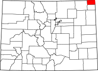 | |
