Ocean Township, Ocean County, New Jersey
| Ocean Township, New Jersey | |
|---|---|
| Township | |
| Township of Ocean | |
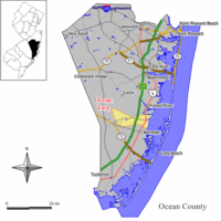 Map of Ocean Township in Ocean County. Inset: Location of Ocean County highlighted in the State of New Jersey. | |
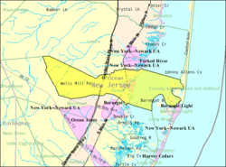 Census Bureau map of Ocean Township, Ocean County, New Jersey | |
| Coordinates: 39°47′07″N 74°13′04″W / 39.78527°N 74.217652°WCoordinates: 39°47′07″N 74°13′04″W / 39.78527°N 74.217652°W[1][2] | |
| Country |
|
| State |
|
| County | Ocean |
| Incorporated | April 13, 1876 |
| Government[3] | |
| • Type | Township |
| • Body | Township Committee |
| • Mayor | Christina "Tina" Wetter (R, term ends December 31, 2016)[4][5] |
| • Administrator | Diane B. Ambrosio[6] |
| • Municipal clerk | Diane B. Ambrosio[7] |
| Area[1] | |
| • Total | 32.044 sq mi (82.993 km2) |
| • Land | 20.555 sq mi (53.238 km2) |
| • Water | 11.489 sq mi (29.756 km2) 35.85% |
| Area rank |
77th of 566 in state 11th of 33 in county[1] |
| Elevation[8] | 59 ft (18 m) |
| Population (2010 Census)[9][10][11][12] | |
| • Total | 8,332 |
| • Estimate (2016)[13] | 9,013 |
| • Rank |
276th of 566 in state 14th of 33 in county[14] |
| • Density | 405.3/sq mi (156.5/km2) |
| • Density rank |
459th of 566 in state 30th of 33 in county[14] |
| Time zone | UTC-5 (Eastern (EST)) |
| • Summer (DST) | UTC-4 (Eastern (EDT)) |
| ZIP code | 08758 - Waretown[15] |
| Area code(s) | 609 exchanges: 242, 693, 971[16] |
| FIPS code | 3402954300[1][17][18] |
| GNIS feature ID | 0882071[1][19] |
| Website |
www |
Ocean Township is a township in Ocean County, New Jersey, United States. As of the 2010 United States Census, the township's population was 8,332,[10][11][12] reflecting an increase of 1,882 (+29.2%) from the 6,450 counted in the 2000 Census, which had in turn increased by 1,034 (+19.1%) from the 5,416 counted in the 1990 Census.[20] The 2010 population was the highest recorded in any decennial census.
History
Ocean Township was incorporated as a township by an act of the New Jersey Legislature on April 13, 1876, from portions of both Lacey Township and Union Township (now Barnegat Township). Portions of the township were taken to create Long Beach Township (March 23, 1899) and Island Beach (June 23, 1933; dissolved in 1965 and absorbed into Berkeley Township).[21] The township derives its name from its seaside location.[22]
All of Ocean Township is commonly referred to as "Waretown" by local residents.[23][24] The local custom is so widespread that it surprises some new residents that the official name is Ocean Township. Non-residents have been known to confuse Ocean Township with the Ocean Township of Monmouth County. There was a petition drive in 2006 to get a name change to Township of Waretown on the ballot but it failed to obtain enough signatures to get on the ballot.[25]
The name Waretown is derived from Abraham Weair (1683-1768), who came to the area with a colony of Rogerine Baptists (Quaker Baptists) circa 1737. When the colony left the area eleven years later, Weair, who had built a sawmill, stayed behind and became a prominent member of the community.[26]
During the War for Independence, British ships sailed into the nearby Barnegat Inlet in an attempt to protect their New York-bound supply vessels from attacks by local privateers sailing schooners and whaleboats. Another British objective was to destroy Newlin's salt works, a local supplier of a crucial commodity to the Revolutionary army, needed for food preservation and gunpowder manufacture.[27] A massacre of local patriots occurred in October, 1782, when Captain John Bacon, loyal to the British crown, led a surprise attack on Long Beach.[27]
During the War of 1812, the British returned to Barnegat Inlet to blockade the Jersey coast. Local privateers were caught and their schooners burned.[27]
In the 1700s and 1800s, Waretown was a shipbuilding center. Vessels such as barques, barkentines, sloops, schooners, whaleboats and sneakboxes were constructed of white cedar native to the area. During this period, many sea captains built stately homes on bay front lots.[27]
Around the turn of the twentieth century, Waretown fishermen sold oysters, clams and scallops to dealers such as the Fulton Fish Market in New York City. Other local industries included charcoal production, cranberry farming and "mossing," or gathering sphagnum moss for sale to florists. Local hunters supplied New York and Philadelphia with wildfowl via the railroads.[27] Waretown became known for its hunting and fishing grounds, and celebrities like Presidents Grover Cleveland and William McKinley, baseball great Babe Ruth, and Wild West entertainer Buffalo Bill Cody came to participate in these pursuits.[28]
During World War II, blimps cruised along the Jersey coast looking for German U-boats. Local fishermen reported periscopes of U-boats within 20 miles of the shore. As a precaution, troops were stationed in town at the Bayview Hotel on Barnegat Bay.[29] In 1960, the landmark structure burned to the ground, nearly 70 years after its opening in 1890.[30]
Geography
According to the United States Census Bureau, the township had a total area of 32.044 square miles (82.993 km2), including 20.555 square miles (53.238 km2) of land and 11.489 square miles (29.756 km2) of water (35.85%).[1][2]
Waretown (with a 2010 Census population of 1,569[31]) is an unincorporated community and census-designated place (CDP) located within Ocean Township.[32][33][34]
Other unincorporated communities, localities and place names located partially or completely within the township include Brookville, Wells Mills, Pebble Beach, Barnegat Beach, Holiday Beach, Sands Point Harbor, Skippers Cove, Bay Haven and Dogtown.[35]
The township borders the Ocean County municipalities of Barnegat Light, Barnegat Township, Berkeley Township, Lacey Township and Long Beach Township.[36]
The township is one of 56 South Jersey municipalities that are included within the New Jersey Pinelands National Reserve, a protected natural area of unique ecology covering 1,100,000 acres (450,000 ha), that has been classified as a United States Biosphere Reserve and established by Congress in 1978 as the nation's first National Reserve.[37] All of the township is included in either the state-designated Pinelands Area or the Pinelands National Reserve, which includes portions of Burlington County, along with areas in Atlantic, Camden, Cape May, Cumberland, Gloucester and Ocean counties.[38]
Demographics
| Historical population | |||
|---|---|---|---|
| Census | Pop. | %± | |
| 1880 | 484 | — | |
| 1890 | 482 | −0.4% | |
| 1900 | 436 | * | −9.5% |
| 1910 | 397 | −8.9% | |
| 1920 | 286 | −28.0% | |
| 1930 | 387 | 35.3% | |
| 1940 | 427 | * | 10.3% |
| 1950 | 520 | 21.8% | |
| 1960 | 921 | 77.1% | |
| 1970 | 2,222 | 141.3% | |
| 1980 | 3,731 | 67.9% | |
| 1990 | 5,416 | 45.2% | |
| 2000 | 6,450 | 19.1% | |
| 2010 | 8,332 | 29.2% | |
| Est. 2016 | 9,013 | [13][39] | 8.2% |
| Population sources: 1880-2000[40] 1880-1920[41] 1880-1890[42] 1890-1910[43] 1910-1930[44] 1930-1990[45] 2000[46][47] 2010[9][10][11][12] * = Lost territory in previous decade.[21] | |||
Census 2010
As of the 2010 United States Census, there were 8,332 people, 3,483 households, and 2,557 families residing in the township. The population density was 405.3 per square mile (156.5/km2). There were 4,291 housing units at an average density of 208.8 per square mile (80.6/km2). The racial makeup of the township was 96.75% (8,061) White, 0.59% (49) Black or African American, 0.13% (11) Native American, 1.08% (90) Asian, 0.01% (1) Pacific Islander, 0.46% (38) from other races, and 0.98% (82) from two or more races. Hispanic or Latino of any race were 2.76% (230) of the population.[10]
There were 3,483 households out of which 20.2% had children under the age of 18 living with them, 60.8% were married couples living together, 8.3% had a female householder with no husband present, and 26.6% were non-families. 20.9% of all households were made up of individuals, and 10.0% had someone living alone who was 65 years of age or older. The average household size was 2.39 and the average family size was 2.76.[10]
In the township, the population was spread out with 16.1% under the age of 18, 7.1% from 18 to 24, 20.0% from 25 to 44, 32.3% from 45 to 64, and 24.4% who were 65 years of age or older. The median age was 49.6 years. For every 100 females there were 98.7 males. For every 100 females ages 18 and older there were 96.7 males.[10]
The Census Bureau's 2006-2010 American Community Survey showed that (in 2010 inflation-adjusted dollars) median household income was $74,736 (with a margin of error of +/- $6,360) and the median family income was $75,815 (+/- $7,572). Males had a median income of $49,189 (+/- $9,450) versus $33,250 (+/- $10,524) for females. The per capita income for the borough was $36,895 (+/- $4,315). About 0.9% of families and 4.0% of the population were below the poverty line, including 4.2% of those under age 18 and 2.2% of those age 65 or over.[48]
Census 2000
As of the 2000 United States Census[17] there were 6,450 people, 2,446 households, and 1,743 families residing in the township. The population density was 310.1 people per square mile (119.7/km²). There were 2,981 housing units at an average density of 143.3 per square mile (55.3/km²). The racial makeup of the township was 97.33% White, 0.74% African American, 0.16% Native American, 0.42% Asian, 0.03% Pacific Islander, 0.36% from other races, and 0.96% from two or more races. Hispanic or Latino of any race were 3.10% of the population.[46][47]
There were 2,446 households out of which 33.4% had children under the age of 18 living with them, 57.5% were married couples living together, 9.6% had a female householder with no husband present, and 28.7% were non-families. 23.3% of all households were made up of individuals and 10.1% had someone living alone who was 65 years of age or older. The average household size was 2.61 and the average family size was 3.08.[46][47]
In the township the population was spread out with 25.5% under the age of 18, 6.8% from 18 to 24, 30.3% from 25 to 44, 23.7% from 45 to 64, and 13.8% who were 65 years of age or older. The median age was 38 years. For every 100 females, there were 98.5 males. For every 100 females age 18 and over, there were 97.3 males.[46][47]
The median income for a household in the township was $46,461, and the median income for a family was $55,379. Males had a median income of $39,149 versus $32,188 for females. The per capita income for the township was $22,830. About 5.6% of families and 7.8% of the population were below the poverty line, including 10.1% of those under age 18 and 4.6% of those age 65 or over.[46][47]
Parks and Recreation
Park facilities in Ocean Township include:[49]
- Waretown Lake and Recreation Area, 182 Wells Mill Road, includes a swimming lake, tennis courts, children's playset, picnic tables and a covered pavilion.
- Tuomey Park, 230 11th Street, includes a baseball field, basketball courts, horseshoe pits, children's playset and picnic tables.
- Crystal Bay Peninsula Park, end of Tuscarora Avenue, includes benches and picnic tables.
- Waretown Municipal Dock, end of Bryant Road, includes a fishing pier.
- Sands Point Park/Boat Ramp, 49 Dock Avenue, includes a fishing pier, fish cleaning facility, boat launch, trailer parking, tennis courts, children's playset and picnic tables.
- Wells Mills County Park, 905 Wells Mill Road, is the largest county park, comprising over 900 acres of Pinelands forest managed by the Ocean County Department of Parks and Recreation. Included are 16 miles of marked trails for hiking and biking, a freshwater lake for fishing and boating, rental canoes in season, a picnic area, playground, and the Wells Mills Nature Center with the Elizabeth Meirs Morgan Observation Deck. In the late 1800s the Estlow family built two adjacent sawmills on the property, giving the name of the park its plural nature. The first person to dam the Oyster Creek and build a sawmill in this locale was James Wells in the late 1700s.[50]
- Barnegat Branch Trail is an Ocean County rail trail that runs through Ocean Township along an abandoned rail corridor of the Barnegat Branch Division of the Central Railroad of New Jersey. When completed, the trail will extend 15.6 miles from Barnegat to Toms River. Seven continuous miles of the trail are open from Barnegat to Lacey Township, plus several shorter segments.[51]
Government
Local government
Ocean Township is governed under the Township form of government. The three-member Township Committee is elected directly by the voters at-large in partisan elections to serve three-year terms of office on a staggered basis, with one seat coming up for election each year as part of the November general election in a three-year cycle.[3][52] At an annual reorganization meeting, the Township Committee selects one of its members to serve as Mayor.[4][53]
As of 2016, Township Committee members are Mayor Dennis F. Tredy (R, term on committee and as mayor ends December 31, 2016), Deputy Mayor Christina "Tina" Wetter (R, term on committee ends 2017; term as deputy mayor ends 2016) and Daniel Collamer (R, 2018).[4][54][55][56][57][58][59]
On July 23, 2009, local Republican party member and former Mayor Daniel Van Pelt was arrested by the Federal Bureau of Investigation as part of a statewide money laundering investigation. In May 2010, Van Pelt was convicted on federal corruption charges, and had been scheduled to be sentenced to federal prison on November 4, 2010.[60]
Federal, state and county representation
Ocean Township is located in the 3rd Congressional District[61] and is part of New Jersey's 9th state legislative district.[11][62][63]
New Jersey's 3rd Congressional District is represented by Tom MacArthur (R, Toms River).[64] New Jersey is represented in the United States Senate by Democrats Cory Booker (Newark, term ends 2021)[65] and Bob Menendez (Paramus, 2019).[66][67]
For the 2018–2019 session (Senate, General Assembly), the 9th Legislative District of the New Jersey Legislature is represented in the State Senate by Christopher J. Connors (R, Lacey Township) and in the General Assembly by DiAnne Gove (R, Long Beach Township) and Brian E. Rumpf (R, Little Egg Harbor Township).[68][69] The Governor of New Jersey is Phil Murphy (D, Middletown Township).[70] The Lieutenant Governor of New Jersey is Sheila Oliver (D, East Orange).[71]
Ocean County is governed by a Board of Chosen Freeholders consisting of five members, elected on an at-large basis in partisan elections and serving staggered three-year terms of office, with either one or two seats coming up for election each year as part of the November general election.[72] At an annual reorganization held in the beginning of January, the board chooses a Director and a Deputy Director from among its members. As of 2015, Ocean County's Freeholders (with party affiliation, term-end year, residence and department directorship listed in parentheses) are Freeholder Director John C. Bartlett, Jr. (R, term ends December 31, 2015, Pine Beach; Finance, Parks and Recreation),[73] Freeholder Deputy Director Gerry P. Little (R, 2015, Surf City; Human Services),[74] John P. Kelly (R, 2016, Eagleswood Township; Law and Public Safety),[75] James F. Lacey (R, 2016, Brick Township; Transportation)[76] and Joseph H. Vicari (R, 2017, Toms River; Senior Services and County Operations).[77][78][79] Constitutional officers elected on a countywide basis are County Clerk Scott M. Colabella (R, 2015, Barnegat Light),[80][81] Sheriff Michael Mastronardy (R, 2016; Toms River)[82] and Surrogate Jeffrey Moran (R, 2018, Beachwood).[83][84]
Politics
As of March 23, 2011, there were a total of 6,245 registered voters in Ocean Township, of which 1,017 (16.3%) were registered as Democrats, 2,095 (33.5%) were registered as Republicans and 3,128 (50.1%) were registered as Unaffiliated. There were 5 voters registered to other parties.[85] Among the township's 2010 Census population, 75.0% (vs. 63.2% in Ocean County) were registered to vote, including 89.4% of those ages 18 and over (vs. 82.6% countywide).[85][86]
In the 2012 presidential election, Republican Mitt Romney received 62.4% of the vote (2,881 cast), ahead of Democrat Barack Obama with 36.7% (1,693 votes), and other candidates with 0.9% (42 votes), among the 4,647 ballots cast by the township's 6,583 registered voters (31 ballots were spoiled), for a turnout of 70.6%.[87][88] In the 2008 presidential election, Republican John McCain received 60.0% of the vote (2,654 cast), ahead of Democrat Barack Obama with 37.6% (1,665 votes) and other candidates with 1.4% (64 votes), among the 4,423 ballots cast by the township's 5,996 registered voters, for a turnout of 73.8%.[89] In the 2004 presidential election, Republican George W. Bush received 53.4% of the vote (506 ballots cast), outpolling Democrat John Kerry with 44.9% (425 votes) and other candidates with 0.7% (9 votes), among the 947 ballots cast by the township's 1,308 registered voters, for a turnout percentage of 72.4.[90]
In the 2013 gubernatorial election, Republican Chris Christie received 79.2% of the vote (2,577 cast), ahead of Democrat Barbara Buono with 19.4% (631 votes), and other candidates with 1.4% (45 votes), among the 3,307 ballots cast by the township's 6,555 registered voters (54 ballots were spoiled), for a turnout of 50.5%.[91][92] In the 2009 gubernatorial election, Republican Chris Christie received 67.5% of the vote (2,274 ballots cast), ahead of Democrat Jon Corzine with 25.0% (841 votes), Independent Chris Daggett with 5.3% (178 votes) and other candidates with 1.1% (38 votes), among the 3,370 ballots cast by the township's 6,082 registered voters, yielding a 55.4% turnout.[93]
Education
For pre-kindergarten through sixth grade, public school students attend the Ocean Township School District. As of the 2014-15 school year, the district and its two schools had an enrollment of 982 students and 50.6 classroom teachers (on an FTE basis), for a student–teacher ratio of 19.4:1.[94] Schools in the district (with 2014-15 enrollment data from the National Center for Education Statistics[95]) are Waretown Elementary School[96] with an enrollment of 304 students in pre-K to 3rd grade and Frederic A. Priff Elementary School[97] with 240 students in grades 4 - 6.[98][99]
For seventh through twelfth grades, public school students attend the schools of the Southern Regional School District, which serves the five municipalities in the Long Beach Island Consolidated School District — Barnegat Light, Harvey Cedars, Long Beach Township, Ship Bottom and Surf City — along with students from Beach Haven and Stafford Township, together with the students from Ocean Township who attend as part of a sending/receiving relationship.[100] Schools in the district (with 2014-15 enrollment data from the National Center for Education Statistics[101]) are Southern Regional Middle School[102] (grades 7 and 8; 937 students) and Southern Regional High School[103] (grades 9 – 12; 2,064 students).[104] Both schools are in the Manahawkin section of Stafford Township.
Transportation
Roads and highways
As of May 2010, the township had a total of 58.12 miles (93.54 km) of roadways, of which 36.64 miles (58.97 km) were maintained by the municipality, 16.35 miles (26.31 km) by Ocean County and 2.95 miles (4.75 km) by the New Jersey Department of Transportation and 2.18 miles (3.51 km) by the New Jersey Turnpike Authority.[105]
The Garden State Parkway (accessible via Exit 69) and U.S. Route 9 both pass through the township, as does County Route 532. The Parkway connects Barnegat Township in the south to Lacey Township in the north[106] and includes interchange 69 for CR 532, which is signed for Waretown / Forked River.[107]
Public transportation
NJ Transit provides bus service to and from Atlantic City on the 559 bus route.[108]
Ocean Ride local service is provided on the Waretown Shoppers Loop route.[109][110][111]
Points of Interest
- Albert Music Hall, 131 Wells Mill Road (CR 532). Sometimes called the "Grand Ol' Opry of the Pinelands", Albert Music Hall offers Saturday night concerts of country, bluegrass and folk music by bands from the tri-state area.[112] The venue had its origins in the 1950s when Joseph and George Albert began hosting musical gatherings at the "Home Place," their deer lodge cabin in the Brookville section of Waretown. In 1975, the Pinelands Cultural Society was incorporated to construct a building for the preservation and promotion of the cultural history and activities of the Pinelands, including the music. Since its dedication in 1997, Albert Music Hall has hosted over 330,000 visitors. In 2000, Albert Music Hall was inducted into the American Folklore Center, Local Legacies Collection Archive in the Library of Congress, Washington, D.C.[113]
- Lighthouse Center for Natural Resource Education, 7th Street and Navaho Drive. Located on 194 acres of coastal habitats adjacent to Barnegat Bay, the Lighthouse Center for Natural Resource Education has a mission of ecological leadership through education, research and interpretation. Facilities include the "Experience Barnegat Bay" trail with eight learning stations, a 250-foot pier into Barnegat Bay, a marine station, boat house, cabins, dormitories, a lodge, dining hall, computer lab and other recreational facilities. The site is largely handicapped accessible. A foundation operates the 501c3 facility under a license agreement with the New Jersey Division of Fish and Wildlife.[114][115]
- The Little Red School House and Museum, 182 Wells Mill Road (CR 532). In use between 1875 and 1958, the Little Red School House was replicated on Wells Mill Road near Waretown Lake and established as a museum.[116] The site serves as the meeting place for the Waretown Historical Society and is open to the public 1-3 p.m. on Fridays in July and August.[117]
Notable people
People who were born in, residents of, or otherwise closely associated with Ocean Township include:
- Kenneth G. Miller (born 1956), geologist at Rutgers University who has written and lectured on global warming and sea level change.[118]
- George E. Smith (born 1930), winner of the 2009 Nobel Prize winner in Physics for his work on the charge-coupled device.[119]
- Daniel Van Pelt (born 1964), politician who served as Ocean Township's mayor and in the New Jersey General Assembly from 2008 to 2009, when he resigned after being arrested in connection with Operation Bid Rig on federal corruption charges for allegedly accepting a $10,000 bribe.[120]
- Sung J. Woo (born 1971), author.[121]
References
- 1 2 3 4 5 6 2010 Census Gazetteer Files: New Jersey County Subdivisions, United States Census Bureau. Accessed May 21, 2015.
- 1 2 US Gazetteer files: 2010, 2000, and 1990, United States Census Bureau. Accessed September 4, 2014.
- 1 2 2005 New Jersey Legislative District Data Book, Rutgers University Edward J. Bloustein School of Planning and Public Policy, April 2006, p. 49.
- 1 2 3 Township Committee, Township of Ocean. Accessed July 27, 2016.
- ↑ 2017 New Jersey Mayors Directory, New Jersey Department of Community Affairs. Accessed May 30, 2017. As of date accessed, Dennis F. Tredy is incorrectly listed as mayor.
- ↑ Administration, Township of Ocean. Accessed July 27, 2016.
- ↑ Township Clerk, Township of Ocean. Accessed July 27, 2016.
- ↑ U.S. Geological Survey Geographic Names Information System: Township of Ocean, Geographic Names Information System. Accessed March 8, 2013.
- 1 2 "DataUniverse: 2010 Census Populations - Ocean County, Asbury Park Press. Accessed December 30, 2012.
- 1 2 3 4 5 6 DP-1 - Profile of General Population and Housing Characteristics: 2010 for Ocean township, Ocean County, New Jersey, United States Census Bureau. Accessed December 30, 2012.
- 1 2 3 4 Municipalities Grouped by 2011-2020 Legislative Districts, New Jersey Department of State, p. 5. Accessed January 6, 2013.
- 1 2 3 Profile of General Demographic Characteristics: 2010 for Ocean township, New Jersey Department of Labor and Workforce Development. Accessed December 30, 2012.
- 1 2 PEPANNRES - Annual Estimates of the Resident Population: April 1, 2010 to July 1, 2016 - 2016 Population Estimates for New Jersey municipalities, United States Census Bureau. Accessed June 16, 2017.
- 1 2 GCT-PH1 Population, Housing Units, Area, and Density: 2010 - State -- County Subdivision from the 2010 Census Summary File 1 for New Jersey, United States Census Bureau. Accessed December 30, 2012.
- ↑ Look Up a ZIP Code for Waretown, NJ, United States Postal Service. Accessed December 30, 2012.
- ↑ Area Code Lookup - NPA NXX for Ocean, NJ, Area-Codes.com. Accessed September 8, 2014.
- 1 2 American FactFinder, United States Census Bureau. Accessed September 4, 2014.
- ↑ A Cure for the Common Codes: New Jersey, Missouri Census Data Center. Accessed October 29, 2012.
- ↑ US Board on Geographic Names, United States Geological Survey. Accessed September 4, 2014.
- ↑ Table 7. Population for the Counties and Municipalities in New Jersey: 1990, 2000 and 2010, New Jersey Department of Labor and Workforce Development, February 2011. Accessed December 30, 2012.
- 1 2 Snyder, John P. The Story of New Jersey's Civil Boundaries: 1606-1968, Bureau of Geology and Topography; Trenton, New Jersey; 1969. p. 204. Accessed October 23, 2012.
- ↑ Hutchinson, Viola L. The Origin of New Jersey Place Names, New Jersey Public Library Commission, May 1945. Accessed September 13, 2015.
- ↑ Riley, Michael. "WARETOWN It's all in the name", Asbury Park Press, May 6, 2005. Accessed December 30, 2012. "OFFICIALLY, the name of this community of 7,400 residents is Ocean Township.... People who arrive there from Exit 69 of the Garden State Parkway know the place as Waretown, which is what the original settlers called the village when they named it after their leader, whose name, incidentally, was Abraham Waier, not Abraham Ware."
- ↑ Staff. "Ocean mayor visits other Ocean". Asbury Park Press. November 21, 2006.
- ↑ "Waretown activist plans to try again.", Ocean County Observer, August 22, 2006.
- ↑ Fischer, William H. (1899). Biographical Cyclopaedia of Ocean County, New Jersey. Philadelphia, Pennsylvania: A. D. Smith & Company. pp. 31–32.
- 1 2 3 4 5 "Welcome to Ocean Township". Barnegat Branch Rail Trail Signs. Ocean County Cultural and Heritage Commission. Missing or empty
|url=(help);|access-date=requires|url=(help) - ↑ Township of Ocean 2017 Calendar. Waretown, New Jersey: Township of Ocean in cooperation with Waretown Historical Society. 2017.
- ↑ Township of Ocean 2016 Calendar. Waretown, New Jersey: Township of Ocean in cooperation with Waretown Historical Society. 2016.
- ↑ Township of Ocean 2017 Calendar. Waretown, New Jersey: Township of Ocean in cooperation with Waretown Historical Society. 2017.
- ↑ DP-1 - Profile of General Population and Housing Characteristics: 2010 Demographic Profile Data for Waretown CDP, New Jersey, United States Census Bureau. Accessed December 30, 2012.
- ↑ GCT-PH1 - Population, Housing Units, Area, and Density: 2010 - County -- County Subdivision and Place from the 2010 Census Summary File 1 for Ocean County, New Jersey, United States Census Bureau. Accessed December 30, 2012.
- ↑ 2006-2010 American Community Survey Geography for New Jersey, United States Census Bureau. Accessed December 30, 2012.
- ↑ New Jersey: 2010 - Population and Housing Unit Counts - 2010 Census of Population and Housing (CPH-2-32), United States Census Bureau, August 2012. Accessed December 30, 2012.
- ↑ Barnegat Branch Trail, Trail Signs, Welcome to Ocean Township. Accessed May 31, 2018.
- ↑ Areas touching Ocean Township, MapIt. Accessed August 11, 2015.
- ↑ The Pinelands National Reserve, New Jersey Pinelands Commission. Accessed November 27, 2013.
- ↑ Pinelands Municipalities, New Jersey Pinelands Commission, April 2003. Accessed November 27, 2013.
- ↑ Census Estimates for New Jersey April 1, 2010 to July 1, 2016, United States Census Bureau. Accessed June 16, 2017.
- ↑ Barnett, Bob. Population Data for Ocean County Municipalities, 1850 - 2000, WestJersey.org, January 6, 2011. Accessed December 25, 2012.
- ↑ Compendium of censuses 1726-1905: together with the tabulated returns of 1905, New Jersey Department of State, 1906. Accessed July 29, 2013.
- ↑ Porter, Robert Percival. Preliminary Results as Contained in the Eleventh Census Bulletins: Volume III - 51 to 75, p. 99. United States Census Bureau, 1890. Accessed December 25, 2012.
- ↑ Thirteenth Census of the United States, 1910: Population by Counties and Minor Civil Divisions, 1910, 1900, 1890, United States Census Bureau, p. 338. Accessed December 25, 2012.
- ↑ Fifteenth Census of the United States : 1930 - Population Volume I, United States Census Bureau, p. 718. Accessed December 25, 2012.
- ↑ Table 6. New Jersey Resident Population by Municipality: 1930 - 1990, New Jersey Department of Labor and Workforce Development. Accessed June 28, 2015.
- 1 2 3 4 5 Census 2000 Profiles of Demographic / Social / Economic / Housing Characteristics for Ocean township, Ocean County, New Jersey, United States Census Bureau. Accessed December 30, 2012.
- 1 2 3 4 5 DP-1: Profile of General Demographic Characteristics: 2000 - Census 2000 Summary File 1 (SF 1) 100-Percent Data for Ocean township, Ocean County, New Jersey, United States Census Bureau. Accessed December 30, 2012.
- ↑ DP03: Selected Economic Characteristics from the 2006-2010 American Community Survey 5-Year Estimates for Ocean township, Ocean County, New Jersey, United States Census Bureau. Accessed December 30, 2012.
- ↑ "Parks and Facilities". Township of Ocean, Ocean County, New Jersey. Retrieved May 31, 2018.
- ↑ "Trail Map, p. 2" (PDF). Wells Mills County Park Trail Map, Ocean County, New Jersey. Retrieved June 1, 2018.
- ↑ "Barnegat Branch Trail". Ocean County Department of Planning, Ocean County, New Jersey. Retrieved June 1, 2018.
- ↑ "Forms of Municipal Government in New Jersey", p. 7. Rutgers University Center for Government Studies. Accessed June 3, 2015.
- ↑ Form of Government, Township of Ocean. Accessed July 27, 2016.
- ↑ 2016 Municipal User Friendly Budget, Township of Ocean. Accessed July 27, 2016.
- ↑ 2016 Ocean County & Municipal Elected Officials, Ocean County, New Jersey Clerk, updated February 22, 2016. Accessed July 26, 2016.
- ↑ Township of Ocean, Ocean County, New Jersey. Accessed July 26, 2016.
- ↑ 2015 General Election Official Results November 3, 2015, Ocean County, New Jersey Clerk, updated November 10, 2015. Accessed July 26, 2016.
- ↑ General Election November 4, 2014, Ocean County, New Jersey Clerk, updated November 12, 2014. Accessed July 26, 2016.
- ↑ General Election November 5, 2013, Ocean County, New Jersey Clerk, updated November 14, 2013. Accessed July 26, 2016.
- ↑ Spoto, MaryAnn. "Ex-N.J. Assemblyman Daniel Van Pelt is convicted of taking $10K bribe", The Star-Ledger, May 19, 2010. Accessed July 29, 2013. "Van Pelt, a former Ocean Township mayor and committeeman, brings to 19 the number of people who have been convicted or pleaded guilty in the investigation."
- ↑ Plan Components Report, New Jersey Redistricting Commission, December 23, 2011. Accessed January 6, 2013.
- ↑ 2017 New Jersey Citizen's Guide to Government, p. 62, New Jersey League of Women Voters. Accessed May 30, 2017.
- ↑ Districts by Number for 2011-2020, New Jersey Legislature. Accessed January 6, 2013.
- ↑ Tom MacArthur Biography, United States House of Representatives. Accessed January 7, 2015.
- ↑ About Cory Booker, United States Senate. Accessed January 26, 2015. "He now owns a home and lives in Newark's Central Ward community."
- ↑ Biography of Bob Menendez, United States Senate, January 26, 2015. "He currently lives in Paramus and has two children, Alicia and Robert."
- ↑ Senators of the 114th Congress from New Jersey. United States Senate. Accessed January 26, 2015. "Booker, Cory A. - (D - NJ) Class II; Menendez, Robert - (D - NJ) Class I"
- ↑ Legislative Roster 2018-2019 Session, New Jersey Legislature. Accessed January 22, 2018.
- ↑ District 9 Legislators, New Jersey Legislature. Accessed January 22, 2018.
- ↑ Governor Phil Murphy, State of New Jersey. Accessed January 16, 2018.
- ↑ Lieutenant Governor Oliver, State of New Jersey. Accessed January 16, 2018. "Assemblywoman Oliver has resided in the City of East Orange for over 40 years."
- ↑ Freeholder History, Ocean County, New Jersey. Accessed January 25, 2015.
- ↑ Freeholder Director John C. Bartlett Jr., Ocean County, New Jersey. Accessed January 25, 2015.
- ↑ Freeholder Deputy Director Gerry P. Little, Ocean County, New Jersey. Accessed January 25, 2015.
- ↑ Freeholder John P. Kelly, Ocean County, New Jersey. Accessed January 25, 2015.
- ↑ Freeholder James F. Lacey, Ocean County, New Jersey. Accessed January 25, 2015.
- ↑ Freeholder Joseph H. Vicari, Ocean County, New Jersey. Accessed January 25, 2015.
- ↑ Board of Chosen Freeholders, Ocean County, New Jersey. Accessed January 25, 2015.
- ↑ County Directory, Ocean County, New Jersey. Accessed January 25, 2015.
- ↑ County Clerk, Ocean County, New Jersey. Accessed January 25, 2015.
- ↑ Biography of Scott M. Colabella, Office of the County Clerk. Accessed January 25, 2015.
- ↑ Sheriff Michael Mastronardy, Ocean County Sheriff's Office. Accessed January 25, 2015.
- ↑ County Surrogate Jeffrey W. Moran, Ocean County, New Jersey. Accessed January 25, 2015.
- ↑ 2015 Elected Officials of Ocean County, Ocean County, New Jersey. Accessed January 25, 2015.
- 1 2 Voter Registration Summary - Ocean, New Jersey Department of State Division of Elections, March 23, 2011. Accessed December 30, 2012.
- ↑ GCT-P7: Selected Age Groups: 2010 - State -- County Subdivision; 2010 Census Summary File 1 for New Jersey, United States Census Bureau. Accessed December 30, 2012.
- ↑ "Presidential General Election Results - November 6, 2012 - Ocean County" (PDF). New Jersey Department of Elections. March 15, 2013. Retrieved December 24, 2014.
- ↑ "Number of Registered Voters and Ballots Cast - November 6, 2012 - General Election Results - Ocean County" (PDF). New Jersey Department of Elections. March 15, 2013. Retrieved December 24, 2014.
- ↑ 2008 Presidential General Election Results: Ocean County, New Jersey Department of State Division of Elections, December 23, 2008. Accessed December 30, 2012.
- ↑ 2004 Presidential Election: Ocean County, New Jersey Department of State Division of Elections, December 13, 2004. Accessed December 30, 2012.
- ↑ "Governor - Ocean County" (PDF). New Jersey Department of Elections. January 29, 2014. Retrieved December 24, 2014.
- ↑ "Number of Registered Voters and Ballots Cast - November 5, 2013 - General Election Results - Ocean County" (PDF). New Jersey Department of Elections. January 29, 2014. Retrieved December 24, 2014.
- ↑ 2009 Governor: Ocean County, New Jersey Department of State Division of Elections, December 31, 2009. Accessed December 30, 2012.
- ↑ District information for Ocean Township School District, National Center for Education Statistics. Accessed December 7, 2016.
- ↑ School Data for the Ocean Township School District, National Center for Education Statistics. Accessed December 7, 2016.
- ↑ Waretown Elementary School, Ocean Township School District. Accessed January 31, 2017.
- ↑ Frederic A. Priff Elementary School, Ocean Township School District. Accessed January 31, 2017.
- ↑ Schools, Ocean Township School District. Accessed January 31, 2017.
- ↑ New Jersey School Directory for the Ocean Township School District, New Jersey Department of Education. December 29, 2016.
- ↑ Southern Regional High School 2015 Report Card Narrative, New Jersey Department of Education. Accessed June 2, 2016. "Located in Manahawkin, the Southern Regional School District draws from the constituent districts of Long Beach Township, Beach Haven, Surf City, Ship Bottom, Barnegat Light, Harvey Cedars and Stafford Township, as well as the tuition sending district of Ocean Township (Waretown).
- ↑ School Data for the Southern Regional School District, National Center for Education Statistics. Accessed December 7, 2016.
- ↑ Southern Regional Middle School, Southern Regional School District. Accessed January 31, 2017.
- ↑ Southern Regional High School, Southern Regional School District. Accessed January 31, 2017.
- ↑ New Jersey School Directory for the Southern Regional School District, New Jersey Department of Education. Accessed December 29, 2016.
- ↑ Ocean County Mileage by Municipality and Jurisdiction, New Jersey Department of Transportation, May 2010. Accessed July 18, 2014.
- ↑ Garden State Parkway Straight Line Diagram, New Jersey Department of Transportation, January 1997. Accessed September 8, 2014.
- ↑ Travel Resources: Interchanges, Service Areas & Commuter Lots, New Jersey Turnpike Authority. Accessed September 8, 2014.
- ↑ Ocean County Bus / Rail Connections, NJ Transit, backed up by the Internet Archive as of July 26, 2010. Accessed December 30, 2012.
- ↑ Ocean County Bus Service, Greater Mercer TMA. Accessed August 11, 2015.
- ↑ Ocean Ride Rider's Guide, Ocean County, New Jersey. Accessed August 11, 2015.
- ↑ Ocean County Transit Guide, Ocean County, New Jersey. Accessed August 11, 2015.
- ↑ O'Reilly, David (December 23, 2016). "'Grand Ol' Opry' of the Pinelands marks 20 years". The Inquirer, Philadelphia, Pennsylvania. Retrieved June 2, 2018.
- ↑ "PCS/Albert Music Hall Chronological Fact Sheet". Albert Music Hall. Retrieved May 31, 2018.
- ↑ "About Us". Lighthouse Center for Natural Resource Education. Retrieved June 1, 2018.
- ↑ Reddington, Linda (May 2017). "Places of Interest". Welcome to Our Neck of the Woods: Your Guide to Barnegat, Lacey, Stafford and Waretown, The Times-Beacon Newspapers: 35.
- ↑ Reddington, Linda (May 2017). "Places of Interest". Welcome to Our Neck of the Woods: Your Guide to Barnegat, Lacey, Stafford and Waretown, The Times-Beacon Newspapers: 38.
- ↑ "Historical Society". Township of Ocean, Ocean County, New Jersey. Retrieved June 1, 2018.
- ↑ Kenneth G. Miller, Rutgers University Department of Earth and Planetary Sciences. Accessed November 27, 2013. "A resident of Pennington, NJ, Ken grew up in Medford, NJ in the heart of the pine barrens and still owns a house in Waretown, NJ, the home of the sounds of the NJ pines, where he watches the inexorable rise in sea level from his deck 16 ft above Barnegat Bay."
- ↑ Staff. "NJ man's discovery lands Nobel Prize", WPVI-TV, October 6, 2009. Accessed November 27, 2013. "George E. Smith, 79, holds a display with a photograph of the first video telephone and some early CCD chips at his home in Waretown, N.J., Tuesday, Oct. 6, 2009, after it was announced that he had won the Nobel Prize in physics."
- ↑ Spoto, MaryAnn. "Corruption trial opens for former N.J. Assemblyman Daniel Van Pelt", NJ Advance Media for NJ.com, May 5, 2010. Accessed September 13, 2015. "Van Pelt, a former mayor and committeeman of Ocean Township in Ocean County, is accused of accepting a $10,000 bribe from Dwek, who was posing as fictitious developer David Esenbach, to speed along the permitting process for a development project in Van Pelt's Shore community."
- ↑ Galante, Meredith. "South Korean man draws on his experience of immigrating to Jersey as basis for award-winning book and his coming to terms with his cultural differences", The Star-Ledger, January 7, 2011. Accessed September 13, 2015. "Woo could only count to 10 in English before arriving. To him, life on West Park Avenue in Ocean Township looked a lot like where he lived in Doug Kyo Doug neighborhood about 20 miles from downtown Seoul: the suburbs."
External links
- Ocean Township website
- Ocean Township School District
- Ocean Township School District's 2015–16 School Report Card from the New Jersey Department of Education
- School Data for the Ocean Township School District, National Center for Education Statistics
- Southern Regional School District
- Waretown Branch of Ocean County Library
Places adjacent to Ocean Township, Ocean County, New Jersey | ||||||||||
|---|---|---|---|---|---|---|---|---|---|---|
| ||||||||||