Herbertsville, New Jersey
| Herbertsville, New Jersey | |
|---|---|
| Unincorporated community | |
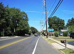 Along Herbertsville Road near the Lanes Mill Road intersection | |
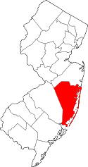
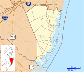 Herbertsville Herbertsville's location in Ocean County (Inset: Ocean County in New Jersey)  Herbertsville Herbertsville (New Jersey)  Herbertsville Herbertsville (the US) | |
| Coordinates: 40°06′43″N 74°06′33″W / 40.11194°N 74.10917°WCoordinates: 40°06′43″N 74°06′33″W / 40.11194°N 74.10917°W | |
| Country |
|
| State |
|
| County | Ocean |
| Township | Brick |
| Elevation | 52 ft (16 m) |
| GNIS feature ID | 877054[1] |
Herbertsville is an unincorporated community located within Brick Township in Ocean County, New Jersey, United States.[2] The suburban community is located in the northern reaches of the township centered about the intersection of Herbertsville Road (County Route 549 Spur) and Lanes Mill Road.[3]
References
- ↑ U.S. Geological Survey Geographic Names Information System: Herbertsville, New Jersey
- ↑ Locality Search, State of New Jersey. Accessed March 14, 2015.
- ↑ Google (August 31, 2016). "Aerial view of Herbertsville" (Map). Google Maps. Google. Retrieved August 31, 2016.
This article is issued from
Wikipedia.
The text is licensed under Creative Commons - Attribution - Sharealike.
Additional terms may apply for the media files.