Bullock, New Jersey
| Bullock, New Jersey | |
|---|---|
| Unincorporated community | |
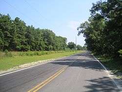 Along Pasadena Road | |
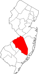
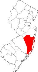
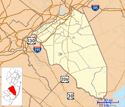 Bullock Location of Bullock in Burlington County (Inset: Location of county within the state of New Jersey)  Bullock Bullock (New Jersey)  Bullock Bullock (the US) | |
| Coordinates: 39°52′54″N 74°26′59″W / 39.88167°N 74.44972°WCoordinates: 39°52′54″N 74°26′59″W / 39.88167°N 74.44972°W | |
| Country |
|
| State |
|
| County | Burlington, Ocean |
| Township | Woodland, Manchester |
| Elevation[1] | 144 ft (44 m) |
| Time zone | UTC-5 (Eastern (EST)) |
| • Summer (DST) | UTC-4 (EDT) |
| GNIS feature ID | 875023[1] |
Bullock is an unincorporated community that straddles Woodland Township, Burlington County and Manchester Township, Ocean County in the middle of the New Jersey Pine Barrens.[2] Much of the area surrounding Bullock is a part of the Brendan T. Byrne State Forest though there are some clearings for small houses along Savoy Boulevard in Woodland Township and Pasadena Road in Manchester Township. The settlement is located where these two roads, the New Jersey Southern Railroad, and the Keith line (separating the two counties) converge.[2]
References
- 1 2 "Bullock". Geographic Names Information System. United States Geological Survey.
- 1 2 Google (March 14, 2015). "Bullock, Woodland Township, Burlington County, New Jersey 08015" (Map). Google Maps. Google. Retrieved March 14, 2015.
This article is issued from
Wikipedia.
The text is licensed under Creative Commons - Attribution - Sharealike.
Additional terms may apply for the media files.