Harmony, Ocean County, New Jersey
| Harmony, New Jersey | |
|---|---|
| Unincorporated community | |
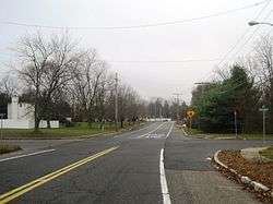 Looking south on Harmony Road approaching Hyson Road | |
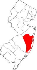
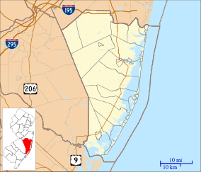 Harmony, New Jersey Harmony's location in Ocean County (Inset: Ocean County in New Jersey)  Harmony, New Jersey Harmony, New Jersey (New Jersey)  Harmony, New Jersey Harmony, New Jersey (the US) | |
| Coordinates: 40°09′07″N 74°18′03″W / 40.15194°N 74.30083°WCoordinates: 40°09′07″N 74°18′03″W / 40.15194°N 74.30083°W | |
| Country |
|
| State |
|
| County | Ocean |
| Township | Jackson |
| Elevation | 157 ft (48 m) |
| ZIP code | 08527 |
| GNIS feature ID | 0876955[1] |
Harmony is an unincorporated community located within Jackson Township, in Ocean County, New Jersey, United States.[2]
Harmony is located near exit 22 on Interstate 195 and is also located near County Route 526 (County Line Road). Originally the area was largely rural with a mix of farms, forest, and some houses along arterial road but by the late 1990s/early 2000s, housing developments were built and the area is now mostly suburban.[3][4]
References
- ↑ "Harmony". Geographic Names Information System. United States Geological Survey. Retrieved 2012-09-23.
- ↑ Locality Search, State of New Jersey. Accessed June 9, 2016.
- ↑ "Aerial view of Harmony". Historic Aerials. 1995. Retrieved December 30, 2015.
- ↑ Google (December 30, 2015). "Aerial view of Harmony" (Map). Google Maps. Google. Retrieved December 30, 2015.
This article is issued from
Wikipedia.
The text is licensed under Creative Commons - Attribution - Sharealike.
Additional terms may apply for the media files.