Garden State Parkway
| ||||
|---|---|---|---|---|
|
Garden State Parkway highlighted in green | ||||
| Route information | ||||
| Maintained by the New Jersey Turnpike Authority | ||||
| Length | 172.40 mi[1] (277.45 km) | |||
| Existed | 1947 – present | |||
| Tourist routes | Pine Barrens Byway | |||
| Restrictions | No trucks north of exit 105 | |||
| Major junctions | ||||
| South end |
| |||
| ||||
| North end | Garden State Parkway Connector in Ramapo, New York | |||
| Location | ||||
| Counties | Cape May, Atlantic, Burlington, Ocean, Monmouth, Middlesex, Union, Essex, Passaic, Bergen | |||
| Highway system | ||||
| ||||

The Garden State Parkway (GSP) is a 172.4-mile (277.5 km)[1] limited-access toll parkway that stretches the length of New Jersey from the New York line at Montvale to Cape May at the state's southernmost tip. Its name refers to New Jersey's nickname, the "Garden State". Most New Jerseyans refer to it as simply "the Parkway". The parkway's official, but unsigned, designation is Route 444. At its north end, the parkway becomes the Garden State Parkway Connector, a component of the New York State Thruway system that connects to the Thruway mainline in Ramapo. The Parkway is primarily for passenger vehicle use; trucks weighing over 10,000 pounds (4,500 kg) are prohibited north of exit 105.[2] The Parkway has been ranked as the busiest toll highway in the country based on the number of toll transactions.[3][4] At approximately 172 miles, the Parkway is the longest highway in the state.
Route description

The Garden State Parkway begins at an at-grade trumpet interchange with Route 109 in Lower Township. Southbound, the junction with Route 109 is marked as exit 0. The parkway runs north as a four lane limited-access highway through Cape May County, crossing interchanges with Route 47 and Route 147, which provide drivers access to Wildwood and nearby North Wildwood. Crossing into Cape May Court House, the road crosses exits 9, 10 and 11, former at-grade intersections upgraded in favor of graded interchanges. At exit 13, there is an access to the city of Avalon, featuring an odd interchange with a left-handed merge from the median of the roadway. After exit 17, the access to Sea Isle City, the parkway reaches the Ocean View Service Area.[5]

Exit 17 northbound marks the last interchange on the parkway before a toll barrier in Cape May County, as Upper Township marks the location of the Cape May Toll Barrier. Running west of swamplands along the Jersey Shore, the parkway crosses an interchange with Route 50 (the eastern terminus of the latter). Just to the north, the parkway's median is the home of the John B. Townsend Shoemaker Holly Picnic Area, one of two of the original ten picnic areas left along the Parkway. At exit 25 in Upper Township, U.S. Route 9 northbound joins the road before it crosses the Great Egg Harbor Bay on the Great Egg Harbor Bridge just east of the former Beesley's Point Bridge. After landing in the Atlantic County community of Somers Point, Route 9 turns off at exit 29, which is located next to the Great Egg Toll Plaza going southbound.[5]
Returning to a four-lane arterial, the parkway runs along the western edges of Somers Point, soon crossing into Egg Harbor Township. In Egg Harbor Township, exit 36 marks the junction with U.S. Route 40, U.S. Route 322 and County Route 563. This marks the first of three interchanges with roads that access Atlantic City, located to the east. Two miles north, the road crosses a cloverleaf interchange with the limited-access Atlantic City Expressway. Crossing west of the Atlantic City Reservoir, the parkway is now six lanes, crossing an interchange with U.S. Route 30 (White Horse Pike) in Pomona. North of the exit, the parkway median is home to the Atlantic Service Area, which also provides home to a barrack of the New Jersey State Police and access to CR 561. Winding north into the Port Republic Wildlife Management Area, Route 9 merges back in to the parkway and crosses over the Mullica River into Burlington County.[5]

Now in Bass River Township, Route 9 departs at exit 50. North of exit 53, the parkway crosses the Bass River Toll Barrier northbound. Crossing northward through Bass River State Forest, the six-lane highway becomes desolate. At exit 63, Route 72 meets the Parkway, providing access to Manahawkin and Long Beach Island. Crossing northeast through the Pine Barrens, the parkway crosses into Lacey Township and the Forked River Service Area in the median. North of exit 77, the route crosses through Double Trouble State Park and enters the Toms River area. In Toms River, the parkway meets Route 37, which provides access to Lakehurst, Seaside Heights and Island Beach State Park. North of exit 83 is the Toms River Toll Barrier southbound.[5] North of the Toms River Toll Barrier, the parkway crosses an interchange with Route 70, connecting Brick Township and Point Pleasant Beach. Crossing through Brick Township, the parkway reaches exit 98 near Allaire State Park. The interchange, formerly designated as 96 and 97,[6] involves a pair of collector-distributor roads to reach Interstate 195, Route 34 and Route 138. A park and ride is present in the cloverleaf with Route 138. Now in Monmouth County, the parkway reaches the Monmouth Service Area in the median. The service area provides a park and ride for commuters and access to County Route 18 (Belmar Boulevard). North of the service area, the parkway enters the stretch of exits 100A–C, serving Route 33 and Route 66. North of exit 102 in Tinton Falls, the road reaches the Asbury Park Toll Barrier.[5]
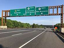
After the toll barrier, the two directions of road expand into express and local lanes in each direction. Just north of the split marks exit 105, servicing Route 18 and Route 36. The connector road from the parkway to the terminus of Route 36 and CR 51 (Hope Road) is designated as Route 444S. The express and local lanes wind northwest through Monmouth County, passing east of Freehold. At exit 116, access is provided to the PNC Bank Arts Center, Telegraph Hill Picnic Area and the New Jersey Vietnam Veterans Memorial. There is also access to nearby Crawfords Corner Road in Holmdel Township and a nearby park and ride. Crossing west of Hazlet, the parkway reaches exit 117 and exit 118, which mark access to Route 35, Route 36 and nearby Aberdeen. This connector road is designated as Route 444R. The parkway crosses northwest through Cheesequake State Park, bending into Middlesex County.[5]
Through Middlesex County, the parkway features the Cheesequake Service Area in the median, with access to both the express and local lanes of the highway. Crossing into South Amboy, the lanes merge as they reach the Raritan Toll Barrier southbound. Here, exit 125 southbound is the only EZ-Pass only exit on the highway, reaching Chevalier Avenue in South Amboy. Paralleing Route 9 and Route 35, all three cross the Raritan River. The parkway becomes 13 lanes as it crosses the Driscoll Bridge. Northbound, lanes split up for exit 127, a massive interchange for Route 440 and Route 9, providing access to the Outerbridge Crossing. Just north of exit 127 in Woodbridge Township, the parkway reaches exit 129, which provides access to the New Jersey Turnpike and Route 9. Running northeast through Woodbridge Township, the parkway crosses Route 1 at exit 130 and Route 27 at exit 132. There is also access northbound to Metropark station of New Jersey Transit at exit 131B.[5]

North of exit 132, the parkway curves northeast, passing the Colonia South and Colonia North service areas, along with the closed Madison Hill Picnic Area. Crossing into Union County, the highway crosses through dense neighborhoods as an eight–ten lane roadway. At exit 140, U.S. Route 22 crosses the Parkway with Route 82. Northbound, the road also passes the Vaux Hall Service Area. After the service area, the road crosses the Union Toll Barrier northbound and crosses a massive interchange with Interstate 78 at exit 142A–B. Running northeast into Essex County, the parkway reaches Irvington and soon crosses into the dense East Orange. In East Orange is an interchange with Interstate 280 at exit 145. Winding into Bloomfield, the parkway crosses exit 148 at CR 506 (Bloomfield Avenue). North of exit 149, the southbound parkway has the Essex Toll Barrier.[5]
After the Brookdale North and Brookdale South service areas, the parkway crosses into exit 153, which serves Route 3. After exit 153B, the parkway crosses into Passaic County and the city of Clifton. There, the route has several interchanges, with U.S. Route 46 and Route 19. After Route 19, the route turns northeast and crosses through Clifton to another interchange with Route 46 and soon, Route 21. To the northeast of Route 21, the parkway reaches an interchange with Interstate 80 (exit 159) and the Bergen Toll Barrier. Entering Bergen County, the road crosses a pair of interchanges for Route 4 and Route 208 as they enter Paramus. The final major interchange comes at Route 17 (exit 163). North of the interchange, there is another large junction at exit 165, which has a park and ride.[5]
Winding through suburban Bergen County, the parkway reaches the Montvale Service Area, the final of the group of service areas. There is access to CR 94 (Grand Avenue), which also has a nearby ramp for exit 172. Exit 172 marks the final exit of the Garden State Parkway, which crosses into New York in Montvale. From there, the route becomes the Garden State Parkway Connector, bringing access southbound to CR 41 in Rockland County, New York. The connector meets Interstate 87, Interstate 287 and the New York State Thruway in Nanuet, marking the northern end.[5]
On the Garden State Parkway, the emergency assistance number is #GSP, which is #477 in number form. New Jersey State Police are the primary police agency that handles calls for service on the parkway. Other emergency services such as fire and first aid are usually handled by the jurisdictions in which that section of the parkway passes.
History
| |
|---|---|
| Location | Hackensack–New York state line |
Route S101 was a northern extension of Route 101 planned from Hackensack through Paramus to the New York state line near Montvale. The section from Hackensack to Paramus was never built; the section from Paramus to the state line would become part of the Garden State Parkway.
The parkway was originally designated as the Route 4 Parkway when it was started in 1947 in Union County, but, due to lack of funds, only 11 miles (18 km) were completed by 1950. The solution was for the state to establish the New Jersey Highway Authority in 1952 to oversee construction and operation as a self-liquidating toll road.[7] Much of the original section, between exits 129 and 140, was long administered by the New Jersey Department of Transportation and has always been untolled. The segment can be distinguished by the stone facing on the overpasses.
The parkway was constructed between 1946 and 1957 to connect suburban northern New Jersey with resort areas along the Atlantic coast and to alleviate traffic on traditional north–south routes running through each town center, such as US 1, US 9, and Route 35. Unofficially, it has two sections: the "metropolitan section" north of the Raritan River and the "shore section" between the Raritan River and Cape May. Only 18 miles (29 km) had been constructed by 1950, but taking a cue from the successful New York State Thruway, on April 14, 1952, the New Jersey Legislature created the New Jersey Highway Authority, empowered to construct, operate, and maintain a self-sufficient toll parkway from Paramus to Cape May.
The landscape architect and engineer in charge of the newly named Garden State Parkway was Gilmore David Clarke, of the architectural firm of Parsons, Brinkerhof, Hall and MacDonald,[7] who had worked with Robert Moses on the parkway systems around New York City. Clarke's design prototypes for the parkway combined the example of the Pennsylvania Turnpike, a model of efficiency with parallels in the German Autobahn routes of the 1930s, with the Merritt Parkway model that stressed a planted "green belt" for beauty. Both design models featured wide planted medians to prevent head-on collisions and mask the glare of oncoming headlights. The Garden State Parkway was designed to have a natural feel. Many trees were planted, and the only signs were those for exits—there were no distracting billboards. Most of the signs were constructed from wood, or a dark-brown metal, instead of the chrome bars used on most other highways. The guardrails were also made from wood and dark metal. Most early overpasses were stone, but then changed to concrete, with green rails and retro etchings, popular around the 1950s and 1960s. These are now in decay and being replaced by sleek, new bridges. The parkway was designed to curve gently throughout its length so that drivers would remain alert and not fall asleep at the wheel.
Most of the metropolitan section is like any other expressway built in the 1950s through heavily populated areas. The shore section parallels US 9 and runs through unspoiled wilderness in the New Jersey Pine Barrens. In Cape May County, the parkway had three traffic lights (at exits 9, 10, and 11), but these were eliminated in 2015, with construction of three overpasses in Cape May Court House and Stone Harbor.
The parkway had an old alignment before the Great Egg Harbor Bridge was completed. It was detoured onto US 9 and over the Beesley's Point Bridge. That bridge was closed in 2003 and demolished in 2014.
The Garden State Parkway was off-limits to motorcycles until Malcolm Forbes pushed successfully for legislation to allow them.[8]
On July 9, 2003, Governor Jim McGreevey's plan to merge the operating organizations of the Garden State Parkway and the New Jersey Turnpike into one agency was completed.[9]
Literature from the time of the parkway's construction indicates that the parkway would become toll-free once bonds used for its construction were paid off. However, additional construction projects, plus the expectation that the parkway will pay for its own maintenance and policing (and the massive E-ZPass project) make it unlikely it will become toll-free in the foreseeable future.[10]
The parkway was also planned to be the southern terminus for Route 55 at milemarker 19. This was cancelled after the conclusion that the highway ran through too many wetland areas. The idea is still being revisited after frequent traffic jams on Route 47.
On July 22, 2014, the New Jersey Turnpike Authority filed a federal lawsuit against Jersey Boardwalk Pizza, a pizza chain in Florida, for using a logo too similar to the signs for the Garden State Parkway.[11] Federal Judge William Martini dismissed the suit on March 26, 2015.[12]
Usage
The speed limit on the parkway is 65 mph (105 km/h) with the following exceptions: 55 mph (90 km/h) between mileposts 123.5 and 163.3, 55 mph (90 km/h) between mileposts 80.0 and 85.2, and 45 mph (70 km/h) between mileposts 27 and 29, approaching and traversing the Great Egg Harbor Bridge, and between milepost 126.7 and 127.7, approaching and traversing the Driscoll Bridge.[1][13]
Commercial trucks with a registered weight of over 10,000 pounds (4,500 kg) are not allowed to use the northern parts of the parkway.[14]
All trucks must exit at exit 105, just past the Asbury Park toll plaza. From Tinton Falls to the southern end of the parkway at Cape May, trucks are allowed, but must pay additional tolls. Buses are allowed for the entire length of the parkway.[15] In April 2011, New Jersey Transportation Commissioner James Simpson announced the NJTA was looking into the possibility of allowing trucks on the northern portion of the Garden State Parkway.[16] However, the idea was quickly abandoned after the agency found the road had engineering concerns that would make the consideration of allowing trucks on this segment impossible.[17]
Toll collection

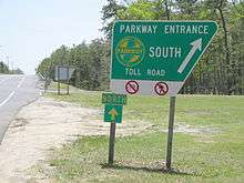
While the New Jersey Turnpike uses a system of long-distance tickets, obtained once by a motorist upon entering and surrendered upon exiting at toll gates (a "closed" system), the Garden State Parkway uses no tickets but collects tolls at toll plazas at somewhat regular intervals along its length and at certain exits (an "open" system). As of 2018, the standard car toll is $0.75 on the main road at two-way toll plazas and $1.50 at one-way toll plazas. Some individual exits require a toll of either $0.50, $0.75, $1.00, or $1.50.
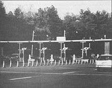
The parkway has implemented the E-ZPass electronic toll collection system; it was first installed at the Pascack Valley toll plaza in December 1999, and the system was completed on September 19, 2000.[18] Parkway tokens continued to be available until January 1, 2002,[19] and were invalidated effective January 1, 2009.[20] Drivers using exact change lanes are now required to pay with coins only in all toll baskets. The Union Toll Plaza was the first to use an automated toll-collection machine. A plaque commemorating this event includes the first quarter collected at its toll booths.[21]
Tokens originally cost $10 for a roll of 40 tokens (the toll was 25 cents when tokens were introduced), but when the toll was increased to 35 cents, rolls were 30 tokens for $10. Before invalidating the tokens, the NJHA gave several months' warning and gave motorists the opportunity to redeem tokens. Tokens were originally brass, but were changed to a bimetallic composition with an outer silver-colored ring and a brass core. There were also larger bus tokens that existed in each composition, primarily for the use of Atlantic City-bound buses. These were sold in rolls of 20 for $20.
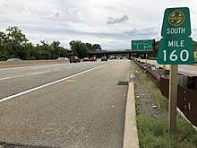
To reduce congestion, most toll plazas on the roadway were converted into one-way plazas between September 2004 and February 2010, dubbed "one-way tolling".[22] Under this program, the toll is doubled in one direction, and the other direction is toll-free. The Cape May (in Upper Township), Great Egg (in Somers Point), New Gretna (in Bass River Township), Barnegat (in Barnegat Township), Asbury Park (in Tinton Falls), Raritan (in Sayreville), Union (in Hillside Township), Essex (in Bloomfield Township), Bergen (in Saddle Brook Township), and Pascack Valley (in Washington Township) toll plazas had been converted to one-way toll plazas. The Toms River (in Toms River Township) Toll Plaza is the only toll barrier plaza where a toll is collected in both directions.
Beginning on November 19, 2001, E-ZPass customers were charged the approximate token rate, that is 33 cents (peak travel) or 30 cents (off-peak travel), instead of 35 cents, the cash toll rate at the time.[19] Due to tremendous cost overruns in implementing the E-ZPass system on New Jersey's toll highways the discount was eliminated the next year.[23] NJHA E-ZPass customers were charged a $1-per-month account fee,[23] causing many customers to turn in their NJHA E-ZPass transponders in favor of a transponder from an out-of-state authority which did not charge a monthly fee.

There are three types of toll lanes at the toll plazas, however not all plazas have every type of lane at all times. The first type of toll plaza lane is E-ZPass only, which only accept vehicles with E-ZPass tags. The speed limit in these lanes is 15 mph (24 km/h), or 55–65 mph (89–105 km/h) for Express E-ZPass lanes.
The second type of toll plaza lane is exact change. Although they previously accepted both parkway tokens or exact change, the tokens were no longer sold after January 1, 2002, and were no longer accepted on the parkway after January 1, 2009. Drivers using exact change lanes are now required to pay with coins only. In these lanes, motorists deposit coins in a toll basket and each coin is mechanically counted. Payment of tolls is enforced by photo, a system that went into effect on October 17, 2011.[24] In the six weeks following September 24, 2018, all exact change lanes at the mainline toll plazas on the Parkway will be removed and will become either Full-Service lanes or E-Z Pass Only lanes but the exact change lanes at the exit and entrance ramp toll plazas will still be in place.
The third type of toll plaza lane is Cash/Receipts also known as Full-Service lanes. These lanes are manned; toll collectors can provide change and receipts to drivers. E-ZPass is also accepted.
Picnic areas

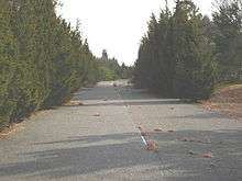
One of the objectives of the parkway was to become a state park its entire length, and its users would enjoy park-like aesthetics with minimal intrusion of urban scenery. Along the ride, users were permitted to stop and picnic along the roadway to further enjoy the relaxation qualities the parkway had to offer. All picnic areas had tall trees that provided shade and visual isolation from the roadway. Grills, benches, running water and restrooms were provided. Over time as the parkway transformed into a road of commerce, the picnic areas were being closed for a variety of reasons. Their ramp terminals became insufficient to accommodate the high-speed mainline traffic and in addition to the decreasing amount of users, the picnic areas were becoming more effective as maintenance yards and were converted as such or closed altogether.
The two remaining picnic areas are closed from dusk to dawn. Posted signs within the picnic area prohibit fires and camping.
There were ten operational picnic areas:
| Name | Location | Milepost | Direction | Opened | Closed | Reason | Notes |
|---|---|---|---|---|---|---|---|
| John B. Townsend Shoemaker Holly | Upper Township | 22.7 miles (36.5 km) | Both | October 20, 1965[25] | – | – | John B. Townsend was a physician from Ocean City who became the New Jersey Highway Authority's second Vice Chairman in 1955. The word Shoemaker comes from the last name of the landowner in the way of the Parkway's alignment during its initial construction. The term Holly comes from the Shoemaker's holly tree that was on his property. The tree is presumed to be 300 years old and one of, if not, the oldest holly tree in the United States. The bathrooms at Shoemaker Holly were demolished in August 2014.[26] |
| Stafford Forge | Stafford Township | 61.6 miles (99.1 km) | Both | May 27, 1955[27] | – | – | |
| Oyster Creek | Lacey Township | Both | May 27, 1955[27] | – | – | The murder of Maria Marshall orchestrated by her husband Robert O. Marshall occurred in the Oyster Creek picnic area on the night of September 7, 1984.[28] The story was made into a novel and television movie on NBC. | |
| Double Trouble | Double Trouble | 79.0 miles (127.1 km) | Southbound | February 23, 1961[29] | Mosquito outbreak | The NJHA chose to abandon the service area due to the outbreak of mosquitoes from a nearby cranberry bog.[29] | |
| Polhemus Creek | Brick Township | 82.0 miles (132.0 km) | Northbound | June 4, 1955[30] | – | – | |
| Herbertsville | Wall Township | 94.65 miles (152.32 km) | Southbound | May 27, 1955[27] | – | – | Converted to a maintenance yard of the same name and heavy vehicle weigh station. |
| Telegraph Hill | Holmdel Township | 115.85 miles (186.44 km) | Both | April 24, 1957[31] | – | – | The picnic area is off exit 116, next to the PNC Bank Arts Center. |
| Glenside | Woodbridge Township | 130.2 miles (209.5 km) | Southbound | October 23, 1987[32] | Illegal use for sex and drugs[32] | ||
| Madison Hill | Woodbridge Township | 134.9 miles (217.1 km) | Northbound | November 1, 1950[33] | – | Madison Hill was an overlook constructed for the Route 4 Parkway rather than the whole Garden State Parkway.[33] | |
| Tall Oaks | Cranford | 137.0 miles (220.5 km) | Southbound | July 1988[34] | Illegal use for sex and drugs[34] | ||
Service areas
All service areas are located in the center median, unless otherwise noted.
| Name | Location | Milepost | Direction | Opened | Closed | Facilities | Notes |
|---|---|---|---|---|---|---|---|
| Ocean View | Dennis Township | 18.3 miles (29.5 km) | Both | July 8, 1955[35] | Restrooms, fuel, vending machines, tourist information | Formerly known as Seaville. | |
| Atlantic Plaza | Galloway Township | 41.4 miles (66.6 km) | Both | Food, restrooms, fuel and information | |||
| New Gretna | Bass River Township | 53 miles (85 km) | Both | July 1, 1955[35] | Food, restrooms, fuel | Temporary service area built for services until the permanent service areas were completed. Now site of a Parkway maintenance facility. | |
| Forked River | Lacey Township | 76.0 miles (122.3 km) | Both | May 19–26, 1955[27][36] | Food, restrooms, fuel | The snack bar at Forked River opened the weekend of May 19–20, 1955 but full facilities did not open until May 26.[36] | |
| Monmouth | Wall Township | 100.4 miles (161.6 km) | Both | July 1, 1955[37] | Food, restrooms, fuel | ||
| Eatontown | Tinton Falls | 107 miles (172 km) | Both | July 1, 1955[35] | Food, restrooms, fuel | Temporary service area built for services until the permanent service areas were completed. | |
| Cheesequake | Old Bridge Township | 123.0 miles (197.9 km) | Both | May 12, 1955[38] | Food, restrooms, fuel | ||
| Colonia South | Woodbridge Township | 132.79 miles (213.70 km) | Southbound | Fuel, convenience stores and restrooms | |||
| Colonia North | 133.45 miles (214.77 km) | Northbound | Fuel, convenience stores and restrooms | ||||
| Vaux Hall | Union Township | 142.0 miles (228.5 km) | Northbound | May 26, 1955[27][36] | Food, restrooms and fuel | ||
| Brookdale South | Bloomfield | 153.3 miles (246.7 km) | Southbound | August 10, 1956[39] | Food, restrooms and fuel | ||
| Brookdale North | 153 miles (246 km) | Northbound | December 10, 1956[40] | Fuel only | Doubles as barracks for New Jersey State Police. | ||
| Montvale | Montvale | 171 miles (275 km) | Both | September 18, 1958[41] | Food, restrooms, fuel and information |
Park-ettes
In the 1950s, four petroleum companies were hired to provide gasoline and vehicular necessities—Esso, Texaco, Atlantic and Cities Service. The Cities Service company was the petroleum provider at Monmouth, Forked River, Atlantic City (Absecon at the time) and Ocean View (Seaville at the time) and offered a service where female employees were hired for those service area showrooms, wore uniforms and were known as the Park-ettes. Their duties included providing directions and other information to motorists as well as rendering odd bits of service such as sewing a missing button on a patron's coat.[42]
Exit list
Many entrances and exits have tolls. In general, exits have tolls when they precede a barrier toll, and exits are free when they follow a barrier toll. Conversely, entrances that precede a barrier toll are free; and tolls are paid at entrances just beyond a barrier toll. This avoids double tolling (e.g., paying a barrier toll and then immediately paying again to exit) and under-tolling (e.g., driving a long distance and then exiting for free just before a barrier toll).
There are no tolls between exits 127 and 141, inclusive, as this was the original road segment that predates the New Jersey Highway Authority.
| County | Location | mi[1] | km | Old exit | New exit | Destinations | Notes[43] |
|---|---|---|---|---|---|---|---|
| Cape May | Lower Township | 0.00 | 0.00 | 0 | At-grade intersection, access to Cape May–Lewes Ferry | ||
| Middle Township | 3.90 | 6.28 | 4 | Toll (northbound exit and southbound entrance); signed as exit 4A (south) and 4B (north) southbound | |||
| 6.54 | 10.53 | 6 | Southbound exit and northbound entrance | ||||
| 8.40 | 13.52 | 9 | Former at-grade intersection, removed 2014 | ||||
| 9.90 | 15.93 | 10 | Cape May Court House, Stone Harbor | Access via CR 657, former at-grade intersection, removed 2014[44] | |||
| 11.04 | 17.77 | 11 | Former at-grade intersection, removed 2015[44] | ||||
| 11.80 | 18.99 | 12 | Southbound entrance only, no exit | ||||
| 13.60 | 21.89 | 13 | |||||
| Dennis Township | 17.50 | 28.16 | 17 | Sea Isle City, Dennis Township | Access via CR 625, southbound exit and northbound entrance | ||
| Upper Township | 19.38 | 31.19 | Cape May Toll Plaza (northbound only) | ||||
| 20.25 | 32.59 | 20 | Northbound exit and southbound entrance | ||||
| 25.34 | 40.78 | 25 | Southern terminus of concurrency with US 9; access to Corson's Inlet State Park | ||||
| Great Egg Harbor Bay | 27.77 | 44.69 | Great Egg Harbor Bridge | ||||
| Atlantic | Somers Point | 28.78 | 46.32 | Great Egg Toll Plaza (southbound only) | |||
| 28.90 | 46.51 | 29 | Northern terminus of concurrency with US 9; northbound exit and southbound entrance | ||||
| 30.00 | 48.28 | 30 | Somers Point, Ocean City | Access via North Laurel Drive, southbound exit and northbound entrance, toll (on southbound exit only) | |||
| Egg Harbor Township | 35.82 | 57.65 | 36 | No southbound exit, northbound exit only | |||
| 36.08 | 58.07 | No northbound exit, southbound exit only | |||||
| 36.28 | 58.39 | 37N | Northbound entrance only, no exit | ||||
| 36.59 | 58.89 | 37 | Southbound exit and northbound entrance, access to CR 563 north | ||||
| 37.23 | 59.92 | 38 | Signed as exits 38A (east) and 38B (west), Exit 38B provides access to Atlantic City International Airport and the FAA Tech Center | ||||
| Galloway Township | 40.04 | 64.44 | 40 | Southbound exit and northbound entrance | |||
| 41.70 | 67.11 | 41 | Opened March 13, 2015; Access to AtlantiCare Medical Campus and Stockton University | ||||
| 43.98 | 70.78 | 44 | Northbound exit and southbound entrance opened August 2015; Access to Stockton University, Atlantic City International Airport and the FAA Tech Center | ||||
| Port Republic | 48.29 | 77.72 | 48 | Southern terminus of concurrency with US 9; southbound exit and northbound entrance | |||
| Burlington | Bass River Township | 50.67 | 81.55 | 50 | Northern terminus of concurrency with US 9; northbound exit and southbound entrance | ||
| 52.70 | 84.81 | 52 | Southbound exit and northbound entrance | ||||
| 53.54 | 86.16 | New Gretna Toll Plaza (northbound only) | |||||
| Ocean | Little Egg Harbor Township | 58.69 | 94.45 | 58 | |||
| Stafford Township | 64.11 | 103.18 | 63 | Signed as exits 63A (east) and 63B (west) northbound | |||
| Barnegat Township | 67.81 | 109.13 | 67 | Signed as exits 67A (east) and 67B (west) southbound | |||
| 68.61 | 110.42 | Barnegat Toll Plaza (southbound only) | |||||
| Ocean Township | 70.45 | 113.38 | 69 | Toll (southbound exit and northbound entrance) | |||
| Lacey Township | 75.34 | 121.25 | 74 | Toll (southbound exit and northbound entrance) | |||
| Berkeley Township | 77.40 | 124.56 | 77 | Berkeley | Access via CR 618 / CR 619, toll (southbound exit and northbound entrance) | ||
| South Toms River | 80.85 | 130.12 | 80 | Southern terminus of concurrency with US 9; southbound exit and northbound entrance | |||
| Toms River | 81.85 | 131.72 | 81 | Lakehurst Road (CR 527) – Toms River | |||
| 82.35 | 132.53 | 82 | Signed as exits 82 (east) and 82A (west); access to Island Beach State Park | ||||
| 84.10 | 135.35 | 83 | Northern terminus of concurrency with US 9; no southbound exit | ||||
| 84.72 | 136.34 | Toms River Toll Plaza | |||||
| Lakewood Township | 89.36 | 143.81 | 88 | 89[45][46] | Signed as exit 89A northbound for Route 70 east and west; 89A (east) and 89B (west) southbound; toll on all ramps | ||
| 90.18 | 145.13 | Signed as exit 89B northbound and 89C southbound; toll on all ramps | |||||
| Brick Township | 91.10 | 146.61 | 90 | Northbound exit and southbound entrance | |||
| 92.62 | 149.06 | 91 | Signed as exits 91B (south) and 91A (north) southbound; toll on southbound exit and northbound entrance | ||||
| Monmouth | Wall Township | 98.23 | 158.09 | 96–97 | 98 | Toll (southbound exit and northbound entrance); Access from Northbound Parkway to NJ-34 and I-195 west via NJ-138 west (unsigned); Junction with NJ 34 formerly exit 96 and NJ 138 formerly exit 97[6] | |
| Tinton Falls | 101.24 | 162.93 | 100 | 100A | Bradley Beach not signed on southbound signage; formerly exit 100 | ||
| 101.49 | 163.33 | 100A | 100B | no southbound access to NJ 66 east; formerly exit 100A; northbound exit and southbound entrance | |||
| 101.74– 163.73 | 163.73– 263.50 | 100B | 100C | signed as exit 100B southbound; | |||
| 103.15 | 166.00 | 102 | Neptune, Asbury Park | Access via CR 16, southbound exit and northbound entrance | |||
| 103.96 | 167.31 | Asbury Park Toll Plaza (northbound only) | |||||
| 104.20 | 167.69 | South end of local-express lanes split | |||||
| 106.12– 106.39 | 170.78– 171.22 | 105 | Toll (on northbound entrance only); southbound exit and northbound entrance from express and local lanes; commercial vehicles must exit here | ||||
| Middletown Township | 110.14 | 177.25 | 109 | Toll (southbound exit and northbound entrance) | |||
| Middletown–Holmdel township line | 113.88 | 183.27 | 114 | Holmdel, Middletown | Access via CR 52, toll (southbound exit and northbound entrance); exit opened December 21, 1962[47] | ||
| Holmdel Township | 115.85 | 186.44 | 116 | ||||
| 117.00 | 188.29 | Crossover ramps between express and local lanes | |||||
| Hazlet Township | 118.50 | 190.71 | 117 | Toll (southbound exit and northbound entrance); southbound exit and northbound entrance from express lanes | |||
| Aberdeen Township | 118.79 | 191.17 | 117A | 118 | Aberdeen | Access via CR 3, southbound exit and entrance, toll, formerly 117A until 2016 | |
| Middlesex | Old Bridge Township | 121.13 | 194.94 | 120 | Laurence Harbor, Matawan | Access via CR 689, access to Cheesequake State Park | |
| Sayreville | 124.64 | 200.59 | 123 | Southbound exit and northbound entrance | |||
| 124.99 | 201.15 | 124 | Main Street (CR 670) | Southbound exit and northbound entrance Exit opened October 25, 1982[48] | |||
| 125.28 | 201.62 | North end of local-express lanes split | |||||
| 125.68 | 202.26 | Raritan Toll Plaza (southbound only) | |||||
| 126.36 | 203.36 | 125 | Northbound exit only but no northbound entrance; southbound exit for E-Z Pass users only and southbound entrance will now be accessed from Main Street Extension | ||||
| Raritan River | 127.33 | 204.92 | Driscoll Bridge | ||||
| Woodbridge Township | 128.0 | 206.0 | 127 | Signed as exit 129 southbound; southbound exit via New Brunswick Avenue | |||
| 129.50 | 208.41 | 128 | 129 | Exit 11 on I-95 / Turnpike; exit opened September 18, 1969[49] | |||
| 129.50 | 208.41 | Southbound exit only, northbound exit via exit 127 | |||||
| 130.63 | 210.23 | 130 | Southbound exit and northbound entrance; signed as exit 130B (south/Trenton) and 130A (north/Newark) | ||||
| 131.33 | 211.36 | 131 | Wood Avenue South (CR 649) | Signed as exit 131A northbound | |||
| 131.83 | 212.16 | 131B | Access via CR 657, northbound exit and southbound entrance | ||||
| 131.97 | 212.39 | 131 | 132 | Formerly exit 131 until March 2015[50] | |||
| Union | Clark | 136.22 | 219.22 | 135 | Clark, Westfield | Access via CR 613 | |
| Cranford | 137.59 | 221.43 | 136 | Linden, Roselle | Access via CR 607 / CR 615 | ||
| 138.74 | 223.28 | 137 | |||||
| Kenilworth | 140.34 | 225.86 | 138 | ||||
| Union Township | 141.10 | 227.08 | 139A | Roselle Park | Northbound exit and entrance | ||
| 139B | Signed as exit 140A (formerly 140) southbound | ||||||
| 141.70 | 228.04 | 140 | Signed as exit 140B (formerly 140A) southbound | ||||
| 142.10 | 228.69 | 141 | Vauxhall Road (CR 630) – Union | Southbound exit and northbound entrance | |||
| Hillside | 142.66 | 229.59 | Union Toll Plaza (northbound only) | ||||
| 142.80 | 229.81 | 142 | 142A | Toll (northbound exit and entrance only); southbound exit to I-78 east opened December 10, 2010 | |||
| 142.90 | 229.98 | 142 | 142B | Toll (northbound exit and entrance only); northbound exit ramp to I-78 west opened September 16, 2009 | |||
| 143.00 | 230.14 | 142A | 142C | Hillside, Maplewood | Access via North Union Avenue, northbound exit and southbound entrance | ||
| Essex | Irvington | 144.0 | 231.7 | 143 | Springfield Avenue (CR 603) / Lyons Avenue (CR 602) – Irvington, Maplewood, Hillside | Signed as exits 143A (Hillside), 143B (Maplewood) and 143C (Springfield) southbound | |
| 145.98 | 234.93 | 144 | Toll (northbound exit and southbound entrance) | ||||
| East Orange | 146.93– 147.15 | 236.46– 236.81 | 146 | 145 | Toll (on southbound entrance only); One way tolls at Exit 145 towards The Oranges started on July 26, 2018 at 10 pm.[51]); exit opened October 17, 1967[52] | ||
| 148.44 | 238.89 | 147 | Springdale Avenue – East Orange | Southbound exit and northbound entrance | |||
| Bloomfield | 149.2 | 240.1 | 148 | Toll (northbound exit and southbound entrance) | |||
| 150.22 | 241.76 | 148A | 149 | Belleville Avenue (CR 506) – Belleville, Glen Ridge | Southbound exit and northbound entrance; formerly exit 148A until May 1967[53] | ||
| 150.66 | 242.46 | Essex Toll Plaza (southbound only) | |||||
| 151.1 | 243.2 | 149A | 150 | Hoover Avenue (CR 651) – Bloomfield, Belleville | Northbound exit and southbound entrance; formerly exit 149A until May 1967[53] | ||
| 152.45 | 245.34 | 151 | Watchung Avenue (CR 655) – Nutley, Montclair | Toll (southbound exit and northbound entrance) | |||
| Passaic | Clifton | 154.06– 154.45 | 247.94– 248.56 | 153 | Toll (southbound exit and northbound entrance); signed as exits 153A (east) and 153B (west) northbound; no southbound access to Route 3 west, access to Meadowlands Sports Complex | ||
| 155.91 | 250.91 | 154 | Toll (southbound exit and northbound entrance); exit opened December 30, 1958[54] | ||||
| 156.4 | 251.7 | 155P | 155A | Northbound exit and southbound entrance | |||
| 156.68 | 252.15 | 155 | 155B | Hazel Street (CR 702) | Northbound exit and southbound entrance | ||
| 158.19 | 254.58 | 156 | Northbound exit and southbound entrance | ||||
| Bergen | Elmwood Park | 158.87 | 255.68 | 157 | Same directional movements only | ||
| Saddle Brook | 160– 160.35 | 260– 258.06 | 159 | Toll (on northbound exit only); northbound exit and southbound entrance. No direct northbound access to I-80 west | |||
| 160.46 | 258.24 | Bergen Toll Plaza (northbound only) | |||||
| Paramus | 161.53 | 259.96 | 160 | Northbound exit and southbound entrance | |||
| 161.88 | 260.52 | 161 | Northbound exit and southbound entrance | ||||
| 163.06 | 262.42 | 163 | Southbound exit and northbound entrance, access to Meadowlands Sports Complex | ||||
| 163.29 | 262.79 | Northbound exit and southbound entrance | |||||
| 164.94 | 265.45 | 165 | Ridgewood, Oradell | Access via CR 80, toll (northbound exit and southbound entrance); exit opened July 3, 1957[55] | |||
| 165.93 | 267.04 | 166 | Washington, Westwood | Access via CR 110, southbound exit and northbound entrance; exit opened July 3, 1957[55] | |||
| Washington Township | 166.25 | 267.55 | Pascack Valley Toll Plaza (southbound only) | ||||
| 167.46 | 269.50 | 168 | Northbound exit and southbound entrance; exit opened July 3, 1957[55] | ||||
| Woodcliff Lake | 170.15 | 273.83 | 171 | Chestnut Ridge Road (CR S-73) – Woodcliff Lake | Northbound exit and southbound entrance | ||
| Montvale | 171.52 | 276.03 | 172 | Grand Avenue (CR 94) – Montvale, Park Ridge | Northbound exit and southbound entrance; exit opened July 3, 1957[55] | ||
| 172.40 | 277.45 | – | Continuation into New York via the GSP Connector | ||||
1.000 mi = 1.609 km; 1.000 km = 0.621 mi
| |||||||
See also


References
- 1 2 3 4 "Garden State Parkway straight line diagram" (PDF). New Jersey Department of Transportation. Retrieved December 8, 2009.
- ↑ "What trucks are allowed on the Garden State Parkway and where?".
- ↑ Samuel, Peter (January 6, 2003). "15-lane bridge for Garden State Parkway". Tollroads News. Archived from the original on October 17, 2007. Retrieved September 23, 2008. "The Garden State Parkway is America's busiest single tollroad in terms of toll transaction numbers - 609m in 2001 or 1.67m/day average."
- ↑ Samuel, Peter (January 29, 2008). "USA Today reports dramatically more expensive tolls—lousy data". TollRoadsNews. Archived from the original on September 5, 2008. Retrieved September 23, 2008.
- 1 2 3 4 5 6 7 8 9 10 Google (April 22, 2018). "overview map of the Garden State Parkway (NJ 444)" (Map). Google Maps. Google. Retrieved April 22, 2018.
- 1 2 "Parkway Improvement Program to Take Toll". The Asbury Park Press. June 29, 1973. p. 7. Retrieved April 22, 2018 – via Newspapers.com.

- 1 2 Laurie, Maxine N.; Mappen, Marc (2004–2005). Encyclopedia of New Jersey. Rutgers University Press. p. 305.
- ↑ Pierson, Melissa Holbrook (1998). The perfect vehicle: what it is about motorcycles. W. W. Norton & Company. p. 82. ISBN 0-393-31809-5.
- ↑ "Governor McGreevey Announces Planned Improvements from Turnpike Authority Consolidation" (Press release). New Jersey Turnpike Authority. July 10, 2003. Archived from the original on October 28, 2003. Retrieved March 18, 2010.
- ↑ Ahlersnewspaper=Cape May County Herald, Bob (July 19, 2011). "Funding Failed, Tolls Imposed To Pay for Garden State Parkway". Retrieved September 14, 2018.
- ↑ "New Jersey Sues Florida Pizza Shop". Philadelphia, PA: WCAU-TV. Associated Press. July 24, 2014. Retrieved July 24, 2014.
- ↑ "New Jersey Turnpike suit over Florida pizza shop logo tossed". CBS New York. The Associated Press. March 27, 2015.
- ↑ Google (September 16, 2016). "Google Street View imagery of Garden State Parkway" (Map). Google Maps. Google. Retrieved September 16, 2016.
- ↑ The NJ Law Reads as follows: "3. With the exception of vehicles holding a special permit, only New Jersey State Police vehicles, Authority maintenance vehicles and other Authority authorized vehicles, with a gross weight, G.V.W.R. and/or G.C.W.R. in excess of 10,000 pounds, shall be allowed on the Parkway north of Interchange 105, except that all vehicles in excess of 10,000 pounds are allowed on Ramp 7 in Woodbridge Township, Middlesex County for purposes of accessing the Turnpike."
- ↑ "Section 19:8-1.9(b)15" (PDF). Garden State Parkway Regulations. State of New Jersey. October 23, 1987. Archived from the original (PDF) on October 25, 2007. Retrieved October 17, 2007.
19:8-1.9(b)15: All vehicles except cars, campers, omnibuses, and vehicles entitled to toll-free passage under N.J.A.C. 19:8-3.2 (Toll-free passage) are prohibited from the Parkway north of Interchange 105.
- ↑ "N.J. to consider allowing trucks on Garden State Parkway north of exit 105". The Star-Ledger. Associated Press. April 18, 2011. Retrieved April 19, 2011.
- ↑ "N.J. won't allow trucks on Garden State Parkway north of exit 105". The Star-Ledger. Associated Press. April 18, 2011. Retrieved April 19, 2011.
- ↑ "E-ZPass open from N.Y. State to Cape May" (Press release). New Jersey Highway Authority. September 19, 2000. Archived from the original on September 25, 2003.
- 1 2 "Parkway to Discontinue Token Sales" (Press release). New Jersey Highway Authority. December 26, 2001. Archived from the original on February 12, 2005.
- ↑ Strauss, Robert (July 20, 2008). "Soon, Token Non Grata on the Garden State". The New York Times. Retrieved March 18, 2010.
- ↑ "Union Watersphere". lostinjersey.wordpress.com. March 19, 2009. Retrieved February 23, 2012.
- ↑ NJ Turnpike and Garden State Parkway Project. Retrieved May 11, 2011.
- 1 2 "E-ZPass: A plan that works for NJ" (PDF). July 11, 2002. pp. 9–10. Retrieved June 22, 2009.
- ↑ PAY TOLL Photo Enforced to all exact change lanes "Archived copy" (PDF). Archived from the original (PDF) on October 18, 2011. Retrieved October 17, 2011. Retrieved October 13, 2011.
- ↑ "Picnic Area Built Around Ancient Holly". The Asbury Park Evening Press. October 12, 1965. p. 13. Retrieved April 14, 2018 – via Newspapers.com.
- ↑ Wittkowski, Donald (August 1, 2014). "Bathrooms gone, but ancient holly remains at parkway rest stop in Cape May". The Press of Atlantic City. Retrieved April 14, 2018.
- 1 2 3 4 5 "Parkway Picnic Area Stymied". The Asbury Park Press. May 27, 1955. p. 19. Retrieved April 14, 2014 – via Newspapers.com.
- ↑ Sheppard, R.Z. (January 2, 1989). "Books: Serpents in The Garden State". Time. Retrieved May 3, 2010.
- 1 2 "Mosquitos Get Double Trouble". The Plainfield Courier-News. February 24, 1961. p. 1. Retrieved April 14, 2018 – via Newspapers.com.
- ↑ "New Picnic Area Opens on Parkway". The Central New Jersey Home News. June 5, 1955. p. 28. Retrieved April 14, 2018 – via Newspapers.com.
- ↑ "Parkway Dedicates Telegraph Hill Park". The Asbury Park Evening Press. April 25, 1957. p. 1. Retrieved April 14, 2018 – via Newspapers.com.
- 1 2 Coleman, Steven (October 24, 1987). "Rest Stop's Closing Blamed on Drugs, Sex". The Courier-News. p. 15. Retrieved October 13, 2017 – via Newspapers.com.
- 1 2 "First Section of Route 4 Parkway is Completed". The Central New Jersey Home News. October 29, 1950. p. 1, 32. Retrieved April 14, 2018 – via Newspapers.com.
- 1 2 Kasen, Timothy (July 21, 1988). "Parkway to Shut Down Cranford Rest Area". The Courier-News. p. 25. Retrieved October 13, 2017 – via Newspapers.com.
- 1 2 3 "Parkway Closes Temporary Areas". The Plainfield Courier-News. July 8, 1955. p. 7. Retrieved April 20, 2018 – via Newspapers.com.
- 1 2 3 "New Bridge Due to Open". The Plainfield Courier-News. May 26, 1955. p. 6. Retrieved April 20, 2018 – via Newspapers.com.
- ↑ "Parkway to Open Two More Service Areas". The Asbury Park Press. June 25, 1955. p. 7. Retrieved April 20, 2018 – via Newspapers.com.
- ↑ "Parkway Opens First Restaurant". The Plainfield Courier-News. May 12, 1955. p. 36. Retrieved April 20, 2018 – via Newspapers.com.
- ↑ "Parkway Restaurant Opens Friday". The Asbury Park Press. August 8, 1956. p. 22. Retrieved April 20, 2018 – via Newspapers.com.
- ↑ "Garden State Parkway Adds Service Area". The Plainfield Courier-News. December 10, 1956. p. 6. Retrieved April 20, 2018 – via Newspapers.com.
- ↑ "Parkway Site to be Opened". The Plainfield Courier-News. September 17, 1958. p. 8. Retrieved April 20, 2018 – via Newspapers.com.
- ↑ "The First Five Years of the Garden State Parkway" published by the New Jersey Highway Authority, page 29.
- ↑ "Garden State Parkway Exits (Milemarkers)". www.maikoff.net.
- 1 2 "Advisory: Mechanic Street Exit from Garden State Parkway to Close Permanently". Middle Township New Jersey. Middle Township Municipality. Archived from the original on August 26, 2014. Retrieved August 24, 2014.
- ↑
- ↑ Nee, Daniel (June 10, 2015). "New Brick Parkway Exit Ramps Open This Week".
- ↑ "Parkway to Open New Interchange". The Plainfield Courier-News. December 20, 1962. p. 34. Retrieved April 21, 2018 – via Newspapers.com.
- ↑ "Parkway Ramp Debuts Monday". The Central Jersey Home News. October 23, 1982. p. 3. Retrieved April 21, 2018 – via Newspapers.com.
- ↑ "Toll Highway Link Opens Tomorrow". The Asbury Park Press. September 17, 1969. pp. 1, 7. Retrieved April 23, 2018 – via Newspapers.com.
- ↑ "What Exit? New Jersey Question Gets a Bit Trickier". Philadelphia, PA: WCAU-TV. March 13, 2015. Retrieved November 4, 2015.
- ↑ Turnpike Authority, New Jersey (17 July 2018). "Tolls for drivers leaving the northbound lanes on the Parkway at Exit 145 in The Oranges will be eliminated on July 26, 2018 at 10 pm while drivers enter the southbound lanes on the Parkway will be charged $1.00". New Jersey Turnpike Authority. Retrieved 17 July 2018.
- ↑ "Parkway Link Opens Tuesday". The Asbury Park Press. October 14, 1967. p. 20. Retrieved April 21, 2018 – via Newspapers.com.
- 1 2 "2 Parkway Exits' Numbers Change". The Asbury Park Evening Press. May 23, 1967. p. 18. Retrieved April 22, 2018 – via Newspapers.com.
- ↑ "To Open New Ramps at Rt. 46". The Daily Home News. December 26, 1958. p. 16. Retrieved April 22, 2018 – via Newspapers.com.
- 1 2 3 4 "Parkway's Link-Up with Thruway Near". The Asbury Park Sunday Press. June 30, 1957. p. 6. Retrieved April 21, 2018 – via Newspapers.com.
External links
| Wikimedia Commons has media related to Garden State Parkway. |
Route map: