Wheatland, New Jersey
| Wheatland, New Jersey | |
|---|---|
| Unincorporated community | |
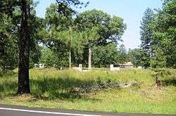 Settlement as seen from Pasadena Road | |
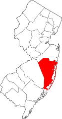
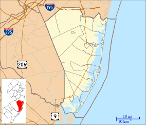 Wheatland, New Jersey Location within Ocean County (Inset: Ocean County in New Jersey)  Wheatland, New Jersey Wheatland, New Jersey (New Jersey)  Wheatland, New Jersey Wheatland, New Jersey (the US) | |
| Coordinates: 39°53′42″N 74°26′02″W / 39.89500°N 74.43389°WCoordinates: 39°53′42″N 74°26′02″W / 39.89500°N 74.43389°W | |
| Country |
|
| State |
|
| County | Ocean |
| Township | Manchester |
| Elevation[1] | 45 m (148 ft) |
| Time zone | UTC-5 (Eastern (EST)) |
| • Summer (DST) | UTC-4 (EDT) |
| GNIS feature ID | 881766[1] |
Wheatland (also called Pasadena[2]) is an unincorporated community within Manchester Township in Ocean County, New Jersey, United States.[1][3]
Wheatland is located approximately four miles (6.4 km) southwest of Whiting, along a now-abandoned line of the New Jersey Southern Railroad.[4]
The Pasadena Wildlife Management Area is located east of the settlement.[5]
History
Sand—mined from nearby pits—was used to manufacture clay drain pipes at a factory erected at Wheatland during the 1870s.[6]
In 1882, Wheatland had a post office, and a population of 125.[4]
References
- 1 2 3 U.S. Geological Survey Geographic Names Information System: Wheatland
- ↑ Whiting, NJ Topo Map 1:24000 (Map) (rev. 1971 ed.). United States Geological Survey. 1957. Retrieved August 18, 2015.
- ↑ Google (January 25, 2015). "Wheatland, Manchester Township, New Jersey" (Map). Google Maps. Google. Retrieved January 25, 2015.
- 1 2 Edwards, Richard (1882). Industries of New Jersey: Essex County Including City of Newark. Historical Publishing Company. p. 135.
- ↑ U.S. Geological Survey Geographic Names Information System: Pasadena Wildlife Management Area
- ↑ Transactions, Volume 6. American Institute of Mining Engineers. 1879. p. 187.
This article is issued from
Wikipedia.
The text is licensed under Creative Commons - Attribution - Sharealike.
Additional terms may apply for the media files.