List of power stations in California

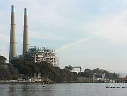
Ormond Beach
AES Alamitos
Calenergy
Location of some major power stations in California


This is a map of electricity-generating power stations in California, sorted by type and name.
Coal
| Plant | Location | Coordinates | Capacity (MW) | Refs |
|---|---|---|---|---|
| Argus Cogeneration Plant | Trona, Inyo County, California | 35°45′55.86″N 117°22′30.59″W / 35.7655167°N 117.3751639°W | 55 | [1][2] |
Nuclear
| Name | Location | Coordinates | Capacity (MW) | Capacity Factor | Annual Generation (GWh) | Ref |
|---|---|---|---|---|---|---|
| Diablo Canyon Power Plant | San Luis Obispo County | 35°12′39.10″N 120°51′22.23″W / 35.2108611°N 120.8561750°W | 2,240 | 90%+ | 18,000 |
Natural Gas-fired
Hydro-electric
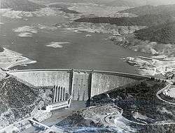
The Shasta Dam
Conventional
*Located along aqueduct or tunnel
Pumped-storage
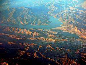
Castaic Lake and Dam
Wind Power

| Name | Location | Coordinates | Capacity (MW) |
|---|---|---|---|
| Alta Wind Energy Center* | Kern County | 35°00′00″N 118°18′00″W / 35.00000°N 118.30000°W | 1,320 |
| Tehachapi Pass Wind Farm | Tehachapi Mountains | 35°06′08″N 118°16′58″W / 35.10222°N 118.28278°W | 705 |
| San Gorgonio Pass Wind Farm | White Water | 33°54′54″N 116°35′18″W / 33.91500°N 116.58833°W | 615 |
| Altamont Pass Wind Farm | Livermore | 37°43′57″N 121°39′09″W / 37.73250°N 121.65250°W | 576 |
| Ocotillo Wind Energy Facility* | Ocotillo, California[20] | 315[21] | |
| Tule Wind Energy Project[22] | Eastern San Diego County | 200[23][24] | |
| Shiloh Wind Power Plant | Bird's Landing | 38°07′00″N 121°50′30″W / 38.11667°N 121.84167°W | 300 |
| Kumeyaay Wind farm | Campo Indian Reservation[25] | 50[26] |
*Under construction
Solar
Photovoltaic
List of major solar photovoltaic power stations in California as of July 23, 2014.
| Station | Location | Coordinates | Capacity (MW) | Status | Notes |
|---|---|---|---|---|---|
| Solar Star | Rosamond, California | 579 | Operational | ||
| California Valley Solar Ranch | Carrizo Plain | 35°20′N 119°55′W / 35.333°N 119.917°W | 250 | Operational | |
| Imperial Valley Solar Project | Imperial County | 99 | Operational | ||
| Centinela Solar Energy Project | Imperial County | 170 | Operational | ||
| Catalina Solar Project | Kern County | 143 | Operational | ||
| Campo Verde Solar Project | Imperial County | 139 | Operational | ||
| Imperial Solar Energy Center South | Imperial County | 130 | Operational | ||
| Avenal Solar Facility | Kings County | 45 | Operational | ||
| Desert Sunlight Solar Farm | Mojave Desert | 550 | Operational | ||
| Topaz Solar Farm | Carrizo Plain | 35°23′N 120°4′W / 35.383°N 120.067°W | 550 | Operational | |
| Westlands Solar Park | Kings County | 2,400 | Under construction | ||
| McCoy Solar Energy Project | Mojave Desert | 750 | Under construction | ||
| Blythe Solar Power Project | Riverside County | 485 | Under construction | ||
| Panoche Valley Solar Farm | San Benito County | 399 | Under construction | ||
| Antelope Valley Solar Ranch | Los Angeles County | 230 | Under construction |
Thermal
List of current solar thermal power stations in California.
| Station | Location | Coordinates | Capacity (MW) | Status | Notes |
|---|---|---|---|---|---|
| Solar Energy Generating Systems | Mojave Desert | 35°01′54″N 117°20′53″W / 35.03167°N 117.34806°W | 354 | Operational | |
| Kimberlina Solar Thermal Energy Plant | Bakersfield, California | 35°34′06″N 119°12′06″W / 35.56833°N 119.20167°W | 5 | Operational | |
| Sierra SunTower | Lancaster, California | 34°46′0.0″N 118°8′0.0″W / 34.766667°N 118.133333°W | 5 | Operational | |
| Ivanpah Solar Power Facility | Mojave Desert | 35°34′N 115°28′W / 35.57°N 115.47°W | 392 | Operational |
Geothermal
| Plant | Location | Coords. | Capacity (MW) | Refs |
|---|---|---|---|---|
| Calenergy | Calipatria, California | 33°09′49.28″N 115°36′55.78″W / 33.1636889°N 115.6154944°W | 327 | |
| The Geysers | Mayacamas Mountains | 38°47′1″N 122°42′50″W / 38.78361°N 122.71389°W | 750 | [27] |
| Heber | 52 | [27][28] | ||
| Calistoga | 176 | [29] | ||
| Hudson Ranch | 50 | [27] | ||
| Leathers | 36 | [27] | ||
| Mammoth | 40 | [27] | ||
| West Ford Flat | 26 | [27][30] | ||
Biomass
Former facilities
| Plant | Type | Location | Coords. | Capacity (MW) | Year Commissioned | Year Decommissioned | References |
|---|---|---|---|---|---|---|---|
| South Bay Power Plant | Gas-fired | Chula Vista, California | 700 | 2010 | [32] | ||
| Rancho Seco Nuclear Generating Station | Nuclear | Herald, California | 38°20′43″N 121°07′18″W / 38.34528°N 121.12167°W | 917 | 1975 | 2009 | [33] |
| Humboldt Bay Power Plant - Unit 3 | Nuclear | Humboldt Bay, California | 40°44′28.76″N 124°12′32.56″W / 40.7413222°N 124.2090444°W | 65 | 1963 | 1976 | [34] |
| San Onofre Nuclear Generating Station | Nuclear | San Diego County, California | 33°22′8″N 117°33′18″W / 33.36889°N 117.55500°W | 2,150 | 1968 | 2013 | [35] |
| Morro Bay Power Plant | Gas-fired | Morro Bay, California | 35°22′20″N 120°51′24.5″W / 35.37222°N 120.856806°W | 650 | 2014 | [36] |
See also
References
- ↑ "Actual and Expected Energy From Coal for California" (PDF). California Energy Commission. 3 November 2016. Retrieved 3 November 2016.
- ↑ "Electricity Data Browser: Argus Cogen Plant". US Energy Information Administration. 2018-03-01.
- 1 2 3 4 5 6 7 8 9 10 11 12 13 14 15 16 17 18 19 20 "Database of California Power Plants". California Energy Commission. 6 November 2012. Retrieved 26 November 2013.
- ↑ "AES Alamitos LLC Gas Plant". Global Energy Observatory. Retrieved 10 May 2014.
- 1 2 3 4 5 6 "CCGT Plants in Southern California". Gallery. Power Plants Around The World. 24 November 2013. Retrieved 10 May 2014.
- 1 2 3 4 "CCGT Plants in Northern California". Gallery. Power Plants Around The World. 3 August 2013. Retrieved 10 May 2014.
- ↑ City of Santa Clara Electric Resources - Silicon Valley Power
- ↑ "NRG Generation Assets" (PDF). NRG Energy. 12 December 2012. Retrieved 26 November 2013.
- ↑ California Energy Commission. "La Paloma Generating Power Plant Project". State of California. Retrieved 27 November 2013.
- 1 2 Two New Calpine Power Plants Begin Commercial Operations in California
- ↑ "Moss Landing Power Plant". Global Energy Observatory. Retrieved 10 May 2014.
- ↑ "Otay Mesa Power Plant Licensing Case". California Energy Commission. State of California. 3 October 2009. Retrieved 15 January 2013.
- ↑ "NRG Generation Assets". NRG Energy. 30 June 2013. Retrieved 26 November 2013.
- ↑ "AES Redondo Beach LLC Gas Plant". Global Energy Observatory. Retrieved 10 May 2014.
- ↑ "SMUD Cosumnes Power Plant Licensing Case - Docket # 01-AFC-19". www.energy.ca.gov. Retrieved 2016-08-01.
- ↑ "Lake Almanor 93-003 Dam". Geographic Names Information System. United States Geological Survey.
- ↑ "Project Facts". Retrieved November 2, 2012.
- ↑ "Indian Valley Dam Hydro Project". Retrieved November 4, 2012.
- ↑ "Aqueduct Power Plant". Los Angeles Department of Water and Power. Retrieved 2014-06-14.
- ↑ Alejandro DaVilla (12 January 2013). "Wind turbine blades spin in Ocotillo". Imperial Valley Press. Retrieved 5 February 2013.
- ↑ "Ocotillo Wind Energy Facility (CACA 051552)". El Centro Field Office. Bureau of Land Management. 15 January 2013. Retrieved 5 February 2013.
- ↑ http://www.sandiegouniontribune.com/business/energy-green/sd-fi-tule-windfarm-20180125-story,amp.html
- ↑ "Avangrid Renewables — About Tule Wind". Retrieved 2017-10-28.
- ↑ "Tule Wind Energy Project". Retrieved 2017-10-28.
- ↑ Onell R. Soto (13 January 2010). "Wind farm: A damaging blow". San Diego Union Tribune. Retrieved 5 February 2013.
- ↑ Michael Connolly. "Kumeyaay Wind Energy Project" (PDF). Tribal Energy Program. U.S. Department of Energy. Retrieved 5 February 2013.
- 1 2 3 4 5 6 "Geothermal Power Plants in the USA". Gallery. Power Plants Around The World. 29 November 2013. Retrieved 10 May 2014.
- ↑ "Heber Geothermal Plant". Global Energy Observatory. Retrieved 10 May 2014.
- ↑ "Calistoga Geothermal Power Plant". Global Energy Observatory. Retrieved 10 May 2014.
- ↑ "West Ford Flat Power Plant Geothermal Plant". Global Energy Observatory. Retrieved 10 May 2014.
- 1 2 3 4 5 6 7 8 9 10 11 12 13 14 15 16 17 18 19 20 21 22 23 24 25 26 27 28 "California Biomass Power Map". UC Berkeley Woody Biomass Utilization Group. Retrieved 21 July 2014.
- ↑ Tony Perry (2 February 2013). "Chula Vista says goodbye to a '50s-era power plant". Los Angeles Times. Retrieved 5 February 2013.
- ↑ "RANCHO SECO-1". Power Reactor Information System. International Atomic Energy Agency. Retrieved 10 May 2014.
- ↑ "HUMBOLDT BAY". Power Reactor Information System. International Atomic Energy Agency. Retrieved 10 May 2014.
- ↑ "Southern California Edison Announces Plans to Retire San Onofre Nuclear Generating Station". SCE Newsroom. June 7, 2013. Retrieved 13 January 2014.
- ↑ Dynegy officially closes the Morro Bay Power Plant, San Luis Obispo Tribune, February 5, 2014
Nuclear Energy in California (CA.gov): http://www.energy.ca.gov/nuclear/california.html retrieved: 11/10/12
External links
- U.S. Department of Energy California Statistics
- U.S. Department of Energy California Quick Facts
- Calenergy Geothermal Plant Information

This article is issued from
Wikipedia.
The text is licensed under Creative Commons - Attribution - Sharealike.
Additional terms may apply for the media files.