Carlsbad, California
| Carlsbad, California | ||
|---|---|---|
| City | ||
| City of Carlsbad | ||
 Downtown Carlsbad | ||
| ||
| Nickname(s): Village by the Sea | ||
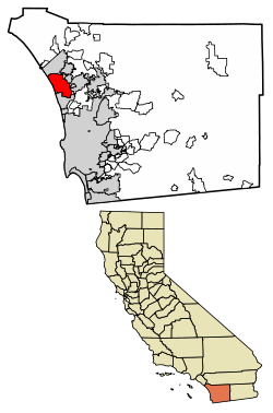 Location of Carlsbad in San Diego County, California. | ||
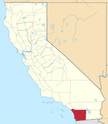
 Carlsbad Location in the United States  Carlsbad Carlsbad (the US) | ||
| Coordinates: 33°7′19″N 117°17′49″W / 33.12194°N 117.29694°WCoordinates: 33°7′19″N 117°17′49″W / 33.12194°N 117.29694°W | ||
| Country |
| |
| State |
| |
| County | San Diego | |
| Incorporated | July 16, 1952[1] | |
| Government | ||
| • Type | Council–manager[2] | |
| • Mayor | Matt Hall[3] | |
| Area[4] | ||
| • Total | 39.12 sq mi (101.31 km2) | |
| • Land | 37.74 sq mi (97.74 km2) | |
| • Water | 1.38 sq mi (3.57 km2) 3.55% | |
| Elevation[5] | 52 ft (16 m) | |
| Population (2010)[6] | ||
| • Total | 105,328 | |
| • Estimate (2016)[7] | 113,952 | |
| • Rank |
5th in San Diego County 54th in California | |
| • Density | 3,019.48/sq mi (1,165.83/km2) | |
| Time zone | UTC−8 (Pacific) | |
| • Summer (DST) | UTC−7 (PDT) | |
| ZIP codes | 92008–92011, 92018 | |
| Area codes | 442/760 | |
| FIPS code | 06-11194 | |
| GNIS feature IDs | 1660437, 2409984 | |
| City flower | Bird‐of‐paradise[8] | |
| Website |
www | |

Carlsbad is an affluent seaside resort city occupying a 7-mile (11 km) stretch of Pacific coastline in northern San Diego County, California. The city is 87 miles (140 km) south of Los Angeles and 35 miles (56 km) north of downtown San Diego and is part of the San Diego-Carlsbad, CA Metropolitan Statistical Area. It is bordered by Oceanside to the north, Vista and San Marcos to the east and Encinitas to the south. Referred to as "The Village by the Sea" by locals, Carlsbad is a tourist destination. The city's estimated 2014 population was 112,299.[9] Among the nation's top 20 wealthiest communities, Carlsbad is the 5th richest city in the state of California with a median household income close to US$105,000.[10]
History
Carlsbad's history began with the Luiseño people (the Spanish name given to them because of their proximity to Mission San Luis Rey). Nearly every reliable fresh water creek had at least one native village, including one called Palamai.[11] The site is located just south of today's Agua Hedionda Lagoon.[11]
The first European land exploration of Alta California, the Spanish Portolà expedition of 1769, met native villagers while camped on Buena Vista Creek.[12] During the Mexican period, in 1842, the southern portion of Carlsbad, was granted as Rancho Agua Hedionda to Juan María Marrón.
In the 1880s a former sailor named John Frazier dug a well in the area. He began offering his water at the train station and soon the whistle-stop became known as Frazier's Station. A test done on a second fresh-water well discovered the water to be chemically similar to that found in some of the most renowned spas in the world, and the town was named after the famed spa in the Bohemian town of Karlsbad (now Karlovy Vary, Czech Republic).[13]
To take advantage of the find, the Carlsbad Land and Mineral Water Company was formed by a German-born merchant from the Midwest named Gerhard Schutte together with Samuel Church Smith, D. D. Wadsworth and Henry Nelson. The naming of the town followed soon after, along with a major marketing campaign to attract visitors. The area experienced a period of growth, with homes and businesses sprouting up in the 1880s. Agricultural development of citrus fruits, avocados and olives soon changed the landscape. By the end of 1887, land prices fell throughout San Diego County. However, the community survived on the back of its fertile agricultural lands.
The site of John Frazier's original well can still be found at Alt Karlsbad, a replica of a German Hanseatic house, located on Carlsbad Boulevard.
In 1952, Carlsbad was incorporated to avoid annexation by its neighbor, Oceanside.[14]
The single-runway Palomar Airport opened in 1959 after County of San Diego officials decided to replace the Del Mar Airport.[15] The airport was annexed to the City of Carlsbad in 1978 and renamed McClellan-Palomar Airport in 1982 after a local civic leader, Gerald McClellan.
The first modern skateboard park, Carlsbad Skatepark, was built in March 1976.[16] It was located on the grounds of Carlsbad Raceway and was designed and built by inventors Jack Graham and John O'Malley. The site of the original Carlsbad Skatepark and Carlsbad Raceway was demolished in 2005 and is now an Industrial Park.[16][17] However, two skateparks have since been developed.
In March 1999, Legoland California was opened. It was the first Legoland theme park outside of Europe and is currently operated by Merlin Entertainments.[18] Merlin Entertainments owns 70 percent of the shares, and the remaining 30 percent is owned by the LEGO group and Kirkbi A/S.[19]
Carlsbad is home to the nation's largest desalination plant.[20] Construction of the US$1 billion Carlsbad Desalination Plant at the Encina Power Plant was completed in December 2015.[21]
Geography
According to the United States Census Bureau, the city has a total area of 39.1 square miles (101 km2) of which 37.7 square miles (98 km2) are land and 1.4 square miles (3.6 km2) are (3.55%) water, the majority of which is contained within three lagoons and one lake.
The northern area of the city is part of a tri-city area consisting of northern Carlsbad, southern Oceanside and western Vista.
Climate
Carlsbad has a semi-arid Mediterranean climate (Koppen classification BSh) and averages 263 sunny days per year. Winters are mild with periodic rain. Frost is rare along the coast, but sometimes occurs in inland valleys in December and January. Summer is almost rain free, but sometimes overcast and cool with fog off the Pacific. While most days have mild and pleasant temperatures, hot dry Santa Ana winds bring high temperatures on a few days each year, mostly in the fall.
| Climate data for Carlsbad, California | |||||||||||||
|---|---|---|---|---|---|---|---|---|---|---|---|---|---|
| Month | Jan | Feb | Mar | Apr | May | Jun | Jul | Aug | Sep | Oct | Nov | Dec | Year |
| Record high °F (°C) | 87 (31) |
90 (32) |
90 (32) |
93 (34) |
101 (38) |
93 (34) |
103 (39) |
94 (34) |
108 (42) |
105 (41) |
100 (38) |
90 (32) |
108 (42) |
| Average high °F (°C) | 64 (18) |
64 (18) |
64 (18) |
65 (18) |
66 (19) |
69 (21) |
72 (22) |
74 (23) |
73 (23) |
71 (22) |
68 (20) |
65 (18) |
67.9 (19.9) |
| Average low °F (°C) | 45 (7) |
47 (8) |
48 (9) |
51 (11) |
56 (13) |
60 (16) |
63 (17) |
64 (18) |
61 (16) |
56 (13) |
49 (9) |
45 (7) |
53.8 (12.1) |
| Record low °F (°C) | 20 (−7) |
28 (−2) |
34 (1) |
33 (1) |
38 (3) |
43 (6) |
44 (7) |
47 (8) |
43 (6) |
36 (2) |
29 (−2) |
27 (−3) |
20 (−7) |
| Average precipitation inches (mm) | 2.42 (61.5) |
2.23 (56.6) |
2.11 (53.6) |
0.92 (23.4) |
0.23 (5.8) |
0.09 (2.3) |
0.02 (0.5) |
0.13 (3.3) |
0.29 (7.4) |
0.43 (10.9) |
0.92 (23.4) |
1.34 (34) |
11.13 (282.7) |
| Source: [22] | |||||||||||||
Transportation
Carlsbad has Coaster and Amtrak rail service at its two stations, Carlsbad Village station and Carlsbad Poinsettia station.
Interstate 5 and California State Route 78 either pass through or border the city of Carlsbad.
McClellan–Palomar Airport is located about seven miles (11 km) southeast of downtown Carlsbad, and allows general aviation and limited commercial service to the city.
Carlsbad neighborhoods
For city planning and growth management purposes, Carlsbad is divided into four distinct quadrants.[23]
Northwest quadrant
The northwest quadrant of Carlsbad (ZIP code 92008) includes the downtown "Village," the Barrio, and "Old Carlsbad." It was the first part of Carlsbad to be settled. Homes range from 1950s cottages and bungalows to elegant mansions on the hill overlooking the ocean. It is also home to Hosp Grove Park, a grove of trees relatively untouched by development and now designated by the city for recreational use, in addition to the Buena Vista and Agua Hedionda Lagoons. It is located west of El Camino Real and north of Palomar Airport Road.
"The Barrio" area is near downtown Carlsbad bordered by Carlsbad Village Drive to the north, Tamarack Avenue to the south, Interstate 5 to the east and the railroad tracks to the west. It was settled by Latinos in the early 20th century.[24] It is the site of the Centro de Aprendizaje, a Spanish division of the Carlsbad City Library.[25]
Northeast quadrant
This quadrant (ZIP code 92010) is located east of El Camino Real and north of Palomar Airport Road and consists mostly of single-family homes, with larger lots found in the older area known as Chestnut Hills and the new developments around Calavera Hills.
.jpg)
Southeast quadrant
The southeast quadrant (ZIP code 92009) is located east of El Camino Real and south of Palomar Airport Road and features several newer expensive master-planned communities set among hillsides, golf courses, Alga Norte Community Park and permanent open spaces. It includes Bressi Ranch and the La Costa neighborhoods of Rancho La Costa, La Costa Ridge, La Costa Oaks, La Costa Greens, and Rancho Carillo. In 1965, La Costa gave its name to the Gold Medal Golf Resort, La Costa Resort and Spa, now known as the Omni La Costa Resort and Spa.[26] Residents here are served by the Carlsbad Unified School District, San Marcos Unified School District and the Encinitas Union School District.
Southwest quadrant
This quadrant (ZIP code 92011) extends along the Pacific Ocean to the south of the center of Carlsbad. It includes the Aviara neighborhood. It is located west of El Camino Real and south of Palomar Airport Road.
Demographics
| Historical population | |||
|---|---|---|---|
| Census | Pop. | %± | |
| 1960 | 9,253 | — | |
| 1970 | 14,944 | 61.5% | |
| 1980 | 35,490 | 137.5% | |
| 1990 | 63,126 | 77.9% | |
| 2000 | 78,247 | 24.0% | |
| 2010 | 105,328 | 34.6% | |
| Est. 2016 | 113,952 | [7] | 8.2% |
| U.S. Decennial Census[27] | |||
2010/2011
As of the 2010 United States Census[28] Carlsbad had a population of 105,328. The population density was 2,693.1 per square mile (1,039.8/km²). The racial makeup of Carlsbad was 87,205 (82.8%) White, 1,379 (1.3%) African American, 514 (0.5%) Native American, 7,460 (7.1%) Asian, 198 (0.2%) Pacific Islander, 4,189 (4.0%) from other races, and 4,383 (4.2%) from two or more races. Hispanic or Latino of any race were 13,988 persons (13.3%).
The Census reported that 104,413 people (99.1% of the population) lived in households, 459 (0.4%) lived in non-institutionalized group quarters, and 456 (0.4%) were institutionalized.
Out of 39,964 households in 2011, there were 26,992 (67.5%) families, of which 12,345 (30.9%) had children under the age of 18 living in them, 21,705 (54.3%) were married-couple families, 1,489 (3.7%) had a male householder with no wife present, and 3,798 (9.5%) had a female householder with no husband present. There were 12,972 (32.5%) nonfamily households, of which 10,198 (25.5%) were made up of a householder living alone and 3,299 (8.3%) were a householder living alone who was 65 years or over. The average household size was 2.55 and the average family size was 3.10.
The population was spread out with 25,366 people (24.1%) under the age of 18, 6,718 people (6.4%) aged 18 to 24, 28,073 people (26.7%) aged 25 to 44, 30,373 people (28.8%) aged 45 to 64, and 14,798 people (14.0%) who were 65 years of age or older. The median age was 40.4 years. For every 100 females, there were 95.6 males. For every 100 females age 18 and over, there were 92.5 males.
There were 44,673 housing units at an average density of 1,142.2 per square mile (441.0/km²), of which 26,808 (64.8%) were owner-occupied, and 14,537 (35.2%) were occupied by renters. The homeowner vacancy rate was 1.4%; the rental vacancy rate was 4.6%. 69,855 people (66.3% of the population) lived in owner-occupied housing units and 34,558 people (32.8%) lived in rental housing units.
In 2011, the median household income was US$85,743 and the median family income was US$102,254, with 11.9% of households and 14.9% of families earning US$200,000 or more.[29] Males had a median income of US$80,590 versus US$54,159 for females. The per capita income for the city was US$42,712. About 6.8% of families and 8.4% of the population reported income below the poverty line, including 10.1% of those under age 18 and 3.5% of those age 65 or over.
Of the population 25 years and over, 95.7% graduated from high school and 51.3% held a bachelor's degree or higher. 65.2% of the population 16 years and over was in the labor force.
2000
As of the census of 2000, there were 78,247 people, 31,521 households, and 20,898 families residing in the city.[30] The population density was 2,090.2 people per square mile (806.9/km²). There were 33,798 housing units at an average density of 902.8 per square mile (348.5/km²). The racial makeup of the city was 86.6% Caucasian, 1.0% African American, 0.4% Native American, 4.2% Asian, 0.2% Pacific Islander, 4.7% from other races, and 3.0% from two or more races. Hispanic or Latino of any race were 11.7% of the population.
There were 31,521 households out of which 30.7% contained children under the age of 18, 54.3% were married couples living together, 8.6% had a female householder with no husband present, and 33.7% were non-families. 24.8% of all households were made up of single individuals and 8.2% had someone living alone who was 65 years of age or older. The mean household size was 2.46 and the mean family size was 2.96.
23.3% of residents were under the age of 18, 6.2% from 18 to 24, 31.9% from 25 to 44, 24.6% from 45 to 64, and 14.0% 65 years of age or older. The median age was 39 years. For every 100 females, there were 95.8 males. Among those 18 and older, there were 92.8 males for every 100 females.
Politics and government
Carlsbad voters in 2008 voted to make Carlsbad a charter city.[2] City government is led by an elected mayor and four council members, elected at large.
Carlsbad's current mayor is Matt Hall, who has served since 2010. Starting with the 2018 elections, Carlsbad will go from having its city council members being at large to district representation. The mayoral office will remain at large.[31]
The city has drafted ordinances protecting sensitive wildlife habitat, becoming one of the first municipalities in California to do so. The city has also pledged to protect about 40 percent of the city as permanent open space.[32]
Federal and state representation
In the California State Legislature, Carlsbad is in the 36th Senate District, represented by Republican Patricia Bates, and in the 76th Assembly District, represented by Republican Rocky Chávez.[33]
In the United States House of Representatives, Carlsbad is in California's 49th congressional district, represented by Republican Darrell Issa.[34]
Economy
Carlsbad's core industries include information technology, video game development, manufacturing, robotics, medical devices, life science, wireless technology, clean technology, action sports, tourism, design development and real estate. In 2013, Google named Carlsbad the digital capital of California with the strongest online business community.[35]
Carlsbad is also known as the "Titanium Valley" because of it being the golf manufacturing capital of the world. With Callaway Golf Company, TaylorMade-adidas Golf Company, Cobra Golf, Titleist, and Odyssey Golf all located in Carlsbad.
Top employers
According to March 2015 figures,[36] the top employers in the city are:
| # | Employer |
|---|---|
| 1 | Viasat |
| 2 | Life Technologies Corporation |
| 3 | Legoland California |
| 4 | Carlsbad Unified School District |
| 5 | Smart Kids Publishing, Smart Kidz Media, Inc., and Penton Overseas, Inc. |
| 6 | Omni La Costa Resort and Spa |
| 7 | TaylorMade-Adidas Golf Company (TMaG) |
| 8 | SGN Nutrition |
| 9 | Gemological Institute of America |
| 10 | City of Carlsbad |
| 11 | Optum Rx |
Notable corporate headquarters
- Arkeia Software, network backup solutions
- Atticus Clothing, Apparel
- Business.com, online B2B marketing platform
- Callaway Golf Company, Golf equipment and apparel manufacturer
- Cobra Golf, Golf equipment and apparel manufacturer
- Fallen Footwear, Shoe company
- Gemological Institute of America, gem nonprofit
- Hay House, new age publisher
- Hot Dog on a Stick, restaurants
- Islands Fine Burgers & Drinks, restaurant
- Jazzercise, International dance fitness program
- Jenny Craig, Inc., Weight management
- Kisco Senior Living, senior living
- Macbeth Footwear, apparel
- MaxLinear, Semiconductors
- No Fear, apparel
- Osiris Shoes, Shoe company
- PC Power & Cooling, PC power supply manufacturer
- Rockstar San Diego, video game developer
- Rubio's Fresh Mexican Grill, Quick serve restaurants
- TaylorMade-adidas Golf Company, Golf equipment and apparel manufacturer
- Upper Deck, Sports and entertainment trading card manufacturer
- ViaSat, Satellite communications
Schools
- School Districts
- Carlsbad Unified School District
- Encinitas Union School District-for Elementary schools in South Carlsbad
- San Dieguito Union High School District-for Junior High and High schools in South Carlsbad
- San Marcos Unified School District-for schools in southeast Carlsbad
- Public High
- Public Intermediate
- Aviara Oaks Middle School
- Calavera Hills Middle School
- Valley Middle School
- Public Interlevel
- Carlsbad Seaside Academy (Independent Study)
- Public Elementary
- Aviara Oaks Elementary School
- Buena Vista Elementary School
- Calavera Hills Elementary School
- Carlsbad Seaside Academy (K-6 Alternative Education)
- El Camino Creek Elementary School
- Hope Elementary School
- Jefferson Elementary School
- Kelly Elementary School
- La Costa Heights Elementary School
- La Costa Meadows Elementary School
- Magnolia Elementary School
- Pacific Rim Elementary School
- Poinsettia Elementary School
- Mission Estancia Elementary School
- Olivenhain Pioneer Elementary School
- Rancho Carillo Elementary School
- Private Schools
- Army and Navy Academy: College Prep Middle and High School
- Beautiful Saviour Lutheran Elementary School
- Montessori Arts and Sciences School
- Pacific Ridge School
- Palisades Point Christian Academy
- St. Patrick School
- The Academy by the Sea: Camp Pacific
Public libraries
- Carlsbad City Library (three branches)
Sister cities
Carlsbad has two sister cities, as designated by Sister Cities International:

Attractions
- Amusement Parks
- Aquariums
- Sea Life Aquarium at Legoland California Resort
- Beaches
- Campgrounds
- Golf
- Aviara Golf Club and The Aviara Golf Academy.[38]
- La Costa Resort and Spa
- The Crossings at Carlsbad.
- Rancho Carlsbad Golf Club
- Open Space
- Museums
- Carlsbad Historical Society Museum
- Museum of Making Music
- Miniature Engineering Craftsmanship Museum
- Gardens
Notable people
- Frank Alesia, character actor and television director[39]
- Marcus Allen, college and professional football star
- Brian P. Bilbray, U.S. Congressman, claims to have lived in Carlsbad[40]
- Ron Blair, bassist for Tom Petty and the Heartbreakers
- David M. Brahms, Marine Corps Brigadier General, Military Lawyer
- Adam Brody, film and television actor; played Seth Cohen on The O.C.[41]
- Chad Butler, drummer for Switchfoot
- Francesca Capaldi, child actress
- Ron Capps (racing driver), Current NHRa Funny Car Driver Former Top Fuel Driver 2016 NHRA Funny Car Champion
- Leo Carrillo, actor, cartoonist, conservationist and preservationist, and owner of Leo Carrillo Ranch in Carlsbad[42]
- Aaron Chang, surf and ocean photographer
- Brandon Chillar, linebacker for the Green Bay Packers
- Jim Cochran, pioneering organic strawberry farmer
- Jonathan Compas, center for Tampa Bay Buccaneers
- S.E. Cupp, journalist and political commentator
- David Díaz, Caldecott-winning illustrator/author
- Drew Ferris (born 1992), football player for the Tampa Bay Buccaneers of the National Football League
- Jon Foreman, lead singer of alternative band Switchfoot
- Tim Foreman, brother of Jon Foreman and bassist for Switchfoot
- Robert C. Frazee, businessman and politician
- Ryan Gallant, professional skateboarder
- Troy Glaus, baseball player
- LeRoy Grannis, photographer
- Ryan Guy, football player for St. Patricks Athletic
- Tony Hawk, professional skateboarder and entrepreneur
- Taylor Knox, professional surfer
- Ted Johnson, professional football player
- Michellie Jones, triathlete, 2006 Ironman world champion, 2000 Olympic silver medalist
- Josh Kalis, professional skateboarder
- Rod Laver, former world #1 Australian tennis player, retired in La Costa[43]
- Fred Lynn, baseball player[44]
- Sal Masekela,[45] son of musician Hugh Masekela. CHS graduate. TV host for Winter X Games on ESPN
- Tim Miller an original student of Ashtanga-yoga founder, K.P. Jois, and one of the foremost teachers of Ashtanga in the US.
- Martin Milner, television actor, Route 66 and Adam-12
- Dale D. Myers, former Deputy Administrator of NASA, three NASA Distinguished Service Medals
- Gregory R Nelson Sr., co-founder of DonJoy, Inc., CEO of United Orthopedic Group
- Emily O'Brien,[46] The Young and the Restless actress; 2003 graduate CHS
- Ron Packard, U.S. Congressman
- Kevin Pearce, snowboarder, public speaker and advocate for traumatic brain injury and Down syndrome research and education; extreme sport commentator[47]
- Jean Peters, actress and wife of Howard Hughes
- John Pugsley, libertarian political activist
- Bridget Regan, actress known for her role as Kahlan Amnell on Legend of the Seeker
- Allard Roen, co-founder and the on-site Manager of the La Costa Resort and Spa in Carlsbad, California.
- Gene Roddenberry, creator of Star Trek[48]
- Boris Said, NASCAR Sprint Cup Series driver
- Steve Scott, champion miler
- Pancho Segura, former professional tennis player and coach[49]
- Brian Simo, NASCAR Nationwide Series driver
- Staciana Stitts, 2000 Summer Olympics gold medalist swimmer; graduate CHS
- Brett Swain, professional football player.[50]
- Victor Villaseñor, author
- Barbara Werle, actress and dancer[51]
- Shaun White, professional snowboarder, skateboarder, 2006, 2010 and 2018 Winter Olympics gold medalist[52]
References
- ↑ "California Cities by Incorporation Date". California Association of Local Agency Formation Commissions. Archived from the original (Word) on November 3, 2014. Retrieved August 25, 2014.
- 1 2 "City Hall". City of Carlsbad. Retrieved February 24, 2015.
- ↑ "Elected Officials". City of Carlsbad. Retrieved October 17, 2014.
- ↑ "2016 U.S. Gazetteer Files". United States Census Bureau. Retrieved Jul 19, 2017.
- ↑ "Carlsbad". Geographic Names Information System. United States Geological Survey. Retrieved October 16, 2014.
- ↑ "Carlsbad (city) QuickFacts". United States Census Bureau. Retrieved January 11, 2015.
- 1 2 "Population and Housing Unit Estimates". Retrieved June 9, 2017.
- ↑ "All About Carlsbad". City of Carlsbad. Retrieved October 16, 2014.
- ↑ "American FactFinder - Results". United States Census Bureau. Retrieved May 24, 2015.
- ↑ "California Is Home To 15 Of 20 Wealthiest Cities Nationwide, Site Finds".
- 1 2 "Mary Robbins-Wade, COASTAL LUISENO: REFINING THE SAN LUIS REY COMPLEX, Articles of the SCA Proceedings, Volume 1, Society for California Archaeology, 1988, p.75 "The site is located within Luiseno territory according to ethnographic maps by Kroeber (1925), White (1963), and True, Meighan, and Crew (1974). The site and nearby satellites may be the village of Palamai, mapped by Kroeber (1925)."" (PDF).
- ↑ Bolton, Herbert E. (1927). Fray Juan Crespi, Missionary Explorer on the Pacific Coast, 1769-1774. HathiTrust Digital Library. p. 128. Retrieved April 2014. Check date values in:
|accessdate=(help) - ↑ City of Carlsbad - History of Carlsbad, retrieved March 1, 2012.
- ↑ The Battle for Incorporation, at the Carlsbad Historical Society, retrieved January 12, 2014.
- ↑ Burge, Michael. "McClellan-Palomar Airport - Flying High at 50". California Pilots Association. Retrieved 6 January 2015.
- 1 2 "Carlsbad Skatepark Memorial". Carlsbad Skate Park. Carlsbad Skate Park Memorial. Archived from the original on March 19, 2012. Retrieved 6 January 2015.
- ↑ "Save The Carlsbad Raceway!". Save Carlsbad Raceway. Retrieved 30 May 2015.
- ↑ Kinsman, Michael (July 14, 2005). "Control of Legoland parks sold". The San Diego Union Tribune.
- ↑ "LEGO GROUP IN PARTNERSHIP WITH MERLIN ENTERTAINMENTS". LEGO Group. Retrieved 6 January 2015.
- ↑ Rogers, Paul. "Nation's largest ocean desalination plant goes up near San Diego; Future of the California coast?". San Jose Mercury News.
- ↑ Fikes, Bradley J. (14 December 2015). "$1-billion desalination plant, hailed as model for state, opens in Carlsbad". Los Angeles Times. Retrieved 27 February 2017.
- ↑ "Average Weather for Carlsbad, CA". The Weather Channel.
- ↑ Quadrant Map, available at the City of Carlsbad's Growth Management page, retrieved March 1, 2012.
- ↑ New effort begins on planning for Carlsbad's Barrio area, in North County Times, retrieved October 19, 2011.
- ↑ Las Bibliotecas de Carlsbad, retrieved October 19, 2011.
- ↑ "Hotels In Carlsbad CA - History of Omni La Costa Resort & Spa". www.omnihotels.com.
- ↑ "Census of Population and Housing". Census.gov. Archived from the original on May 12, 2015. Retrieved June 4, 2015.
- ↑ "2010 Census Interactive Population Search: CA - Carlsbad city". U.S. Census Bureau. Retrieved July 12, 2014.
- ↑ "Archived copy". Archived from the original on September 16, 2013. Retrieved 2013-11-21. factfinder.census.gov
- ↑ "American FactFinder". United States Census Bureau. Archived from the original on September 11, 2013. Retrieved 2008-01-31.
- ↑ http://ncdailystar.com/what-city-council-district-elections-mean-to-carlsbad/
- ↑ "Growth Management". City of Carlsbad. City of Carlsbad, California. Retrieved 6 June 2015.
- ↑ "Statewide Database". UC Regents. Retrieved November 29, 2014.
- ↑ "California's 49th Congressional District - Representatives & District Map". Civic Impulse, LLC.
- ↑ Wright, Ellen. "Carlsbad's economy is on the upswing". The Coast News. Retrieved 19 April 2016.
- ↑ Carlsbad at a Glance, published by the City of Carlsbad
- ↑ "US-Japan Sister Cities by State". Asia Matters for America. Honolulu, HI: East-West Center. Retrieved 20 November 2015.
- ↑ "World-renowned Golf Manufacturers Call San Diego Home". SanDiego.org. Retrieved 19 April 2016.
- ↑ Barnes, Mike (March 4, 2011). "Character actor, director Frank Alesia dies". The Hollywood Reporter. Reuters Canada. Retrieved March 14, 2011.
- ↑ "Where Does Brian Bilbray Really Live?". ABC 10 News. 2007. Retrieved April 11, 2015.
- ↑ "Local Super Bowl alumni honored by NFL". San Diego Tribune. Retrieved May 1, 2017.
- ↑ "City of Carlsbad - Leo Carrillo Ranch Historic Park". www.leocarrilloranch.org.
- ↑ Paris, Jay (June 17, 2005). "Federer is Laver's Wimbledon favorite". North County Times. Retrieved September 25, 2007.
- ↑ Los Angeles Times, August 19, 2012, page C5, "Fred Lynn's Cautionary Tale"
- ↑ "SignOnSanDiego.com > Sports - Winter X marks surfer's spot".
- ↑ Today's Local News » Restless no more Archived March 1, 2007, at the Wayback Machine.
- ↑ "Kevin Pearce's Recovery: Documentary Looks at Snowboarder's Journey Back - Valley News".
- ↑ David Alexander (March–April 1991). "Interview with Gene Roddenberry: Writer, Producer, Philosopher, Humanist Originally published in The Humanist, March/April 1991". DR. RAYMOND NIGHAN'S STAR TREK PAGE. DR. RAYMOND NIGHAN. Archived from the original on September 28, 2013. Retrieved July 29, 2013.
- ↑ "Doris Hart and Francisco "Pancho" Segura inducted into USPTA's Hall of Fame". United States Professional Tennis Association. September 25, 2012. Retrieved 2015-04-18.
- ↑ "Brett Swain". San Diego State University. Retrieved February 22, 2017.
- ↑ "Barbara May Theresa Werle Obituary". U-T San Diego. January 5, 2013. Retrieved January 7, 2013.
- ↑ "Shaun White". United States Olympic Committee. Retrieved April 6, 2015.
External links
| Wikimedia Commons has media related to Carlsbad, California. |

- Official website

- Carlsbad City Library
- Carlsbad Chamber of Commerce
- Carlsbad Historical Society